Indian Head, Maryland facts for kids
Quick facts for kids
Indian Head, Maryland
|
|||
|---|---|---|---|
|
|||

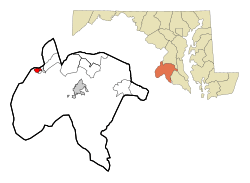
Location of Indian Head, Maryland
|
|||
| Country | |||
| State | |||
| County | Charles | ||
| Incorporated | 1920 | ||
| Area | |||
| • Total | 1.23 sq mi (3.19 km2) | ||
| • Land | 1.23 sq mi (3.19 km2) | ||
| • Water | 0.00 sq mi (0.00 km2) | ||
| Elevation | 105 ft (32 m) | ||
| Population
(2020)
|
|||
| • Total | 3,894 | ||
| • Density | 3,165.85/sq mi (1,222.53/km2) | ||
| Time zone | UTC-5 (Eastern (EST)) | ||
| • Summer (DST) | UTC-4 (EDT) | ||
| ZIP code |
20640
|
||
| Area code | 301, 240 | ||
| FIPS code | 24-41500 | ||
| GNIS feature ID | 0590532 | ||
Indian Head is a town in Charles County, Maryland, United States. In 2020, about 3,894 people lived there. Since 1890, Indian Head has been home to a special naval base. This base focuses on making materials for guns and rockets. Over the years, the base has had different names, but today it is called the Naval Support Facility Indian Head. The main group working there is the Indian Head Naval Surface Warfare Center (NSWC/IH). They do advanced research on energetic systems, which are materials that store a lot of energy. About 3,700 people work at the base.
Contents
History of Indian Head
The area where Indian Head is located is a "head" of land, like a peninsula, that looks out over the Potomac River. For a long time, different groups of indigenous peoples lived here. When the first English settlers arrived, they met the Mattawoman tribe, who spoke an Algonquian language. The settlers called the land "Indian Head," meaning "Indian Peninsula." Some research suggests the name is a shorter version of "Indian Headlands." There's also a story about a young brave being beheaded, but the town's mayor once said it was just a "fairy tale."
Indian Head During the Civil War
During the American Civil War, in August 1861, a Union Army general named Joseph Hooker led his troops near a place called Budd's Ferry. This spot was a meeting place for soldiers who volunteered to fight. The Union Army Balloon Corps also used this area. They used balloons to look for Confederate troop movements across the Potomac River.
How Indian Head Became a Town
The town of Indian Head officially became a town in 1920. It is located between the Potomac River and Mattawoman Creek. This land was once part of the territory of the Algonquin Native Americans. The name "Indian Head" first appeared in records around 1800.
During World War II, Indian Head grew and had a strong economy. This lasted until the late 1960s. However, when a new community called St. Charles was built nearby, many new stores opened there. This caused businesses in Indian Head to struggle, as people started shopping in St. Charles instead.
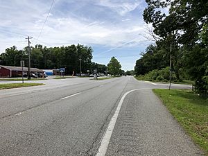
Today, Indian Head is working to bring more businesses back. The town is divided by Maryland Route 210, also known as Indian Head Highway. This road leads right into the middle of town, to the naval base. This means Indian Head needs to be a place people want to visit, not just a place they pass through.
In 2004, the town opened a "black box" stage theater, called the Indian Head Center for the Arts. In 2008, a part of the old railroad to the naval facility was turned into a 13-mile paved trail for hiking and biking. A new technology education center, called the "Velocity Center," was finished in 2020. It is connected to the Naval base.
Some indigenous groups, like the Piscataway Conoy Tribe of Maryland, believe the town's name is offensive. They have asked for the name to be changed.
Youngest Mayor in Maryland
In 2015, Brandon Paulin was elected mayor of Indian Head. He was only 19 years old at the time. This made him the youngest mayor in the history of any town in Maryland! The Vice Mayor, Kiran (Ron) Sitoula, is also notable as the first person born outside the U.S. to hold a public office in Indian Head. Brandon Paulin was elected on May 5, 2015, and officially started his job on May 12, 2015.
Geography
Indian Head is located at 38°35′52″N 77°9′25″W / 38.59778°N 77.15694°W. According to the United States Census Bureau, the town covers about 1.23 square miles (3.19 square kilometers) of land.
Transportation
The main way to get to and from Indian Head is by road. The only major highway serving the town is Maryland Route 210. This road is also called Indian Head Highway. It connects the town to Washington, D.C., and to major highways like Interstate 95 and Interstate 495 (the Capital Beltway).
Population and People
| Historical population | |||
|---|---|---|---|
| Census | Pop. | %± | |
| 1930 | 1,240 | — | |
| 1940 | 1,104 | −11.0% | |
| 1950 | 491 | −55.5% | |
| 1960 | 780 | 58.9% | |
| 1970 | 1,350 | 73.1% | |
| 1980 | 1,381 | 2.3% | |
| 1990 | 3,531 | 155.7% | |
| 2000 | 3,422 | −3.1% | |
| 2010 | 3,844 | 12.3% | |
| 2020 | 3,894 | 1.3% | |
| U.S. Decennial Census 2010 2020 |
|||
In 2020, Indian Head had a population of 3,894 people. The town had 1,391 households and 995 families living there in 2010. The average household had about 2.76 people.
Who Lives in Indian Head?
In 2010, the town's population was made up of different groups:
- About 35.9% were White.
- About 55.5% were African American.
- About 1.3% were Native American.
- About 2.6% were Asian.
- About 3.8% were from two or more races.
- About 3.0% of the population identified as Hispanic or Latino.
The median age in Indian Head in 2010 was 33.2 years old. This means half the people were younger than 33.2 and half were older.
- About 28.2% of residents were under 18 years old.
- About 30.4% were between 25 and 44 years old.
- About 7.4% were 65 years or older.
The town had slightly more females (52.7%) than males (47.3%).
See also
 In Spanish: Indian Head (Maryland) para niños
 | William Lucy |
 | Charles Hayes |
 | Cleveland Robinson |


