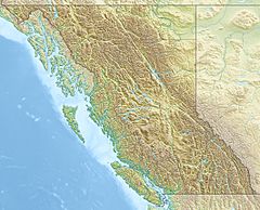
Inhini River facts for kids
Quick facts for kids Inhini River |
|
|---|---|
|
Mouth of Inhini River
|
|
| Country | Canada |
| Province | British Columbia |
| District | Cassiar Land District |
| Physical characteristics | |
| Main source | Boundary Ranges Coast Mountains 1,270 m (4,170 ft) 56°34′23″N 131°21′24″W / 56.57306°N 131.35667°W |
| River mouth | Iskut River Boundary Ranges 25 m (82 ft) 56°42′32″N 131°33′27″W / 56.70889°N 131.55750°W |
| Length | 25 km (16 mi) |
| Basin features | |
| Basin size | 135 km2 (52 sq mi), |
| Topo map | NTS 104B12 Katete River |
The Inhini River is a river in the northwest part of British Columbia, Canada. It is a tributary of the Iskut River. This means the Inhini River flows into the Iskut River.
The Inhini River starts from glaciers on Simma Mountain and Mount Rastus. It flows north for about 25 km (16 mi) (about 15 miles). It then joins the Iskut River, which is just east of where the Iskut River meets the Stikine River.
The area of land that drains into the Inhini River is called its watershed. This watershed covers about 135 km2 (52 sq mi) (about 52 square miles). The average amount of water flowing in the river each year is about 12.4 m3/s (440 cu ft/s).
The land around the river is made up of different types of natural areas. About 26% is shrubland, which has small bushes and shrubs. About 24% is barren land, meaning it has little to no plants. Snow and glaciers cover about 21% of the area. Finally, about 16% is conifer forest, which has trees like pine and fir.
The mouth of the Inhini River is located far from major cities. It is about 57 km (35 mi) (35 miles) east-northeast of Wrangell, Alaska. It's also about 130 km (81 mi) (81 miles) northwest of Stewart, British Columbia. And it's about 135 km (84 mi) (84 miles) south of Telegraph Creek, British Columbia.
The Inhini River flows through lands that have been important to Indigenous peoples for a very long time. It is in the traditional territory of the Tlingit people, especially the Shtax'héen Ḵwáan, also known as the Stikine people. The river is also in the claimed traditional territory of the Tahltan First Nation and Iskut First Nation, who are part of the Tahltan people.
River's Journey
The Inhini River begins with two main branches, or "forks," close to the border with Alaska. The longer eastern fork gets its water from melting glaciers on Mount Rastus and Simma Mountain. This is also near where Simma Creek, another river, starts. This eastern fork flows for about 7 km (4.3 mi) (4 miles).
After flowing for a while, the eastern fork meets the western fork. The western fork also gets its water from melting glaciers, specifically from Mount Fawcett. Mount Fawcett is a mountain that sits right on the border between Alaska and British Columbia.
Flowing North
Once the two forks join, the main Inhini River flows north. It travels between two mountains, Inhini Mountain and Mount Whipple. Further along, it flows between Fizzle Mountain and Snowy Mountain. As it goes, many smaller streams, which don't have names, flow into the Inhini River.
Joining the Iskut
Eventually, the Inhini River reaches the flat area around the Iskut River. Here, the Inhini River becomes a braided river. This means it splits into many smaller, winding channels that look like braids. The Inhini River then empties into one of these side channels of the Iskut River. This meeting point is about 15 km (9.3 mi) (9 miles) east of where the Iskut River itself joins the Stikine River, just a few kilometers before the Alaska border.
See also
 | James Van Der Zee |
 | Alma Thomas |
 | Ellis Wilson |
 | Margaret Taylor-Burroughs |


