Iron Mountain (Idaho) facts for kids
Quick facts for kids Iron Mountain |
|
|---|---|

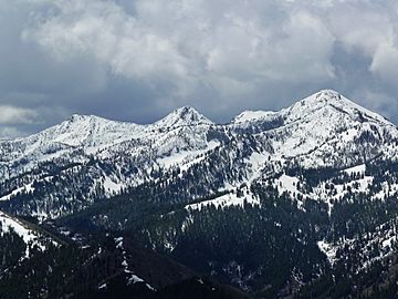
Iron Mountain at right
|
|
| Highest point | |
| Elevation | 9,694 ft (2,955 m) NAVD 88 |
| Prominence | 514 ft (157 m) |
| Geography | |
| Parent range | Soldier Mountains |
| Topo map | USGS Jumbo Mountain |
| Climbing | |
| Easiest route | Simple Scrambling, class 2 |
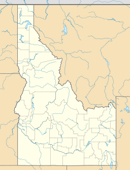
Iron Mountain is a cool peak found in the Soldier Mountains of Idaho. It stands tall at 9,694 feet (about 2,955 meters) above sea level. You can find Iron Mountain at the western end of the Soldier Mountains. It's located northwest of a town called Fairfield in Camas County. This mountain is also part of the beautiful Sawtooth National Forest.
Exploring Iron Mountain
Reaching the Summit
Even though climbing Iron Mountain is not super difficult, the journey is quite long. It's considered a "class 2 ascent." This means you might need to use your hands a bit for balance on some parts. The main trail to the top is about 11 miles (18 kilometers) one way! This trail is open for off-road vehicles with two wheels, like dirt bikes. Once you reach the very top, you'll find an old fire lookout building from the Forest Service. It's a great spot to see amazing views.
Lakes and Rivers Nearby
Iron Mountain is surrounded by amazing nature. The northern slopes of the mountain send water into Deadwood Creek. This creek then flows into the South Fork Boise River. Just north-northeast of Iron Mountain, you'll find Heart Lake. Another lake, Upper Deadwood Lake, is located southeast of the peak. Iron Mountain is also northwest of another mountain called Boardman Peak.
 | Toni Morrison |
 | Barack Obama |
 | Martin Luther King Jr. |
 | Ralph Bunche |


