Ironbark, Queensland facts for kids
Quick facts for kids IronbarkIpswich, Queensland |
|||||||||||||||
|---|---|---|---|---|---|---|---|---|---|---|---|---|---|---|---|

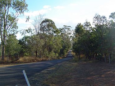
Beethams Road, 2014
|
|||||||||||||||
| Population | 1,173 (2021 census) | ||||||||||||||
| • Density | 77.68/km2 (201.2/sq mi) | ||||||||||||||
| Postcode(s) | 4306 | ||||||||||||||
| Area | 15.1 km2 (5.8 sq mi) | ||||||||||||||
| Time zone | AEST (UTC+10:00) | ||||||||||||||
| Location | |||||||||||||||
| LGA(s) | City of Ipswich | ||||||||||||||
| State electorate(s) | Ipswich West | ||||||||||||||
| Federal Division(s) | Blair | ||||||||||||||
|
|||||||||||||||
Ironbark is a quiet, country area in Queensland, Australia. It's a "locality," which is like a small community or neighborhood. Ironbark is part of the City of Ipswich. In 2021, about 1,173 people lived there.
Where is Ironbark?
Ironbark is located in Queensland, Australia. It is a rural area. This means it has lots of open spaces and fewer buildings than a city.
The eastern edge of Ironbark is next to the Brisbane Valley Highway. This is a main road that helps people travel around. The southern edge follows another important road called the Warrego Highway.
A road called Haigslea–Amberley Road also runs through the area. It goes south towards a place called Walloon. These roads help connect Ironbark to nearby towns and cities.
Who Lives in Ironbark?
The number of people living in Ironbark has been growing. In 2016, about 604 people called Ironbark home. By 2021, the population had increased to 1,173 people. This information comes from the Australian Census. The Census counts everyone in the country every few years.
 | Toni Morrison |
 | Barack Obama |
 | Martin Luther King Jr. |
 | Ralph Bunche |


