Ivanhoe Lake facts for kids
Quick facts for kids Ivanhoe Lake |
|
|---|---|
 |
|
| Lua error in Module:Location_map at line 416: Malformed coordinates value. | |
| Location | Sudbury District, Ontario |
| Coordinates | Lua error in Module:Coordinates at line 614: attempt to index field 'wikibase' (a nil value). |
| Primary inflows | Ivanhoe River |
| Primary outflows | Ivanhoe River |
| Basin countries | Canada |
| Max. length | 25 km (16 mi) |
| Surface elevation | 340 m (1,120 ft) |
| Islands | First island, Second island, Hinton Island, and Klose Island |
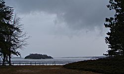
Ivanhoe Lake is a long, narrow lake in Ontario, Canada. It stretches about 25 kilometers (15 miles) and is found in the northern part of Sudbury District. The lake is part of the Ivanhoe River system, which eventually flows into James Bay.
You can find Ivanhoe Lake about 8 kilometers (5 miles) southwest of a town called Foleyet. It's also right by Ontario Highway 101. Most of the lake is inside Ivanhoe Lake Provincial Park, which is a protected area. There are a few private cottages on the northeast side of the lake.
Long ago, the Anishinaabe people called this lake Pishkanogami. It was even home to a trading post run by the Hudson's Bay Company. The lake was officially renamed Ivanhoe Lake in 1960.
Contents
Exploring Ivanhoe Lake's Features
Ivanhoe Lake has several interesting natural features. There are four islands you can spot: First Island, Second Island, Hinton Island, and Klose Island.
There's also a shallow area called Hastle Shoal. It's like an underwater hill, located about 500 meters (1,640 feet) northeast of Second Island.
How Water Flows Through Ivanhoe Lake
The main river flowing into Ivanhoe Lake is the Ivanhoe River, which enters at the southwest end. Other smaller streams also feed into the lake, like Jackpine Creek, Hellyer Creek, and Gullystone Creek.
The Ivanhoe River also flows out of the lake at the northeast end. This outflow is controlled by a special structure called the Ivanhoe Lake Dam. This dam helps manage the water level in the lake. It also stores water for power plants further downstream that make electricity.
There's also an older channel of the Ivanhoe River that flows out from the northwest side of the lake. Both the new and old channels of the river eventually join up again. From there, the Ivanhoe River flows into the Groundhog River, then the Mattagami River, and finally the Moose River before reaching James Bay.
The Famous Sandy Beach
Ivanhoe Lake is known for its very large sandy beach. This beach is along the east side of the lake, inside Ivanhoe Lake Provincial Park. The sand was created over time as the lake level changed. Because this area is wide and shallow, the water at the beach can get very warm and comfortable during the summer.
Getting Around Ivanhoe Lake
It's easy to reach Ivanhoe Lake by road using Highway 101. If you want to fly in, some companies offer private floatplane services from their base right on the lake.
You can also find places to rent boats and buy fuel for them. There are three main spots to launch your boat into the lake:
- Public Boat Launch: This launch is made of gravel and sand. It's good for smaller boats, but bigger boats might find it a bit tricky.
- Redpine Lodge Launch: This is a paid launch with a concrete surface. It's flat and works well for all sizes of boats.
- Provincial Park Launch: Inside Ivanhoe Lake Provincial Park, there's another gravel launch available for visitors.
There's even an airstrip near the lake, between the northwest tip and Highway 101. It was built in the 1960s and was used by small planes for many years.
 | Stephanie Wilson |
 | Charles Bolden |
 | Ronald McNair |
 | Frederick D. Gregory |

