Mattagami River facts for kids
Quick facts for kids Mattagami River |
|
|---|---|

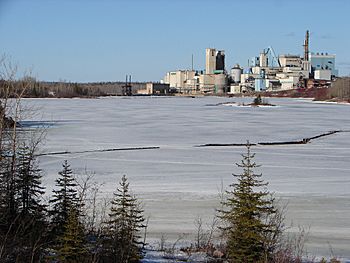
Mattagami River at Smooth Rock Falls
|
|
|
Location of the mouth of the Mattagami River in Ontario
|
|
| Other name(s) | Rivière Mattagami |
| Country | Canada |
| Province | Ontario |
| Region | Northeastern Ontario |
| Districts |
|
| Physical characteristics | |
| Main source | Mattagami Lake Gouin Township, Sudbury District 330 m (1,080 ft) 48°00′46″N 81°33′28″W / 48.01278°N 81.55778°W |
| River mouth | Moose River Gardiner Township, Cochrane District 48 m (157 ft) 50°43′42″N 81°29′14″W / 50.72833°N 81.48722°W |
| Length | 443 km (275 mi) |
| Basin features | |
| River system | James Bay drainage basin |
| Basin size | 37,000 km2 (14,000 sq mi) |
The Mattagami River is a long river located in Northern Ontario, Canada. It is an important waterway in the region.
This river flows for about 443 kilometers (275 miles). It starts at Mattagami Lake in the Sudbury District. The river then travels north through different areas of Ontario. It eventually joins another river called the Missinaibi River. Together, they form the Moose River. This larger river then flows into James Bay, which is part of Hudson Bay.
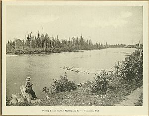
The Mattagami River passes through the city of Timmins. It also flows through the town of Smooth Rock Falls. The area that drains into the Mattagami River is very large. It covers about 37,000 square kilometers (14,000 square miles).
The name Mattagami comes from the Ojibwe language. It might mean "the start of water" or "turbulent water." However, the local Ojibwe people have another idea. They believe it means "meeting of the waters." This name makes sense because many rivers join together here.
Contents
River's Journey: From Source to Mouth
The Mattagami River begins its journey at Mattagami Lake. This lake is found in the Sudbury District of Ontario. The river then flows north, making its way through different landscapes.
It passes through parts of the Canadian Shield. This is an ancient, rocky area. Further north, it enters the Hudson Bay Lowlands. This area is flatter and has many wetlands. The river's journey ends when it meets the Missinaibi River. This meeting point is in the Cochrane District.
Powering the Region: The River's Role
The Mattagami River is not just a natural waterway. It also plays a role in providing electricity. Ontario Power Generation operates a power station on the river. This station is called the Little Long Generating Station.
It is located where the Groundhog and Kapuskasing Rivers flow into the Mattagami. A large dam, over 5 kilometers (3 miles) long, helps create power here. This power helps light up homes and businesses in the region.
Rivers Joining the Mattagami
Many smaller rivers and streams flow into the Mattagami River. These are called tributaries. They add water to the Mattagami as it flows north. Some of the main tributaries include:
- Kapuskasing River
- Nemegosenda River
- Chapleau River
- Nemegosenda River
- Groundhog River
- Ivanhoe River
- Nat River
- Poplar Rapids River
- Kamiskotia River
- Grassy River
- Tatachikapika River
- Mattagami Lake (the source, but also has its own tributaries)
- Minisinakwa River
- Nabakwasi River
- Opikinimika River
- Noble River
- Nabakwasi River
- Minisinakwa River
See also
 In Spanish: Río Mattagami para niños
 | Tommie Smith |
 | Simone Manuel |
 | Shani Davis |
 | Simone Biles |
 | Alice Coachman |


