Jēkabpils facts for kids
Quick facts for kids
Jēkabpils
Jakubów (Polish)
Jakobstadt
|
|||||
|---|---|---|---|---|---|
|
State city
|
|||||
 |
|||||
|
|||||
| Country | |||||
| Municipality | Jēkabpils Municipality | ||||
| Town rights | 1670 | ||||
| Area | |||||
| • Total | Lua error in Module:Wd at line 1,575: attempt to index field 'wikibase' (a nil value). km2 (Formatting error: invalid input when rounding sq mi) | ||||
| • Land | Lua error in Module:Wd at line 1,575: attempt to index field 'wikibase' (a nil value). km2 (Formatting error: invalid input when rounding sq mi) | ||||
| • Water | Expression error: Unexpected < operator. km2 (Formatting error: invalid input when rounding sq mi) | ||||
| Elevation | 77 m (253 ft) | ||||
| Population
(2024)
|
|||||
| • Total | 21,150 | ||||
| GDP | |||||
| • State city | 288,652,000 Euro (2021) | ||||
| • Per capita | 13,421 Euro (2021) | ||||
| Time zone | UTC+2 (EET) | ||||
| • Summer (DST) | UTC+3 (EEST) | ||||
| Postal code |
LV-52(01/02)
|
||||
| Calling code | (+371) 652 | ||||
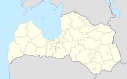
Jēkabpils is a city in southeastern Latvia. It is located about halfway between the capital city, Riga, and Daugavpils. The city sits on both sides of the Daugava River.
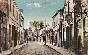
The name Jēkabpils means "Castle of Jacob." The older part of Jēkabpils is on the left bank of the river. The historic Krustpils is on the right bank. These two cities joined together in 1962. They are now one city called Jēkabpils. However, they still have their own unique feel.
Jēkabpils was once home to a Soviet air base.
Contents
History of Jēkabpils
Early Beginnings and Krustpils Castle
A stone castle called Cruczeborch was built in 1237. It was built by the bishop of Riga. Before the castle, this area was a busy trading place. People lived here as early as 1000 BC.
A village grew around Krustpils Castle. This village was often damaged during wars. But it was always rebuilt.
How Jēkabpils Got Its Name
In the 1600s, people called Old Believers came from Russia. They settled along the Daugava River. This settlement grew around an inn. In 1670, it became known as Jēkabpils.
The city was named after Duke Jacob Kettler. He was the Duke of Courland. Duke Jacob gave the town special rights.
The Legend of the Lynx
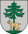
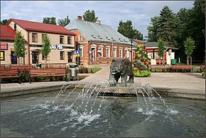
There is a local legend about how the city got its symbol. One day, Duke Jacob was hunting and got lost. He saw a lynx under a fir tree by the Daugava River. At the same time, he saw a town nearby.
Because of this, the image of a lynx under a fir tree became the city's coat of arms.
Life in the Duchy of Courland
During the time of the Duchy of Courland, many people lived in Jēkabpils. They included Russian Old Believers, Poles, and Lithuanians. Duke Jacob built a small port in the town. This port helped transport goods from a nearby iron factory.
By the late 1600s, Jēkabpils had several factories. These included places that made anchors and guns.
Wars and Prosperity
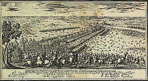
In 1704, during the Great Northern War, Russian forces took over the town. But a few months later, a big battle happened nearby. A Swedish army defeated a larger Russian force. This stopped Russia from invading more of the Duchy.
After the war and a serious illness, the town grew strong again. Boats brought goods like grain and honey from Belarus. Land transport was also very busy. Jēkabpils was an important stop on the postal road.
In 1764, the first ferry crossing to Krustpils opened. Over time, more German craftsmen moved to the town. However, Jews were not allowed to live there. In 1795, Jēkabpils became part of the Russian Empire.
Growth and Modernization
In 1834, the first hospital opened in Jēkabpils. A theater and library were also built. The first streets in the town were paved.
In 1861, a railway opened through Krustpils. This made river transport less important. But the river was still used to float timber.
By the early 1900s, Jēkabpils had a bank and factories. These factories made matches, brewed beer, and more. During World War I, many buildings were destroyed.
In 1932, a sugar factory was built. In 1936, a bridge was built over the Daugava River. This bridge connected Jēkabpils and Krustpils for the first time.
After World War II
During the Second World War, the bridge was destroyed. A new bridge was built in 1962. That same year, Jēkabpils and Krustpils officially became one city.
During the Soviet period, the city had many large factories. These included a sewing factory and a concrete factory. After Latvia became independent in 1991, many factories closed.
Since 2021, Jēkabpils has been a "state city" in Latvia.
Geography and Climate
Jēkabpils has a population of about 29,100 people. The two historic parts of the city, Krustpils and Jēkabpils, are connected by a bridge over the Daugava River.
Climate in Jēkabpils
Jēkabpils has a climate with warm summers and cold winters. This type of climate is called a humid continental climate.
| Climate data for Jēkabpils (Zīlāni, 1991-2020 normals, extremes 1943–present) | |||||||||||||
|---|---|---|---|---|---|---|---|---|---|---|---|---|---|
| Month | Jan | Feb | Mar | Apr | May | Jun | Jul | Aug | Sep | Oct | Nov | Dec | Year |
| Record high °C (°F) | 10.0 (50.0) |
11.8 (53.2) |
18.0 (64.4) |
26.3 (79.3) |
30.0 (86.0) |
32.3 (90.1) |
34.7 (94.5) |
34.3 (93.7) |
30.5 (86.9) |
22.6 (72.7) |
16.6 (61.9) |
10.3 (50.5) |
34.7 (94.5) |
| Mean daily maximum °C (°F) | −1.8 (28.8) |
−1.2 (29.8) |
3.8 (38.8) |
11.8 (53.2) |
17.7 (63.9) |
21.1 (70.0) |
23.6 (74.5) |
22.4 (72.3) |
16.7 (62.1) |
9.6 (49.3) |
3.3 (37.9) |
−0.4 (31.3) |
10.5 (51.0) |
| Daily mean °C (°F) | −4.0 (24.8) |
−4.0 (24.8) |
−0.1 (31.8) |
6.6 (43.9) |
12.1 (53.8) |
15.7 (60.3) |
18.1 (64.6) |
16.9 (62.4) |
11.9 (53.4) |
6.1 (43.0) |
1.4 (34.5) |
−2.1 (28.2) |
6.6 (43.8) |
| Mean daily minimum °C (°F) | −6.5 (20.3) |
−7.1 (19.2) |
−3.9 (25.0) |
1.6 (34.9) |
6.1 (43.0) |
10.1 (50.2) |
12.7 (54.9) |
11.7 (53.1) |
7.6 (45.7) |
3.1 (37.6) |
−0.9 (30.4) |
−4.4 (24.1) |
2.5 (36.5) |
| Record low °C (°F) | −35.4 (−31.7) |
−36.7 (−34.1) |
−24.6 (−12.3) |
−14.4 (6.1) |
−4.6 (23.7) |
−0.4 (31.3) |
4.1 (39.4) |
0.3 (32.5) |
−4.2 (24.4) |
−10.9 (12.4) |
−22.0 (−7.6) |
−35.2 (−31.4) |
−36.7 (−34.1) |
| Average precipitation mm (inches) | 47.8 (1.88) |
40.4 (1.59) |
37.2 (1.46) |
37.0 (1.46) |
59.6 (2.35) |
75.0 (2.95) |
71.0 (2.80) |
74.5 (2.93) |
56.0 (2.20) |
69.4 (2.73) |
54.7 (2.15) |
47.5 (1.87) |
670.1 (26.37) |
| Average precipitation days (≥ 1 mm) | 12 | 10 | 9 | 8 | 9 | 10 | 11 | 11 | 9 | 11 | 11 | 12 | 123 |
| Average relative humidity (%) | 87.9 | 85.6 | 77.3 | 68.5 | 68.0 | 72.6 | 74.6 | 77.0 | 82.0 | 86.4 | 89.5 | 89.4 | 79.9 |
| Source 1: LVĢMC | |||||||||||||
| Source 2: NOAA (precipitation days, humidity 1991-2020) | |||||||||||||
People of Jēkabpils
As of 2017, Jēkabpils had a population of 23,750 people. The city is home to many different groups. Most people are Latvians, making up about 60.6% of the population. Russians are the second largest group at 26.7%. Other groups include Belarusians, Poles, and Ukrainians.
| Demographics of Jēkabpils in 2017 population census | ||||
|---|---|---|---|---|
| Latvians | 60.6% | |||
| Russians | 26.7% | |||
| Belarusians | 3.1% | |||
| Poles | 2.9% | |||
| Ukrainians | 1.8% | |||
| Others | 5.0% | |||
Places to See
In Jēkabpils City
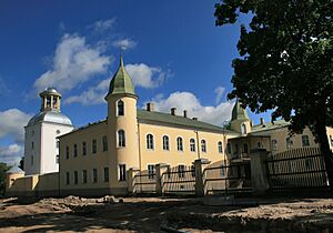
You can still see many old buildings in Jēkabpils. The Krustpils Castle now holds the History Museum of Jēkabpils and Krustpils. It's a great place to learn about the city's past.
Around Jēkabpils District
Near Jēkabpils, you can visit the Strūves park. It has one of the original points from the Struve Geodetic Arc. This was a huge project to measure the Earth's shape.
In Tadenava, there is a museum for the famous Latvian poet Rainis. You can also find the castles of Justine and Dignāja nearby. The highest point in Selonia, Ormaņkalns, is also close by.
Famous People from Jēkabpils
- Uga Skulme (1895-1963), a well-known painter
- Elita Kļaviņa (born 1966), an actress
- Juris Umbraško (born 1978), a basketball coach
- Arvis Viguls (born 1987), a poet and translator
- Deniss Rakels (born 1992), a footballer
- Reinis Nitišs (born 1995), a World Rallycross driver
Sister Cities
Jēkabpils has "sister city" relationships with several cities around the world. These connections help promote friendship and understanding.
Images for kids
See also
 In Spanish: Jēkabpils para niños
 | Delilah Pierce |
 | Gordon Parks |
 | Augusta Savage |
 | Charles Ethan Porter |


