J. Clark Salyer National Wildlife Refuge facts for kids
Quick facts for kids J. Clark Salyer National Wildlife Refuge |
|
|---|---|
|
IUCN Category IV (Habitat/Species Management Area)
|
|

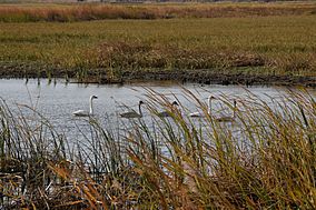
Tundra swans at the refuge
|
|
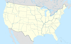
| Location | Bottineau, McHenry counties, North Dakota, United States |
| Nearest city | Upham, North Dakota |
| Area | 58,693 acres (237.52 km2) |
| Established | 1935 |
| Governing body | U.S. Fish and Wildlife Service |
| Website | J. Clark Salyer National Wildlife Refuge |
The J. Clark Salyer National Wildlife Refuge is a special place in north-central North Dakota, United States. It's a protected area where animals and plants can live safely. This refuge is found along the Souris River in Bottineau and McHenry counties.
The refuge covers a huge area, about 58,693 acres (237.5 square kilometers). It stretches about 45 miles (72 kilometers) south from the border with Manitoba, Canada. This land used to be part of a giant ancient lake called Glacial Lake Souris. Because of this, the area is very flat and has many temporary wetlands, which are like marshy areas that can be wet or dry at different times.
Contents
History of the Refuge
The J. Clark Salyer National Wildlife Refuge was first created in 1935. Back then, it was known as the Lower Souris National Wildlife Refuge. Its main goal was to protect the natural habitats for wildlife.
How the Refuge Got Its Name
In 1967, the refuge was renamed to honor a very important person named J. Clark Salyer II. He was the chief of the U.S. Fish and Wildlife Service's Division of Wildlife Refuges for many years, from 1934 to 1961. He played a big role in setting up and managing many wildlife refuges across the United States. Renaming the refuge after him was a way to recognize his dedication to protecting nature.
The Souris River
The Souris River is a key feature of the J. Clark Salyer National Wildlife Refuge. It's a long river that starts in southern Saskatchewan, Canada.
The River's Journey
From Canada, the Souris River flows southwest into North Dakota, passing through towns like Velva, North Dakota. Then, it generally turns north again, flowing back into Manitoba, Canada, where it joins another river called the Assiniboine River.
The part of the Souris River that flows through the United States is about 358 miles (576 kilometers) long. Its drainage basin (the area of land where all the water drains into the river) covers about 9,000 square miles (23,000 square kilometers) in the U.S. A significant portion of the river, about 75 miles (121 kilometers), flows right through the J. Clark Salyer National Wildlife Refuge, making it a vital water source for the animals and plants living there.
Wildlife at the Refuge
The refuge is a home for many different kinds of wildlife, especially birds. The wetlands and the Souris River provide perfect places for them to live, find food, and raise their young.
Birds and Their Habitats
Many types of birds, including Tundra swans, use the refuge during their long migrations. The flat landscape and many wetlands are ideal for waterfowl like ducks, geese, and swans. These areas offer safe nesting spots and plenty of food. Protecting these habitats helps ensure that these birds have a place to rest and thrive as they travel thousands of miles each year.
 | Victor J. Glover |
 | Yvonne Cagle |
 | Jeanette Epps |
 | Bernard A. Harris Jr. |


