
Souris River facts for kids
Quick facts for kids Souris River |
|
|---|---|

The Souris River in the town of Souris, Manitoba
|
|

The Red River drainage basin, with the Souris River highlighted
|
|
| Other name(s) | Mouse River, Rivière Souris |
| Countries |
|
| Provinces | |
| State | North Dakota |
| Cities |
|
| Physical characteristics | |
| Main source | north of Weyburn Saskatchewan 49°49′53″N 103°47′46″W / 49.83139°N 103.79611°W |
| River mouth | Assiniboine River Manitoba, Canada 49°39′54″N 99°34′07″W / 49.66500°N 99.56861°W |
| Length | 435 mi (700 km) |
| Basin features | |
| River system | Red River drainage basin |
| Basin size | 23,600 sq mi (61,000 km2) |
| Tributaries |
|
The Souris River is a river in central North America. It is also known as the Mouse River in the United States. This name is a direct translation from its French name, rivière Souris.
.jpg)
The river is about 700 kilometers (435 miles) long. It drains an area of about 61,100 square kilometers (23,600 square miles). The Souris River starts in the Yellow Grass Marshes, which are north of Weyburn, Saskatchewan.
From there, it flows south through North Dakota. It passes by Minot and reaches its southernmost point at Velva. Then, it turns and flows north again into Manitoba, Canada.
In Manitoba, the river goes through several towns. These include Melita, Hartney, Souris, and Wawanesa. Finally, it joins the Assiniboine River near Treesbank. This meeting point is about 25 miles (40 kilometers) southeast of Brandon.
The main smaller rivers and creeks that flow into the Souris River in Manitoba are the Antler River, the Gainsborough Creek, and Plum Creek. Much of the land around the river is very fertile. This is because it was once covered by an ancient glacial lake called Lake Souris.
Contents
How the River's Flow Changes
The amount of water the Souris River can carry changes along its path. Near the border, it can carry about 4.2 cubic meters per second (150 cubic feet per second). Through Melita, it can carry about 40 cubic meters per second (1,400 cubic feet per second).
Near Lauder, it holds about 31 cubic meters per second (1,100 cubic feet per second). Near Hartney, it can carry about 48 cubic meters per second (1,700 cubic feet per second). North of Hartney, the river's capacity increases to more than 85 cubic meters per second (3,000 cubic feet per second). The river drops only about 15 centimeters per mile (6 inches per mile) between the border and Hartney.
Dams Along the Souris River
During a severe drought from 1930 to 1941, several dams were built. These dams helped store water for livestock. The Snyder and Ross Dams were built near Melita in 1937. The Napinka Dam was built in 1938, and the Hartney Dam in 1941. These dams could hold a total of about 2.96 million cubic meters (2,400 acre-feet) of water.
The Souris Dam was first built in 1911 and then rebuilt in 1935. The Wawanesa Dam was finished in 1951. It can store about 395,000 cubic meters (320 acre-feet) of water.
Two large dams in Saskatchewan, Rafferty Dam and Alameda Dam, were built. One of their purposes was to help reduce big floods on the Souris River.
River Flow and Flooding
Most of the water in the Souris River comes from melting snow and spring rains. The total amount of water flowing each year changes a lot. For example, in 1937, it was only about 4.19 million cubic meters (3,400 acre-feet). But in 1976, it reached about 2.59 billion cubic meters (2.1 million acre-feet).
In 2011, the total water runoff at Wawanesa was expected to be very high. It was about 4.69 billion cubic meters (3.8 million acre-feet). This was a very rare event, expected only once every 500 years. On average, the yearly runoff is like 3 millimeters (0.12 inches) of water over the entire Souris River area.
In the summer of 2011, a huge flood happened in the Souris River basin. The water went over the protective walls (levees). About 11,000 people in Minot had to leave their homes. The flood also caused a lot of damage to farms and other property along the river.
Historical Peak Flow Rates
The table below shows the highest recorded or estimated flow rates at different points along the Souris River during major floods. Flow is measured in cubic feet per second (cfs).
| Location | 1882 Peak Flow (cfs) (Estimated) | 1976 Peak Flow (cfs) | 2011 Peak Flow (cfs) |
|---|---|---|---|
| Minot | 22,813.3 | 9,350 | 26,900 |
| Westhope | 18,500 | 12,400 | 30,400 |
| Melita | 30,017.5 | 21,300 | 26,800 |
| Souris | N/A | 24,800 | 28,200 |
| Wawanesa | 39,905.6 | 26,200 | 27,800 |
Fish Species in the River
The Souris River is home to many different kinds of fish. Some of the fish you might find include:
Smaller Rivers and Creeks that Join the Souris
Many smaller rivers and creeks flow into the Souris River. These are called tributaries. Some of them are:
- Long Creek
- Short Creek
- Moose Mountain Creek
- Des Lacs River
- Livingston Creek
- Wintering River
- Deep River
- Little Deep Creek
- Cut Bank Creek
- North Lake
- Egg Creek
- North Lake
* Hay Coulee
-
-
-
- Buffalo Lodge Lake
-
-
* South Egg Creek
- Willow Creek
- Snake Creek (North Dakota)
- Oak Creek
- Ox Creek
- Wolf Creek
- Stoney Creek
- Jackson Creek
- Graham Creek
- Boundary Creek (North Dakota)
- Antler River
- Gainsborough Creek
Cities and Towns Along the River
The Souris River flows through or near several cities and towns:
- Weyburn, Saskatchewan
- Estevan, Saskatchewan
- Roche Percee, Saskatchewan
- Oxbow, Saskatchewan
- Burlington, North Dakota
- Minot, North Dakota
- Velva, North Dakota
- Towner, North Dakota
- Westhope, North Dakota
- Melita, Manitoba
- Souris, Manitoba
- Wawanesa, Manitoba
Rural Areas Along the River
The river also passes through several rural municipalities (local government areas):
- Souris Valley No. 7, Saskatchewan
- Municipality of Grassland
- Municipality of Oakland-Wawanesa
Images for kids
-
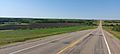
Highway 9 traveling through the Souris River Valley in Saskatchewan

See also
 In Spanish: Río Souris para niños
