Jarbidge, Nevada facts for kids
Quick facts for kids
Jarbidge, Nevada
|
|
|---|---|
 |
|
| Country | United States |
| State | Nevada |
| County | Elko |
| Elevation | 6,218 ft (1,895 m) |
| ZIP code |
89826
|
| Area code(s) | 775 |
| Website | |
| Reference #: | 69 |
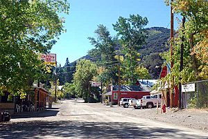
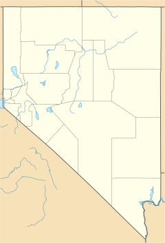
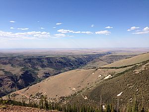
Jarbidge is a small, unincorporated community in Elko County, Nevada, United States. It's located deep in the Jarbidge River's canyon, surrounded by the Jarbidge Mountains. This remote spot is part of the Humboldt-Toiyabe National Forest and is close to the Idaho–Nevada border.
Even though Jarbidge is officially in the Pacific Time Zone, many people there unofficially use the Mountain Time Zone. This is because it's closer to towns in southern Idaho. Jarbidge is a popular place for hunters and campers. The area has many campsites and a large population of elk.
Contents
Discovering Jarbidge's Past
The name "Jarbidge" comes from the Shoshone language. It means "devil." Local native people believed the nearby hills were haunted.
Gold Rush and Robbery
In 1909, gold was found near Jarbidge. This led to one of the last "gold rushes" in the Old West. In 1916, Jarbidge was also the site of the very last stagecoach robbery in the United States.
By 1911, Jarbidge's population grew to almost 2,000 people. However, the population slowly dropped after that. Many of the mining tools and buildings were taken apart to help with the war effort during World War I. Mining stopped completely in 1932. But in 2013, new permits were given to start mining for gold again.
Famous People from Jarbidge
Jazz musician Ralph Peña was born in Jarbidge in 1927. He became a well-known bass player.
Exploring Jarbidge's Location
Jarbidge is known for being very remote. There are no paved roads for almost 20 miles (32 km) around it.
How to Get to Jarbidge
The easiest way to reach Jarbidge by car is usually by taking Three Creek Road. This road starts in Rogerson, Idaho. The last 18 miles (29 km) of this road are unpaved but are usually open all year.
If you are coming from Elko, Nevada, the trip is longer. You would drive about 55 miles (89 km) north on Nevada State Route 225. Then, turn east for 27 miles (43 km) onto Elko County Road 746. Finally, go north for 22 miles (35 km) on Elko County Road 748. The last two parts of this route are unpaved and can be dangerous. They are often closed from October or November until June or July because of heavy snow.
Jarbidge's Weather
Jarbidge has a type of continental climate with warm summers. This means it has distinct seasons. The hottest temperature ever recorded in Jarbidge was 101°F (38°C) on July 14, 2002. The coldest temperature recorded was -38°F (-39°C) on December 22, 1990.
| Climate data for Jarbidge 7 N, Nevada, 1991–2020 normals, 1996-2013 snowfall: 6050ft (1844m) | |||||||||||||
|---|---|---|---|---|---|---|---|---|---|---|---|---|---|
| Month | Jan | Feb | Mar | Apr | May | Jun | Jul | Aug | Sep | Oct | Nov | Dec | Year |
| Record high °F (°C) | 63 (17) |
61 (16) |
77 (25) |
80 (27) |
89 (32) |
97 (36) |
100 (38) |
100 (38) |
92 (33) |
85 (29) |
73 (23) |
61 (16) |
100 (38) |
| Mean daily maximum °F (°C) | 37.6 (3.1) |
37.6 (3.1) |
44.2 (6.8) |
51.1 (10.6) |
61.3 (16.3) |
71.4 (21.9) |
82.4 (28.0) |
81.2 (27.3) |
71.4 (21.9) |
57.6 (14.2) |
43.3 (6.3) |
35.5 (1.9) |
56.2 (13.5) |
| Daily mean °F (°C) | 27.7 (−2.4) |
28.0 (−2.2) |
33.8 (1.0) |
39.1 (3.9) |
47.7 (8.7) |
55.5 (13.1) |
64.9 (18.3) |
63.6 (17.6) |
54.7 (12.6) |
43.5 (6.4) |
32.7 (0.4) |
25.9 (−3.4) |
43.1 (6.2) |
| Mean daily minimum °F (°C) | 17.7 (−7.9) |
18.3 (−7.6) |
23.3 (−4.8) |
27.1 (−2.7) |
34.0 (1.1) |
39.6 (4.2) |
47.5 (8.6) |
46.0 (7.8) |
38.1 (3.4) |
29.4 (−1.4) |
22.0 (−5.6) |
16.4 (−8.7) |
30.0 (−1.1) |
| Record low °F (°C) | −14 (−26) |
−18 (−28) |
1 (−17) |
7 (−14) |
15 (−9) |
23 (−5) |
28 (−2) |
27 (−3) |
16 (−9) |
−7 (−22) |
−6 (−21) |
−20 (−29) |
−20 (−29) |
| Average precipitation inches (mm) | 1.43 (36) |
1.10 (28) |
1.87 (47) |
2.51 (64) |
2.30 (58) |
1.40 (36) |
0.55 (14) |
0.34 (8.6) |
0.92 (23) |
1.13 (29) |
1.49 (38) |
1.29 (33) |
16.33 (414.6) |
| Average snowfall inches (cm) | 15.2 (39) |
13.2 (34) |
16.8 (43) |
12.8 (33) |
3.7 (9.4) |
0.4 (1.0) |
0.0 (0.0) |
0.0 (0.0) |
0.8 (2.0) |
3.8 (9.7) |
9.2 (23) |
14.0 (36) |
89.9 (230.1) |
| Source 1: NOAA | |||||||||||||
| Source 2: XMACIS2 (snowfall & records) | |||||||||||||
| Climate data for Jarbidge, Nevada (Gibbs Ranch), 1991–2020 normals, extremes 1953–present | |||||||||||||
|---|---|---|---|---|---|---|---|---|---|---|---|---|---|
| Month | Jan | Feb | Mar | Apr | May | Jun | Jul | Aug | Sep | Oct | Nov | Dec | Year |
| Record high °F (°C) | 60 (16) |
66 (19) |
75 (24) |
83 (28) |
90 (32) |
95 (35) |
101 (38) |
99 (37) |
96 (36) |
87 (31) |
72 (22) |
59 (15) |
101 (38) |
| Mean maximum °F (°C) | 47.3 (8.5) |
51.0 (10.6) |
62.8 (17.1) |
72.9 (22.7) |
80.0 (26.7) |
88.3 (31.3) |
94.4 (34.7) |
92.7 (33.7) |
87.7 (30.9) |
77.8 (25.4) |
63.8 (17.7) |
50.4 (10.2) |
95.1 (35.1) |
| Mean daily maximum °F (°C) | 36.6 (2.6) |
39.3 (4.1) |
47.7 (8.7) |
55.2 (12.9) |
64.6 (18.1) |
74.6 (23.7) |
85.6 (29.8) |
84.6 (29.2) |
75.7 (24.3) |
62.4 (16.9) |
47.4 (8.6) |
37.3 (2.9) |
59.3 (15.2) |
| Daily mean °F (°C) | 26.1 (−3.3) |
28.7 (−1.8) |
36.7 (2.6) |
42.7 (5.9) |
50.7 (10.4) |
58.7 (14.8) |
67.4 (19.7) |
65.8 (18.8) |
57.4 (14.1) |
46.3 (7.9) |
35.0 (1.7) |
26.5 (−3.1) |
45.2 (7.3) |
| Mean daily minimum °F (°C) | 15.6 (−9.1) |
18.1 (−7.7) |
25.7 (−3.5) |
30.2 (−1.0) |
36.7 (2.6) |
42.8 (6.0) |
49.2 (9.6) |
47.1 (8.4) |
39.2 (4.0) |
30.2 (−1.0) |
22.5 (−5.3) |
15.7 (−9.1) |
31.1 (−0.5) |
| Mean minimum °F (°C) | −2.8 (−19.3) |
−0.2 (−17.9) |
9.4 (−12.6) |
17.9 (−7.8) |
21.6 (−5.8) |
29.7 (−1.3) |
37.1 (2.8) |
34.8 (1.6) |
25.2 (−3.8) |
15.0 (−9.4) |
4.2 (−15.4) |
−2.4 (−19.1) |
−7.2 (−21.8) |
| Record low °F (°C) | −30 (−34) |
−33 (−36) |
−16 (−27) |
−2 (−19) |
7 (−14) |
15 (−9) |
21 (−6) |
19 (−7) |
10 (−12) |
−3 (−19) |
−17 (−27) |
−38 (−39) |
−38 (−39) |
| Average precipitation inches (mm) | 1.27 (32) |
0.76 (19) |
1.04 (26) |
0.97 (25) |
1.72 (44) |
0.86 (22) |
0.57 (14) |
0.47 (12) |
0.63 (16) |
0.73 (19) |
0.91 (23) |
1.13 (29) |
11.06 (281) |
| Average snowfall inches (cm) | 6.2 (16) |
2.7 (6.9) |
3.9 (9.9) |
2.0 (5.1) |
0.3 (0.76) |
0.1 (0.25) |
0.0 (0.0) |
0.0 (0.0) |
0.0 (0.0) |
0.3 (0.76) |
4.2 (11) |
8.1 (21) |
27.8 (71.67) |
| Average extreme snow depth inches (cm) | 6.5 (17) |
4.1 (10) |
2.1 (5.3) |
1.0 (2.5) |
0.1 (0.25) |
0.1 (0.25) |
0.0 (0.0) |
0.0 (0.0) |
0.0 (0.0) |
0.2 (0.51) |
2.3 (5.8) |
4.7 (12) |
8.9 (23) |
| Average precipitation days (≥ 0.01 in) | 5.2 | 4.1 | 4.6 | 5.3 | 8.0 | 4.2 | 3.9 | 3.0 | 2.8 | 3.5 | 4.3 | 5.0 | 53.9 |
| Average snowy days (≥ 0.1 in) | 1.9 | 1.1 | 1.6 | 0.6 | 0.1 | 0.0 | 0.0 | 0.0 | 0.0 | 0.3 | 1.2 | 2.4 | 9.2 |
| Source 1: NOAA | |||||||||||||
| Source 2: National Weather Service | |||||||||||||
See also
 In Spanish: Jarbidge (Nevada) para niños
 | Kyle Baker |
 | Joseph Yoakum |
 | Laura Wheeler Waring |
 | Henry Ossawa Tanner |


