Jarman Gap facts for kids
Quick facts for kids Jarman Gap |
|
|---|---|
| Elevation | 2,172 ft (662 m) |
| Traversed by | County Route 611 – Jarmans Gap Road |
| Location | Albemarle / Augusta counties, Virginia, United States |
| Range | Blue Ridge Mountains |
| Coordinates | 38°05′52″N 78°46′51″W / 38.09778°N 78.78083°W |
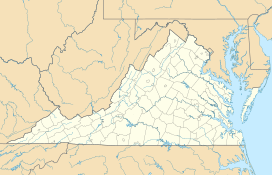
Jarman Gap is a special kind of low spot in the Blue Ridge Mountains. It's like a natural pathway through the mountains. You can find it in Albemarle and Augusta counties in Virginia, United States. It's also sometimes called Jarman's Gap or Jarmans Gap.
Contents
Where is Jarman Gap?
Jarman Gap is about 6.7 miles (10.8 km) northeast of Waynesboro, Virginia. It's also about 16.7 miles (26.9 km) west-northwest of Charlottesville, Virginia. This mountain pass is 2,172 feet (662 meters) high.
History of Jarman Gap
Jarman Gap has a long and interesting history. It was once known as Wood's Gap. This gap was a very important way to cross the Blue Ridge Mountains a long time ago.
Early Trails and Settlements
Before Europeans arrived, Jarman Gap was a path used by buffalo. It was also a trail for Native American people. The first European settlers in this area built their homes near the gap.
Michael Woods was the first European to settle in the Blue Ridge Mountains of Albemarle County. He traveled from Pennsylvania in 1734. Woods and his family crossed the Blue Ridge using what is now Jarman Gap. They settled on a large piece of land called "Mountain Plains" in 1737. This land was on the eastern side of the gap.
Because of Michael Woods and his family, the gap became known as Wood's Gap. Around the year 1800, Thomas Jarman bought the property. After he bought it, the gap was renamed Jarman Gap.
Important Roads and War
The historic Three Notch'd Road also crossed Jarman Gap. This was a colonial era road used in the 1730s. Michael Woods helped build the part of the Three Notch'd Road that went over the gap, starting in 1737.
During the American Civil War, a famous general named Thomas "Stonewall" Jackson used Jarman Gap. In 1862, he moved his Confederate troops across the gap.
Today, another gap called Rockfish Gap is the main way to cross the Blue Ridge. Rockfish Gap is about 6.3 miles (10.1 km) southwest of Jarman Gap. Major roads like U.S. Route 250 and Interstate 64 now use Rockfish Gap. A train line run by CSX Transportation also uses this gap.
 | Chris Smalls |
 | Fred Hampton |
 | Ralph Abernathy |


