
Jarratt, Virginia facts for kids
Quick facts for kids
Jarratt, Virginia
|
|
|---|---|
_Welcome_Sign;_VA_139_%26_Henry_Road.jpg)
Welcome sign at VA 139 and Henry Road in Jarratt.
|
|

Location of Jarratt in Virginia
|
|
| Country | United States |
| State | Virginia |
| Counties | Greensville, Sussex |
| Area | |
| • Total | 1.26 sq mi (3.26 km2) |
| • Land | 1.26 sq mi (3.26 km2) |
| • Water | 0.00 sq mi (0.00 km2) |
| Elevation | 151 ft (46 m) |
| Population
(2020)
|
|
| • Total | 652 |
| • Density | 517.5/sq mi (200.0/km2) |
| Time zone | UTC-5 (Eastern (EST)) |
| • Summer (DST) | UTC-4 (EDT) |
| ZIP codes |
23867, 23870
|
| Area code(s) | 434 |
| FIPS code | 51-40536 |
| GNIS feature ID | 1495754 |
Jarratt is a small town in the state of Virginia, United States. It's unique because it's located in two different counties: Greensville and Sussex.
In 2020, about 652 people called Jarratt home. The town has a long history. Back in 1848, it was an important stop on the Petersburg Railroad. Jarratt officially became a town in 1938.
Contents
Where is Jarratt Located?
Jarratt is right on the border between Greensville and Sussex counties. You can easily reach it from Interstate 95 by taking Exit 20 (Henry Road).
- It's about 10 miles (16 km) north of Emporia.
- It's about 33 miles (53 km) south of Petersburg.
The town covers a total area of about 1.26 square miles (3.3 square kilometers). All of this area is land, with no large bodies of water.
Railroad History in Jarratt
Trains have always been a big part of Jarratt's story. The old Petersburg Railroad line, which ran through the town, is now part of the CSX North End Subdivision.
There was also a connection to the Virginian Railway. While most of that line is no longer used, a small part still leads to the Georgia-Pacific Jarratt Sheathing Plant. This shows how important railroads were for local businesses.
Who Lives in Jarratt?
The population of Jarratt has changed over the years. Here's a quick look at how many people have lived there during different census counts:
| Historical population | |||
|---|---|---|---|
| Census | Pop. | %± | |
| 1940 | 458 | — | |
| 1950 | 574 | 25.3% | |
| 1960 | 608 | 5.9% | |
| 1970 | 591 | −2.8% | |
| 1980 | 614 | 3.9% | |
| 1990 | 556 | −9.4% | |
| 2000 | 589 | 5.9% | |
| 2010 | 638 | 8.3% | |
| 2020 | 652 | 2.2% | |
| U.S. Decennial Census 2010-2020 |
|||
Jarratt's Community in 2020
The 2020 census gives us a picture of the people living in Jarratt.
| Race / Ethnicity (NH = Non-Hispanic) | Pop 2010 | Pop 2020 | % 2010 | % 2020 |
|---|---|---|---|---|
| White alone (NH) | 303 | 261 | 47.49% | 40.03% |
| Black or African American alone (NH) | 313 | 356 | 49.06% | 54.60% |
| Native American or Alaska Native alone (NH) | 5 | 3 | 0.78% | 0.46% |
| Asian alone (NH) | 0 | 0 | 0.00% | 0.00% |
| Native Hawaiian or Pacific Islander alone (NH) | 0 | 0 | 0.00% | 0.00% |
| Other race alone (NH) | 0 | 3 | 0.00% | 0.46% |
| Mixed race or Multiracial (NH) | 3 | 15 | 0.47% | 2.30% |
| Hispanic or Latino (any race) | 14 | 14 | 2.19% | 2.15% |
| Total | 638 | 652 | 100.00% | 100.00% |
Life in Jarratt (2000 Data)
Based on the census from 2000, there were 589 people living in Jarratt. These people lived in 271 households.
- About 30% of households had children under 18.
- Many households were married couples living together.
- The average household had about 2.17 people.
The people in Jarratt were of different ages:
- 22.4% were under 18 years old.
- The median age (the middle age) was 41 years.
The median income for a household was about $32,125 per year. This means half of the households earned more than this, and half earned less. About 13% of the population lived below the poverty line.
Education in Jarratt
Students in Jarratt attend different schools depending on which county they live in.
- If you live in the Greensville County part of Jarratt, you go to schools in Greensville County Public Schools.
- If you live in the Sussex County part, you go to schools in Sussex County Public Schools.
Images for kids
-
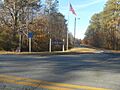
Welcome sign at VA 139 and Henry Road in Jarratt.
-
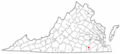
Location of Jarratt in Virginia
See also
 In Spanish: Jarratt (Virginia) para niños
