Jasper, Minnesota facts for kids
Quick facts for kids
Jasper
|
|
|---|---|

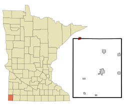
Location of Jasper, Minnesota
|
|
| Country | United States |
| State | Minnesota |
| Counties | Pipestone, Rock |
| Government | |
| • Type | Mayor – Council |
| Area | |
| • Total | 1.02 sq mi (2.65 km2) |
| • Land | 1.02 sq mi (2.64 km2) |
| • Water | 0.00 sq mi (0.01 km2) |
| Elevation | 1,545 ft (471 m) |
| Population
(2020)
|
|
| • Total | 610 |
| • Density | 598.63/sq mi (231.10/km2) |
| Time zone | UTC-6 (Central (CST)) |
| • Summer (DST) | UTC-5 (CDT) |
| ZIP code |
56144
|
| Area code(s) | 507 |
| FIPS code | 27-31760 |
| GNIS feature ID | 0645586 |
Jasper is a small city located in the state of Minnesota, USA. It's unique because it sits across two different counties: Pipestone County and Rock County. Most of the city is in Pipestone County.
In 2010, about 633 people lived in Jasper. By 2020, the population was 610.
Contents
History of Jasper
How Jasper Started
Jasper was officially planned out in 1888. This means its streets and lots were mapped before buildings were constructed. The city got its name from a special type of rock called jasper. This rock was mined nearby.
A post office opened in Jasper in 1888, helping people send and receive mail. The city officially became an incorporated city in 1889.
Famous Tornado Photo
On July 8, 1927, a tornado formed near Jasper. A woman named Lucille Handberg took a picture of it. This photograph became very famous.
Years later, this classic image was even used on the covers of two music albums. The English band Deep Purple used it for their 1974 album, Stormbringer. Another English band, Siouxsie and the Banshees, used it for their 1986 album, Tinderbox.
Geography of Jasper
Where Jasper is Located
Jasper covers a total area of about 0.88 square miles (2.28 square kilometers). All of this area is land.
Main Roads in Jasper
Two important roads, Minnesota State Highway 23 and Minnesota State Highway 269, pass through the community. These highways help connect Jasper to other towns and cities.
Population and People
How Many People Live in Jasper?
| Historical population | |||
|---|---|---|---|
| Census | Pop. | %± | |
| 1890 | 372 | — | |
| 1900 | 559 | 50.3% | |
| 1910 | 704 | 25.9% | |
| 1920 | 968 | 37.5% | |
| 1930 | 769 | −20.6% | |
| 1940 | 880 | 14.4% | |
| 1950 | 840 | −4.5% | |
| 1960 | 850 | 1.2% | |
| 1970 | 754 | −11.3% | |
| 1980 | 731 | −3.1% | |
| 1990 | 599 | −18.1% | |
| 2000 | 597 | −0.3% | |
| 2010 | 633 | 6.0% | |
| 2020 | 610 | −3.6% | |
| U.S. Decennial Census | |||
According to the 2010 census, there were 633 people living in Jasper. These people lived in 292 households, and 166 of these were families.
The population density was about 719 people per square mile (277 people per square kilometer). There were 324 homes in the city.
Who Lives in Jasper?
In 2010, most people in Jasper were White (92.3%). A smaller number were African American (1.4%) or Native American (0.5%). About 3.0% of the population identified with other races, and 2.8% identified with two or more races. People of Hispanic or Latino background made up 5.1% of the population.
Households and Families
About 30.5% of households had children under 18 living with them. Around 42.5% were married couples. Some households had a single parent, either a mother (8.2%) or a father (6.2%).
Many households (40.4%) were made up of people living alone. About 21.6% of these were people aged 65 or older living by themselves. On average, each household had about 2.17 people. Families had about 2.87 people.
Age in Jasper
The average age of people in Jasper in 2010 was 40.5 years old. About 25.8% of residents were under 18. People aged 65 or older made up 22.4% of the population. The city had slightly more females (51.0%) than males (49.0%).
See also
 In Spanish: Jasper (Minnesota) para niños
 | Jackie Robinson |
 | Jack Johnson |
 | Althea Gibson |
 | Arthur Ashe |
 | Muhammad Ali |

