Jayton, Texas facts for kids
Quick facts for kids
Jayton, Texas
|
|
|---|---|
| Jayton, Texas | |

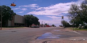
Jayton's water tower and the Kent County Court in 2012
|
|
| Motto(s):
"Where pride makes the difference!”
|
|

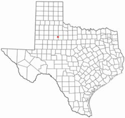
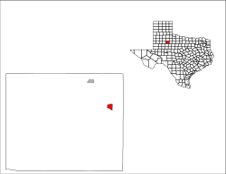
Location of Jayton, Texas
|
|
 |
|
| Country | United States |
| State | Texas |
| County | Kent |
| Area | |
| • Total | 1.70 sq mi (4.39 km2) |
| • Land | 1.70 sq mi (4.39 km2) |
| • Water | 0.00 sq mi (0.00 km2) |
| Elevation | 2,001 ft (610 m) |
| Population
(2020)
|
|
| • Total | 511 |
| • Density | 295.82/sq mi (114.23/km2) |
| Time zone | UTC-6 (Central (CST)) |
| • Summer (DST) | UTC-5 (CDT) |
| ZIP code |
79528
|
| Area code(s) | 806 |
| FIPS code | 48-37468 |
| GNIS feature ID | 2410136 |
Jayton is a small city in Texas, United States. It is the main town, also called the county seat, of Kent County. Jayton is in the northeastern part of the county. In 2020, about 511 people lived there.
Contents
Jayton's Story: A Texas Town's History
Jayton's story began in the 1880s. At first, it was known as "Jay Flat." This early settlement was about 2 miles northeast of where Jayton is today. It got its name from a local family who owned ranches in the area.
In 1886, the community got its own post office. Daniel Jay was the first person to be in charge of the mail there.
Moving the Town and a New Name
In 1907, the town decided to move. It moved to its current spot so it could be closer to train services. Being near a train line was very important for towns back then. Later that same year, the town was officially renamed "Jayton."
The first newspaper in the community, the Jayton Herald, started the next year. In February 1910, Jayton officially became a city. By 1925, about 750 people called Jayton home.
Surviving Tough Times
When Jayton first started, its economy mostly depended on the cotton industry. But in the 1930s, the Dust Bowl hit. This was a time when severe dust storms damaged farms across the Great Plains. It made it very hard to grow cotton.
Luckily, oil was discovered in the area later in the 1930s. This discovery of oil helped the town's economy a lot. Even during the Great Depression, a time of great economic hardship, Jayton stayed stable. Its population never went above 750 people.
Becoming the County Seat
In 1954, after a long legal fight, Jayton became the county seat. This means it became the main town for Kent County, where the county government offices are located. Before this, another nearby town called Clairemont was the county seat, but it was getting smaller. In 1957, a new courthouse was built in Jayton.
From the 1950s to the 1980s, Jayton's population stayed around 600 people. It then dropped to 513 in 1990 and 441 in 2000. However, the local oil industry started to grow again. This helped the population bounce back, and in 2010, 534 people lived in Jayton.
Where is Jayton? A Look at its Geography
Jayton is located in the eastern part of Kent County. U.S. Route 380 runs along the southern edge of the city. This highway goes southeast about 24 miles to Aspermont. It also goes southwest about 13 miles to Clairemont.
Texas State Highway 70 is the main street in Jayton. This highway goes northwest about 24 miles to Spur. The closest big cities are Lubbock, which is about 93 miles to the northwest, and Abilene, about 84 miles to the southeast.
Land Area
According to the United States Census Bureau, Jayton covers a total area of about 1.7 square miles (4.39 square kilometers). All of this area is land; there is no water within the city limits.
Kent County Airport
The Kent County Airport is located just south of Jayton. It has one asphalt runway that is 3,300 feet long. The closest airport where you can catch a commercial flight is in Lubbock, which is about 100 miles away.
Jayton's Climate
Jayton has a semiarid climate. This means it is generally dry, but not a true desert. It gets more rain than a desert, but not enough to be considered humid.
| Climate data for Jayton, Texas (1991–2020 normals, extremes 1962–present) | |||||||||||||
|---|---|---|---|---|---|---|---|---|---|---|---|---|---|
| Month | Jan | Feb | Mar | Apr | May | Jun | Jul | Aug | Sep | Oct | Nov | Dec | Year |
| Record high °F (°C) | 87 (31) |
93 (34) |
99 (37) |
108 (42) |
111 (44) |
116 (47) |
114 (46) |
112 (44) |
110 (43) |
105 (41) |
91 (33) |
86 (30) |
116 (47) |
| Mean maximum °F (°C) | 77.6 (25.3) |
81.8 (27.7) |
89.0 (31.7) |
94.6 (34.8) |
99.9 (37.7) |
102.8 (39.3) |
104.2 (40.1) |
103.7 (39.8) |
99.1 (37.3) |
93.6 (34.2) |
84.2 (29.0) |
77.7 (25.4) |
106.6 (41.4) |
| Mean daily maximum °F (°C) | 56.6 (13.7) |
60.7 (15.9) |
69.1 (20.6) |
78.1 (25.6) |
85.6 (29.8) |
92.9 (33.8) |
96.5 (35.8) |
95.8 (35.4) |
87.8 (31.0) |
78.3 (25.7) |
66.2 (19.0) |
57.2 (14.0) |
77.1 (25.1) |
| Daily mean °F (°C) | 42.2 (5.7) |
45.9 (7.7) |
54.2 (12.3) |
62.7 (17.1) |
71.7 (22.1) |
79.9 (26.6) |
83.6 (28.7) |
82.7 (28.2) |
74.8 (23.8) |
64.0 (17.8) |
52.1 (11.2) |
43.2 (6.2) |
63.1 (17.3) |
| Mean daily minimum °F (°C) | 27.9 (−2.3) |
31.1 (−0.5) |
39.2 (4.0) |
47.3 (8.5) |
57.8 (14.3) |
66.9 (19.4) |
70.7 (21.5) |
69.6 (20.9) |
61.8 (16.6) |
49.8 (9.9) |
38.0 (3.3) |
29.2 (−1.6) |
49.1 (9.5) |
| Mean minimum °F (°C) | 14.2 (−9.9) |
16.9 (−8.4) |
22.5 (−5.3) |
31.5 (−0.3) |
42.3 (5.7) |
57.4 (14.1) |
63.1 (17.3) |
62.2 (16.8) |
48.0 (8.9) |
32.8 (0.4) |
21.7 (−5.7) |
15.2 (−9.3) |
10.2 (−12.1) |
| Record low °F (°C) | −2 (−19) |
−6 (−21) |
6 (−14) |
24 (−4) |
31 (−1) |
44 (7) |
54 (12) |
54 (12) |
34 (1) |
16 (−9) |
10 (−12) |
−5 (−21) |
−6 (−21) |
| Average precipitation inches (mm) | 0.87 (22) |
1.12 (28) |
1.38 (35) |
1.77 (45) |
3.12 (79) |
3.28 (83) |
2.46 (62) |
2.13 (54) |
2.63 (67) |
2.12 (54) |
1.42 (36) |
0.98 (25) |
23.28 (591) |
| Average snowfall inches (cm) | 0.7 (1.8) |
1.9 (4.8) |
0.1 (0.25) |
0.0 (0.0) |
0.0 (0.0) |
0.0 (0.0) |
0.0 (0.0) |
0.0 (0.0) |
0.0 (0.0) |
0.0 (0.0) |
0.8 (2.0) |
0.6 (1.5) |
4.1 (10) |
| Average precipitation days (≥ 0.01 in) | 2.2 | 3.1 | 3.2 | 3.1 | 4.9 | 5.1 | 4.0 | 3.7 | 4.3 | 3.5 | 2.4 | 2.3 | 41.8 |
| Average snowy days (≥ 0.1 in) | 0.4 | 0.6 | 0.1 | 0.0 | 0.0 | 0.0 | 0.0 | 0.0 | 0.0 | 0.1 | 0.3 | 0.4 | 1.9 |
| Source: NOAA | |||||||||||||
Who Lives in Jayton? Demographics
| Historical population | |||
|---|---|---|---|
| Census | Pop. | %± | |
| 1910 | 314 | — | |
| 1930 | 623 | — | |
| 1940 | 770 | 23.6% | |
| 1950 | 635 | −17.5% | |
| 1960 | 649 | 2.2% | |
| 1970 | 703 | 8.3% | |
| 1980 | 638 | −9.2% | |
| 1990 | 608 | −4.7% | |
| 2000 | 513 | −15.6% | |
| 2010 | 534 | 4.1% | |
| 2020 | 511 | −4.3% | |
| U.S. Decennial Census | |||
2020 Census Information
The 2020 United States census counted 511 people living in Jayton. There were 207 households and 108 families in the city.
The table below shows the different groups of people living in Jayton based on the 2020 census.
| Race | Number | Percentage |
|---|---|---|
| White (NH) | 437 | 85.52% |
| Black or African American (NH) | 2 | 0.39% |
| Native American or Alaska Native (NH) | 3 | 0.59% |
| Some Other Race (NH) | 3 | 0.59% |
| Mixed/Multi-Racial (NH) | 5 | 0.98% |
| Hispanic or Latino | 61 | 11.94% |
| Total | 511 |
Note: The US Census counts Hispanic/Latino people as an ethnic group. This table separates them from other racial groups. People who are Hispanic/Latino can be of any race.
Learning in Jayton: Education
The Jayton-Girard Independent School District serves the city. The local high school for students is Jayton High School.
The Texas Legislature has also said that Kent County is part of the Western Texas College District. This means students in Jayton can attend Western Texas College.
Famous People from Jayton
Some notable people have come from Jayton:
- Jim W. Corder (1929–1998), who was a scholar known for studying rhetoric (the art of speaking or writing effectively).
- Weldon Myrick (1938-2014), an American musician famous for playing the steel guitar.
See also
 In Spanish: Jayton (Texas) para niños
 | Mary Eliza Mahoney |
 | Susie King Taylor |
 | Ida Gray |
 | Eliza Ann Grier |

