
John Cary facts for kids
Quick facts for kids
John Cary
|
|
|---|---|
| Born | 23 February 1755, 1754 Corsley |
| Died | 16 August 1835 Mortlake |
| Resting place | Kensington |
| Occupation | Cartographer, engraver, mapseller, printseller, graphic artist |
| Family | William Cary |

_-_Geographicus_-_EastIndies-cary-1801.jpg)
John Cary (born around 1754, died 1835) was a famous English cartographer. A cartographer is someone who makes maps. He was known for creating many detailed maps and globes during his time.
Contents
John Cary's Life and Work
John Cary started his career as an engraver in London. An engraver is an artist who carves designs onto metal plates. He learned his skills during an apprenticeship. In 1783, he opened his own business. It was located in an area of London called the Strand.
Early Success with Maps
John Cary quickly became well-known for his amazing maps and globes. In 1787, he published a very important atlas. An atlas is a book of maps. This atlas was called The New and Correct English Atlas. It became a standard reference book across England. People used it to find their way around and learn about places.
Mapping England's Roads
In 1794, John Cary received a special job from the Postmaster General. This was the head of the postal service in the UK. They asked him to survey all the roads in England. This means he had to carefully measure and map them.
His hard work resulted in a book called Cary's New Itinerary in 1798. This book was a map of all the main roads in England and Wales. He also helped create maps for the Ordnance Survey before 1805. The Ordnance Survey is the national mapping agency of Great Britain.
Working with Geologists
Later in his life, John Cary worked with a geologist named William Smith. A geologist is a scientist who studies rocks and the Earth's physical structure. Together, they created special maps that showed different types of rocks and land formations.
Eventually, John Cary's mapping business was taken over by G. F. Cruchley. This happened between 1822 and 1880.
Major Works by John Cary
John Cary created many important maps and atlases. Here are some of his most famous works:
- Actual Survey of the country fifteen miles around London (1786)
- New and Correct English Atlas (1787)
- Camden's Britannia (1789) - He made maps for the 1789 and 1806 versions of this book.
- Cary's Survey of the High Roads from London (1790)
- Cary's Traveller's Companion (1790)
- New Maps of England and Wales with part of Scotland (1794)
- Inland Navigation; or Select Plans of the Several Navigable Canals throughout Britain (1795)
- Cary's New Itinerary (1798)
- A New Map of Scotland (1801)
- New British Atlas (1805), which he made with John Stockdale.
- A New map of chinese & independent Tartary (1806)
- Cary's New Universal Atlas (1808)
- Cary's English Atlas (1809)
- New Elementary Atlas (1813)
- Cary's New Itinerary (1817)
Images for kids
-
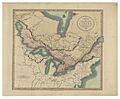
A New Map of Upper & Lower Canada, from the Latest Authorities (1807)

