
Johnson City, Texas facts for kids
Quick facts for kids
Johnson City, Texas
|
|
|---|---|

Blanco County Courthouse
|
|
| Motto(s):
"The Crossroads Of The Texas Hill Country"
|
|

Location of Johnson City, Texas
|
|
 |
|
| Country | United States |
| State | Texas |
| County | Blanco |
| Founded by | James P. Johnson |
| Named for | Sam E. Johnson, Sr. |
| Area | |
| • Total | 1.81 sq mi (4.69 km2) |
| • Land | 1.81 sq mi (4.68 km2) |
| • Water | 0.00 sq mi (0.01 km2) |
| Elevation | 1,221 ft (372 m) |
| Population
(2020)
|
|
| • Total | 1,627 |
| • Density | 900.89/sq mi (347.83/km2) |
| Time zone | UTC-6 (Central (CST)) |
| • Summer (DST) | UTC-5 (CDT) |
| ZIP code |
78636
|
| Area code(s) | 830 |
| FIPS code | 48-37780 |
| GNIS feature ID | 2410146 |


Johnson City is a city in Texas, USA. It's also the main town, or county seat, of Blanco County, Texas. In 2020, about 1,627 people lived there.
The city was started in 1879 by James Polk Johnson. It's named after his uncle, Sam E. Johnson, Sr.. Johnson City is also part of a special area called the Texas-German belt.
Contents
History of Johnson City
-
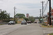
A glimpse of downtown Johnson City

Johnson City was founded by James P. Johnson. He gave 320 acres of land near the Pedernales River in 1879 to start the town.
This city was the hometown of Lyndon B. Johnson, who became the 36th president of the United States. In 1890, Johnson City became the county seat of Blanco County.
Geography and Location
Johnson City is in the middle of Blanco County. It's about 1 mile south of the Pedernales River.
Two major highways, U.S. Route 281 and U.S. Route 290, meet near the center of town.
- U.S. 281 goes north 23 miles to Marble Falls.
- U.S. 290 goes west 30 miles to Fredericksburg.
- The two highways go south together for a bit. Then, U.S. 290 turns east and leads 47 miles to Austin.
- U.S. 281 continues south 64 miles to San Antonio.
The United States Census Bureau says Johnson City covers about 4.7 square kilometers (1.8 square miles) of land.
Climate in Johnson City
Johnson City has a humid subtropical climate. This means it has hot summers and winters that are usually comfortable.
Temperatures in summer are often around 82°F (28°C). In winter, they are usually around 47°F (8°C).
| Climate data for Johnson City, Texas (2 miles north) (1991–2020 normals, extremes 1964–present) | |||||||||||||
|---|---|---|---|---|---|---|---|---|---|---|---|---|---|
| Month | Jan | Feb | Mar | Apr | May | Jun | Jul | Aug | Sep | Oct | Nov | Dec | Year |
| Record high °F (°C) | 89 (32) |
100 (38) |
102 (39) |
101 (38) |
104 (40) |
110 (43) |
110 (43) |
110 (43) |
110 (43) |
98 (37) |
93 (34) |
89 (32) |
110 (43) |
| Mean daily maximum °F (°C) | 62.3 (16.8) |
65.8 (18.8) |
72.9 (22.7) |
79.9 (26.6) |
86.1 (30.1) |
92.4 (33.6) |
95.5 (35.3) |
96.6 (35.9) |
90.2 (32.3) |
81.8 (27.7) |
71.2 (21.8) |
63.9 (17.7) |
79.9 (26.6) |
| Daily mean °F (°C) | 48.7 (9.3) |
52.2 (11.2) |
59.8 (15.4) |
66.5 (19.2) |
74.5 (23.6) |
80.8 (27.1) |
83.4 (28.6) |
83.7 (28.7) |
77.3 (25.2) |
68.1 (20.1) |
58.1 (14.5) |
50.5 (10.3) |
67.0 (19.4) |
| Mean daily minimum °F (°C) | 35.1 (1.7) |
38.7 (3.7) |
46.7 (8.2) |
53.1 (11.7) |
63.0 (17.2) |
69.2 (20.7) |
71.4 (21.9) |
70.8 (21.6) |
64.3 (17.9) |
54.4 (12.4) |
44.9 (7.2) |
37.1 (2.8) |
54.1 (12.3) |
| Record low °F (°C) | 7 (−14) |
3 (−16) |
13 (−11) |
27 (−3) |
36 (2) |
50 (10) |
55 (13) |
50 (10) |
37 (3) |
22 (−6) |
17 (−8) |
1 (−17) |
1 (−17) |
| Average precipitation inches (mm) | 2.25 (57) |
2.01 (51) |
2.56 (65) |
2.77 (70) |
4.03 (102) |
3.23 (82) |
2.15 (55) |
2.21 (56) |
3.36 (85) |
3.62 (92) |
2.98 (76) |
1.85 (47) |
33.02 (839) |
| Average snowfall inches (cm) | 0.1 (0.25) |
0.1 (0.25) |
0.0 (0.0) |
0.0 (0.0) |
0.0 (0.0) |
0.0 (0.0) |
0.0 (0.0) |
0.0 (0.0) |
0.0 (0.0) |
0.0 (0.0) |
0.0 (0.0) |
0.0 (0.0) |
0.2 (0.51) |
| Average precipitation days (≥ 0.01 in) | 7.2 | 7.5 | 8.3 | 6.1 | 7.5 | 7.1 | 5.0 | 5.0 | 6.5 | 7.4 | 6.4 | 6.4 | 80.4 |
| Average snowy days (≥ 0.1 in) | 0.1 | 0.1 | 0.0 | 0.0 | 0.0 | 0.0 | 0.0 | 0.0 | 0.0 | 0.0 | 0.0 | 0.1 | 0.3 |
| Source: NOAA | |||||||||||||
Population of Johnson City
| Historical population | |||
|---|---|---|---|
| Census | Pop. | %± | |
| 1950 | 648 | — | |
| 1960 | 611 | −5.7% | |
| 1970 | 767 | 25.5% | |
| 1980 | 872 | 13.7% | |
| 1990 | 932 | 6.9% | |
| 2000 | 1,191 | 27.8% | |
| 2010 | 1,656 | 39.0% | |
| 2020 | 1,627 | −1.8% | |
| U.S. Decennial Census | |||
In 2020, the 2020 United States census counted 1,627 people living in Johnson City. There were 725 households and 415 families.
Parks and Fun Things to Do
There are some cool places to visit near Johnson City:
- The Lyndon B. Johnson National Historical Park is about 12 miles west of the city. The National Park Service takes care of it.
- Pedernales Falls State Park is about 10 miles east of Johnson City. It's a great place to see waterfalls.
- Selah, Bamberger Ranch Preserve is a wildlife sanctuary nearby. It even has a special man-made bat cave!
Education in Johnson City
Students in Johnson City go to schools in the Johnson City Independent School District. The district has:
- An elementary school
- A middle school
- A high school, called Lyndon B. Johnson High School
Media and News
Newspaper
The Johnson City Record Courier is a newspaper that comes out once a week. It has been published in Johnson City since 1883.
Radio
KFAN-FM/107.9 is a radio station that broadcasts to Johnson City.
See also
 In Spanish: Johnson City (Texas) para niños
