Junction Butte facts for kids
Quick facts for kids Junction Butte |
|
|---|---|

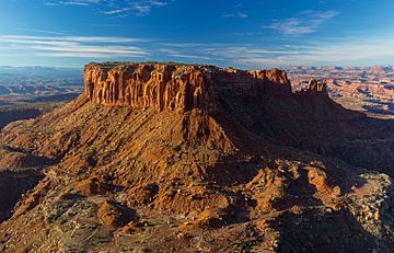
North aspect from Grand View Point
|
|
| Highest point | |
| Elevation | 6,400 ft (2,000 m) |
| Prominence | 1,720 ft (520 m) |
| Isolation | 10.16 mi (16.35 km) |
| Parent peak | Elaterite Butte (6,552 ft) |
| Geography | |
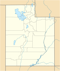
| Location | Canyonlands National Park San Juan County, Utah, U.S. |
| Parent range | Colorado Plateau |
| Topo map | USGS Monument Basin |
| Geology | |
| Age of rock | Late Triassic |
| Type of rock | Wingate Sandstone |
| Climbing | |
| Easiest route | class 5.2 climbing |
Junction Butte is a tall, flat-topped mountain, also known as a butte. It is located in the "Island in the Sky" area of Canyonlands National Park in San Juan County, Utah. This amazing natural landmark stands about 6,400 feet (1,951 meters) high.
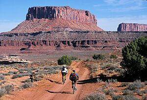
You can find Junction Butte about one mile south of the "Island in the Sky" district. A short walk to Grand View Point offers a fantastic view of this butte. Another way to see it is by driving along the White Rim Road, which is a special four-wheel drive trail. The top of Junction Butte rises steeply, about 1,400 feet (427 meters) from the road in less than a mile!
Rainwater from Junction Butte flows into two major rivers nearby. Water from the east side drains into the Colorado River. Water from the west side flows into the Green River. Junction Butte is located just north of where these two large rivers meet.
What is Junction Butte Made Of?
Junction Butte is mostly made of a very strong, fine-grained rock called Wingate Sandstone. This sandstone formed from huge sand dunes that were blown by the wind about 200 million years ago. This was during a time known as the Late Triassic period.
The hard Wingate Sandstone sits on top of softer layers of rock called the Chinle Formation. The Wingate Sandstone also has a "cap" of another rock layer called the Kayenta Formation. This hard cap helps protect the softer layers below, creating the steep cliffs you see.
Weather at Junction Butte
The best times to visit Junction Butte are during spring and fall. The weather is usually mild and pleasant then. The area has a Cold semi-arid climate. This means it's a desert climate, but it can get quite cold in winter.
This desert region gets less than 10 inches (254 millimeters) of rain each year. Most of the rain and some light snowfall happens during the spring and summer months. Winters usually have light snow.
 | William M. Jackson |
 | Juan E. Gilbert |
 | Neil deGrasse Tyson |


