Kalgary, Texas facts for kids
Quick facts for kids
Kalgary, Texas
|
|
|---|---|

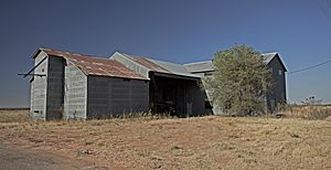
Abandoned cotton gin in Kalgary
|
|
| Country | United States |
| State | Texas |
| Counties | Crosby |
| Elevation | 2,503 ft (763 m) |
| Time zone | UTC-6 (Central (CST)) |
| • Summer (DST) | UTC-5 (CDT) |
| ZIP code |
79370
|
| Area code(s) | 806 |
| GNIS feature ID | 1380019 |
Kalgary is a small, unincorporated community in Crosby County, Texas, United States. This means it's a settlement that isn't officially governed as a city or town. In 2000, about 70 people lived there. Kalgary is also considered part of the larger Lubbock metropolitan area.
Contents
The Story of Kalgary: How It Started
Kalgary began around 1905. A man named E.P. Swenson started selling parts of his huge SMS Ranch, which was over 437,000 acres! At first, the community was called Spur. Later, it became known as Watson, named after an early settler, Richard Watson Self.
A post office opened in Watson in 1911 but closed just two years later. It reopened in 1925, but then closed for good in 1955. In 1927, the community's name changed from Watson to Kalgary. This happened because there was already another town named Watson, Texas in the state.
In the early 1930s, only about 10 people lived in Kalgary. But by 1940, the population grew to 100. At that time, Kalgary had three stores and a cotton gin, which is a machine that separates cotton fibers from their seeds. During the second half of the 1900s, the population was around 140. However, it dropped to 70 by 2000 and even further to just 6 people in 2010.
Kalgary was named after the city of Calgary in Alberta, Canada.
Fossils Found Near Kalgary
A famous scientist named Ermine Cowles Case, who studied ancient life (a paleontologist), found a very important fossil near Kalgary. He discovered the hip bone (pelvis) of a Postosuchus. This was a large, meat-eating reptile that lived a very long time ago, even before the dinosaurs became dominant!
Where is Kalgary Located?
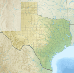
Kalgary is located in southeastern Crosby County, Texas. You can find it along Farm to Market Road 261. It's about 55 miles (88 km) southeast of Lubbock and 21 miles (34 km) south of Crosbyton.
The community sits in an area of rolling plains. It's on a natural dividing line that separates the White River and the Salt Fork Brazos River. Both of these rivers flow into the larger Brazos River. Kalgary is also near McDonald Creek and other roads like Farm to Market Road 2008 and Farm to Market Road 651.
Kalgary's Climate
Kalgary has a semiarid climate. This means it's usually dry, but not as dry as a desert. It gets some rain, but not a lot. On climate maps, this type of weather is often marked as BSk.
Learning in Kalgary: The Story of Its Schools
In 1907, the Watson School was built to teach the growing number of children in the area. Rae Nichols was the main teacher there.
In 1949, the local school district, called Self County Line, joined with the nearby Crosbyton Consolidated Independent School District. After October 1952, no more classes were held in Kalgary. This was because a fire sadly destroyed the local school building.
 | Bessie Coleman |
 | Spann Watson |
 | Jill E. Brown |
 | Sherman W. White |


