Kanab Plateau facts for kids
Quick facts for kids Kanab Plateau |
|
|---|---|

Kanab Plateau
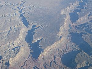
(aerial photo) |
|
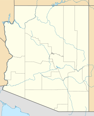
| Location | Fredonia, Coconino, High Plateas section of Arizona, Colorado Plateau, Arizona, United States |
| Coordinates | 36°42′35″N 112°31′45″W / 36.70972°N 112.52917°W |
| Length | 45 ft (14 m) |
| Geology | Moenkopi Formation-(west of Kanab Creek), Kaibab Limestone- (east, older unit) |
The Kanab Plateau is a cool natural area in Arizona, United States. It's about 45 miles (72 km) long and sits just north of the famous Grand Canyon. This plateau is right next to the Kaibab Plateau, which is part of the Grand Canyon's North Rim. In between them is a valley where Kanab Creek flows. This valley is also home to the Kanab Creek Wilderness, a protected natural space.
Kanab Creek flows south and cuts through the Kanab Plateau. This creek also forms the border between Mohave County to the west and Coconino County to the east. Coconino County also touches the Colorado River to the south.
Contents
Exploring the Kanab Plateau
The Kanab Plateau stretches for about 45 miles (72 km). It has a curved shape, almost like an arc, as it wraps around a place called Snake Gulch. Snake Gulch is a smaller stream that flows into Kanab Creek from the northeast. The plateau generally runs from the southwest to the northeast. A small area called Antelope Valley is located to the west and southwest of the plateau, following a similar direction.
Highest Point: Cedar Knoll
The highest spot on the Kanab Plateau is a place called Cedar Knoll. It reaches a height of 5,706 feet (1,739 meters). Cedar Knoll is about 11 miles from the town of Fredonia if you take paved Road 22.
Getting to the Kanab Plateau
There are several ways to reach the Kanab Plateau, especially from the north. The town of Fredonia is a main starting point, located right next to the plateau's northern edge.
Roads for Access
U.S. Route 89A is a major road that helps you get to the area. It comes from Jacob Lake, which is on the north side of the Kaibab Plateau to the east. This road climbs up Cooper Ridge and offers a great view from the LeFevre Overlook. From this overlook, it's about 8 miles across the northeast part of the plateau to Fredonia.
Another important road is Arizona State Route 389. If you head southwest from Fredonia, this road runs parallel to the plateau's northwest side for about 10 miles. From Arizona 389, you can take Antelope Valley Road, which is not paved. This road leads to the east side of Antelope Valley, right at the edge of the Kanab Plateau's west and southwest parts. Near the southwest end of the plateau, there's Road 1023. This road is about 22 miles from Arizona 389 and goes southeast to a hiking trail called Hack Canyon, which is about 5 miles from Kanab Creek.
Road 22 is another paved route that crosses the Kanab Plateau diagonally towards Jacob Lake. It goes through the northeast part of the plateau. Jacob Canyon is to the southwest of this road, and Wildcat Canyon is to the northeast. This paved road is 23 miles long. The last 8 miles of the route are unpaved canyon roads west of Jacob Lake. Remember, Cedar Knoll, the highest point on the plateau, is at the 11-mile mark on this road.
 | Charles R. Drew |
 | Benjamin Banneker |
 | Jane C. Wright |
 | Roger Arliner Young |


