Kautz Glacier facts for kids
Quick facts for kids Kautz Glacier |
|
|---|---|

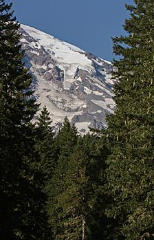
Upper Kautz Glacier descends from the summit ice cap to Kautz Ice Cliff. The lower glacier (left center) descends from the Kautz Glacier Headwall (upper left).
|
|
| Type | Mountain glacier |
| Location | Mount Rainier, Pierce County, Washington, USA |
| Coordinates | 46°49′41″N 121°46′14″W / 46.82806°N 121.77056°W |
| Area | 1.8 square miles (4.7 km2), 1983 |
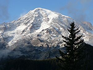
The Kautz Glacier is a long, thin glacier located on the southern side of Mount Rainier. Mount Rainier is a large volcano in Washington, USA. This glacier is named after August Kautz. Some people believe he was the first person to climb Mount Rainier.
The Kautz Glacier covers about 1.8 square miles (4.7 square kilometers). It holds a huge amount of ice, about 7.8 billion cubic feet (221 million cubic meters)! The upper part of the Kautz Glacier stretches south from the top of Mount Rainier's ice cap. It ends at a spot called Kautz Ice Cliff, which is about 11,700 feet (3,566 meters) high.
Just west of this main ice cliff, the glacier continues down a path called Kautz Chute. This chute ends at another ice cliff, just above the lower Kautz Glacier. This lower cliff is around 10,800 feet (3,292 meters) high. Climbers often use the Kautz Glacier route to reach the upper glacier. They usually start by going down a short distance from Camp Hazard, which is at 11,300 feet (3,444 meters) on Wapowety Cleaver.
The lower part of the glacier begins at the Kautz Glacier Headwall, around 12,500 feet (3,810 meters) high. It flows mostly south-southwest between the Kautz and Wapowety Cleaver. Before it meets the Success Glacier, the Kautz Glacier turns right and goes west for a short distance. After these two glaciers join, the combined ice reaches down to about 6,000 feet (1,829 meters) before it ends. The melting water from the glacier flows into Kautz Creek Falls. This water then goes into Kautz Creek, which is a smaller stream that feeds into the Nisqually River.
Glacier Mudflows and Debris
The Kautz Glacier is one of four glaciers on Mount Rainier that are known for causing debris flows. Debris flows are like very thick, fast-moving mudslides. They are made of water, mud, rocks, and other materials. Similar flows have also come from the Nisqually, Winthrop, and South Tahoma glaciers.
A very large mudflow happened from the Kautz Glacier on October 2–3, 1947. Heavy rains caused the lower part of the glacier to melt and erode very quickly. This meltwater turned into a massive mudflow. It was about 14 billion cubic feet (40 million cubic meters) of mud and water! This flow carried huge boulders, some as big as 13 feet (4 meters) across. The mudflow covered Highway 706 with 28 feet (9 meters) of mud and watery debris. You can still see the remains of this 1947 mudflow today. Smaller mudflows also happened in 1961, 1985, and 1986.
 | William L. Dawson |
 | W. E. B. Du Bois |
 | Harry Belafonte |


