Nisqually Glacier facts for kids
Quick facts for kids Nisqually Glacier |
|
|---|---|

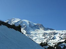
Nisqually Glacier in center background
|
|
| Type | Mountain glacier |
| Location | Mount Rainier National Park, Pierce County, Washington, USA |
| Coordinates | 46°50′05″N 121°44′47″W / 46.83472°N 121.74639°W |
| Area | 1.8 sq mi (4.7 km2) in 1983 |
| Length | 4 mi (6.4 km) |
| Terminus | moraine |
| Status | Retreating |
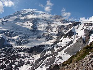
The Nisqually Glacier is a big glacier on the side of Mount Rainier in Washington state, USA. It's one of the largest glaciers on the mountain. It's easy to see this glacier from the Paradise visitor area in Mount Rainier National Park.
The glacier has grown bigger (advanced) and shrunk smaller (retreated) many times since 1850. Right now, it's getting smaller. However, between 1994 and 1997, the glacier actually got 56 ft (17 m) thicker high up. This made scientists think it might start growing again soon. The Nisqually River starts from this glacier.
Scientists have studied Nisqually Glacier for a long time. They've measured its end point every year since 1918. In 1970, the glacier was moving about 29 inches (740 mm) (almost 2.5 feet) every day!
How the Glacier Changes
Nisqually Glacier has grown and shrunk three times since the late 1900s. Its most recent shrinking period began in 1985. In just six years after that, the glacier became 52 feet (16 m) thinner near a spot called Glacier Vista.
The glacier was biggest around 1850. At that time, many glaciers reached their furthest points down valleys. This period is known as the Little Ice Age. Nisqually Glacier stretched 650 to 800 feet (200 to 240 m) past the Glacier Bridge. Other glaciers, like Tahoma and South Tahoma, also joined up. Emmons Glacier on the northeast side came within 1.2 miles (1.9 km) of the White River Campground.
After the Little Ice Age ended, these glaciers slowly started to shrink. This shrinking sped up after 1920. By 1950, Mount Rainier had lost about one-quarter of its glaciers since the Little Ice Age. From 1950 to the 1980s, some larger glaciers grew a little. But since the 1980s, many glaciers have been getting thinner and smaller again.
Mudslides from the Glacier
Nisqually Glacier is one of four glaciers on Mount Rainier that have caused debris flows. A debris flow is like a fast-moving mudslide mixed with rocks and ice. Similar mudslides have also come from the Winthrop, Kautz, and South Tahoma glaciers.
 | Jewel Prestage |
 | Ella Baker |
 | Fannie Lou Hamer |


