Kavaratti facts for kids

Kavaratti Island
|
|
| Geography | |
|---|---|
| Location | Arabian Sea |
| Coordinates | 10°34′N 72°38′E / 10.57°N 72.64°E |
| Archipelago | Lakshadweep |
| Adjacent bodies of water | Indian Ocean |
| Total islands | 1 |
| Major islands |
|
| Area | 3.93 km2 (1.52 sq mi) |
| Length | 5 km (3.1 mi) |
| Width | 1.5 km (0.93 mi) |
| Highest elevation | 1 m (3 ft) |
| Administration | |
| Territory | |
| District | Lakshadweep |
| Island group | Laccadive Islands |
| Tehsils of India | Kavaratti |
| Subdivisions of India | Kavaratti |
| Largest settlement | Kavaratti (pop. 10,000) |
| Demographics | |
| Population | 11,473 (2014) |
| Pop. density | 2,920 /km2 (7,560 /sq mi) |
| Ethnic groups | Malayali, Mahls |
| Additional information | |
| Time zone | |
| PIN | 682555 |
| Telephone code | 04896 |
| ISO code | IN-LD-05 |
| Literacy | 88.6% |
| Avg. summer temperature | 35 °C (95 °F) |
| Avg. winter temperature | 25 °C (77 °F) |
| Sex ratio | 1.227 ♂/♀ |
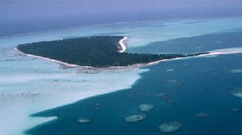
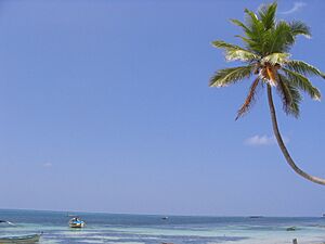
Kavaratti is the capital city of Lakshadweep, a group of islands in India. It's a beautiful island known for its amazing white sand beaches. It also has very calm lagoons, which are perfect for swimming and water sports.
This island is part of an atoll, which is a ring-shaped coral reef. Kavaratti is located in the Arabian Sea. It is about 404 km (251 mi) west of Kochi, a major city in India.
Contents
About Kavaratti Island
Kavaratti island is about 5.6 km (3.5 mi) long. It is widest at one end, measuring about 1.2 km (0.75 mi) across. On the western side of the island, there is a shallow lagoon. You can also see many coconut trees growing on the northern part of the island.
The town of Kavaratti has special buildings. Many of its mosques have beautifully carved wooden pillars and roofs. Even the gravestones are carved with designs. The town also has government buildings, a bank, and an aquarium. Tourism is becoming very important for the island's economy.
Where is Kavaratti?
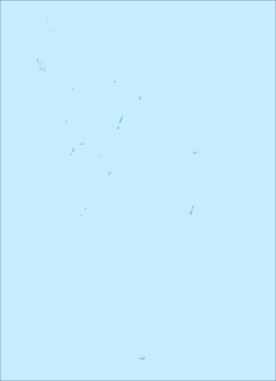
Kavaratti island is located about 360 km (220 mi) away from the coast of Kerala, an Indian state. Its exact location is 10°34′N 72°38′E / 10.57°N 72.64°E. The island is very low, with an average height of 0 meters (0 feet) above sea level.
The closest island to Kavaratti is Pitti islet. It is not inhabited by people and is about 24 km (15 mi) north of Kavaratti. The island of Agatti is 54 km (34 mi) to the northwest. Suheli Par is 53 km (33 mi) to the southwest.
The water area around Kavaratti, called a lagoon, covers about 8.96 km2 (3.46 sq mi).
Kavaratti's Weather
Kavaratti has a tropical savanna climate. This means it's usually warm all year round. The hottest time is from March to May. Temperatures generally stay between 25 and 35 °C or 77 and 95 °F. The air is quite humid, usually between 70% and 76%.
The monsoon season brings a lot of rain. It usually starts in late May and lasts until early November. The island gets about 1,675 mm (65.9 in) of rain each year.
| Climate data for Kavaratti | |||||||||||||
|---|---|---|---|---|---|---|---|---|---|---|---|---|---|
| Month | Jan | Feb | Mar | Apr | May | Jun | Jul | Aug | Sep | Oct | Nov | Dec | Year |
| Mean daily maximum °C (°F) | 30.2 (86.4) |
30.4 (86.7) |
31.1 (88.0) |
31.8 (89.2) |
31.3 (88.3) |
30.4 (86.7) |
29.8 (85.6) |
29.7 (85.5) |
29.8 (85.6) |
30.0 (86.0) |
30.3 (86.5) |
30.3 (86.5) |
30.4 (86.7) |
| Mean daily minimum °C (°F) | 23.7 (74.7) |
24.1 (75.4) |
24.3 (75.7) |
26.5 (79.7) |
26.1 (79.0) |
25.7 (78.3) |
25.4 (77.7) |
25.1 (77.2) |
24.8 (76.6) |
24.5 (76.1) |
24.3 (75.7) |
24.0 (75.2) |
24.3 (75.7) |
| Average rainfall mm (inches) | 27.4 (1.08) |
25.4 (1.00) |
19.8 (0.78) |
72.5 (2.85) |
212.8 (8.38) |
261.3 (10.29) |
250.9 (9.88) |
202.4 (7.97) |
181.9 (7.16) |
183.1 (7.21) |
133.0 (5.24) |
94.8 (3.73) |
1,665.3 (65.57) |
People of Kavaratti
Religion in Kavaratti Island (2011) Islam (91.93%) Hinduism (7.02%) Christianity (0.86%) Others (0.06%) Not Stated (0.13%)
In 2011, about 11,210 people lived in Kavaratti. Slightly more than half of the population (55%) are males, and 45% are females. Most families on the island are doing well.
Many people in Kavaratti can read and write. The literacy rate was 88.6% in 2011, which is a big improvement from 44.4% in 1971. More males (94.1%) can read and write than females (81.66%). About 12% of the people living on the island are under 6 years old.
The main languages spoken here are Malayalam, Mahl, and English.
Kavaratti's Economy
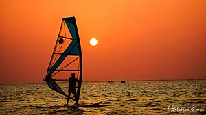
Tourism is a very important part of Kavaratti's economy. Tourists love the island's beautiful white sand beaches, which are great for sunbathing. The calm waters in the lagoons are perfect for water sports and swimming.
Many hotels and resorts have opened on Kavaratti recently. The waters around the island's coral reef are full of different kinds of sea creatures. The Kavaratti Aquarium is a great place to see many types of corals and colorful tropical fish.
Other important jobs on the island are fishing and farming. Coconut trees are the main crop grown here. However, as tourism has grown, the fishing industry has become less important.
Getting Around Kavaratti
One popular way to reach Kavaratti from mainland India is by taking a passenger ship. These ships usually travel overnight from Kochi to Kavaratti and other Lakshadweep islands.
The closest airport is Agatti Airport, which is on Agatti Island, about 54 km (34 mi) away. From Agatti, you can take a helicopter or a boat to Kavaratti. Flights usually come to Agatti from Kochi.
For international travel, the closest airports are Cochin International Airport in Kochi and Calicut International Airport in Kozhikode, both on the mainland.
Water Supply on the Island
The main source of water for Kavaratti comes from underground, called ground water. The island has 190 ponds that collect rainwater during the monsoon season. There are also 1325 wells.
Because the population is growing, the Government of India built a special water plant in Kavaratti in May 2005. This plant is called a low temperature desalination plant (LTTD). It cost ₹5 crores (about 50 million rupees) to build. This plant can turn seawater into 100,000 liters of drinking water every day!
See also
 In Spanish: Kavaratti para niños
 | Laphonza Butler |
 | Daisy Bates |
 | Elizabeth Piper Ensley |


