Kawerau facts for kids
Quick facts for kids
Kawerau
|
|
|---|---|
|
Minor urban area
|
|

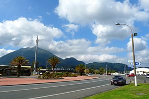
Kawerau, with Putauaki in the background
|
|

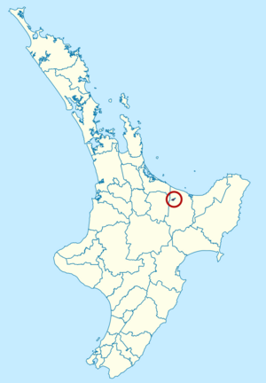
Kawerau district within the North Island
|
|
| Country | New Zealand |
| Region | Bay of Plenty |
| Established | 1953 |
| Electorates | East Coast (general) Waiariki (Māori) |
| Area | |
| • Land | 23.56 km2 (9.10 sq mi) |
| Population
(June 2023)
|
|
| • District | 7,820 |
| • Urban | 7,820 |
| Time zone | UTC+12 (NZST) |
| • Summer (DST) | UTC+13 (NZDT) |
| Postcode |
3127
|
| Area code(s) | 07 |
| Website | Kawerau District Council |
Kawerau is a town in the Bay of Plenty Region, located on the North Island of New Zealand. It's about 100 kilometers southeast of Tauranga and 58 kilometers east of Rotorua. Kawerau is the main town in the Kawerau District and home to the Kawerau District Council.
Kawerau is a small community. Its economy mainly relies on the large pulp and paper mill nearby, run by Norske Skog and OJI Fibre Solutions. You can find it along State Highway 34, southwest of Onepu. It's also the end point for the East Coast Main Trunk Railway and the start of the Murupara Branch railway.
Kawerau is one of three towns in New Zealand where most of the people are Māori. The others are Ōpōtiki and Wairoa. Kawerau was badly affected by the 1987 Edgecumbe earthquake in 1987.
Contents
History and Culture of Kawerau
How Kawerau Was Founded
Kawerau is one of New Zealand's newest towns, started in 1953. It was built as a "mill town" for the new Tasman pulp and paper mill. The Tasman Pulp and Paper Company chose this spot because it had lots of geothermal energy, water from the Tarawera River, and a huge supply of pine trees from the nearby Kaingaroa Forest. The town's location was picked in February 1953.
Unlike many other towns its size, Kawerau was carefully planned before any building began. The town was designed with many facilities to welcome a diverse group of skilled workers from different countries. The mill is still very important to the local economy and affects how well the town does. Kawerau's population was largest in the early 1980s, but it has gone down since then. This happened because the mill and related businesses changed how they operated.
Recent Changes in Kawerau
In 2012, Norske Skog, the company that owned the mill, announced it would close one of its two newsprint machines. In January 2013, it was confirmed that almost half of the mill's jobs would be lost.
Norske Skog, a company from Norway and one of the world's biggest newsprint makers, closed one of its paper machines at the Tasman Mill in Kawerau. This meant 110 jobs were lost. The company had first said it might close a machine in September, after looking at how much newsprint it could make in Australia and New Zealand. The other machine at Tasman Mill kept making newsprint mainly for New Zealand and Australian markets. Norske Skog worked with employees, unions, and others to manage the closure. This included a big restructuring program for the whole mill. The General Manager, Peter McCartey, said that global market changes in the paper industry caused this decision. The machine that closed had been working well for over 50 years. Norske Skog has mills in 11 countries around the world.
By July 16, 2021, all three newsprint paper machines at the mill had stopped working. This was because people needed less newsprint as more information moved online.
Kawerau also has the Kawerau Power Station, which uses geothermal energy. This power station provides electricity for local industries and the rest of New Zealand.
Marae in Kawerau
The local marae (a traditional Māori meeting place) is called Tohia o te Rangi. It is connected to the Ngāti Tūwharetoa hapū (sub-tribe) of Ngāi Tamarangi. The marae has a special meeting house known as Waitaha Ariki Kore.
Kawerau's Population and People
Kawerau District covers 23.56 square kilometers. As of 2023, it had an estimated population of 7,539 people. This means there are about 320 people per square kilometer.
Kawerau District's population grew by 5.5% from 2018 to 2023. It grew by 18.5% from 2013 to 2023. In 2023, there were 3,720 males, 3,804 females, and 15 people of other genders living in 2,418 homes. The average age was 38.6 years. About 22.3% of the people were under 15 years old.
People in Kawerau can identify with more than one ethnic group. In 2023, 63.2% identified as Māori, and 53.8% as European (Pākehā). Other groups included Pasifika (4.7%) and Asian (3.3%). Most people (96.3%) spoke English. About 18.3% spoke the Māori language.
Many people in Kawerau said they had no religion (53.4%). About 26.7% were Christian, and 9.6% followed Māori religious beliefs.
The median income in Kawerau was $29,200, which was lower than the national median of $41,500. About 37.9% of people aged 15 and over worked full-time.
Geography of Kawerau
The 820-meter tall volcanic cone of Mount Edgecumbe/Putauaki is just 3 kilometers east of Kawerau. You can easily see it from the town. The Tarawera River flows along the eastern side of Kawerau and continues north to the Bay of Plenty. Kawerau gets its water from two natural springs. The town's water was even named the best-tasting in New Zealand in 2003 and 2004!
Kawerau has access to huge geothermal resources. There are many geothermal hot springs in the nearby bush, owned and run by local families. The Kawerau geothermal field provides steam power for the paper mill. A 90 MW geothermal power station is also being built there.
The Kawerau District covers 23.56 square kilometers. This makes it the smallest territorial authority (local government area) in New Zealand by land size. It is completely surrounded by the Whakatāne District.
Climate in Kawerau
During summer (December to February), the average highest temperature in Kawerau is 23.7°C. In January 2008, the temperature went above 30°C for five days! In winter (July to August), you'll often see crisp frosts in the early morning, followed by clear, sunny days. The average highest temperature in winter is around 15.6°C.
Rain falls throughout the year, but it's not unusual to have a dry spell during summer.
| Climate data for Kawerau (1971–2000 normals, extremes 1954–present) | |||||||||||||
|---|---|---|---|---|---|---|---|---|---|---|---|---|---|
| Month | Jan | Feb | Mar | Apr | May | Jun | Jul | Aug | Sep | Oct | Nov | Dec | Year |
| Record high °C (°F) | 37.0 (98.6) |
35.6 (96.1) |
32.1 (89.8) |
29.7 (85.5) |
24.8 (76.6) |
21.7 (71.1) |
21.1 (70.0) |
22.0 (71.6) |
26.0 (78.8) |
28.8 (83.8) |
34.6 (94.3) |
34.8 (94.6) |
37.0 (98.6) |
| Mean daily maximum °C (°F) | 25.4 (77.7) |
25.4 (77.7) |
23.4 (74.1) |
20.7 (69.3) |
17.5 (63.5) |
14.9 (58.8) |
14.5 (58.1) |
15.3 (59.5) |
17.2 (63.0) |
19.2 (66.6) |
21.3 (70.3) |
23.5 (74.3) |
19.9 (67.7) |
| Daily mean °C (°F) | 19.7 (67.5) |
19.8 (67.6) |
18.0 (64.4) |
15.3 (59.5) |
12.1 (53.8) |
9.8 (49.6) |
9.2 (48.6) |
10.0 (50.0) |
11.9 (53.4) |
14.0 (57.2) |
16.0 (60.8) |
18.1 (64.6) |
14.5 (58.1) |
| Mean daily minimum °C (°F) | 14.0 (57.2) |
14.2 (57.6) |
12.5 (54.5) |
9.8 (49.6) |
6.7 (44.1) |
4.7 (40.5) |
4.0 (39.2) |
4.8 (40.6) |
6.7 (44.1) |
8.8 (47.8) |
10.7 (51.3) |
12.7 (54.9) |
9.1 (48.4) |
| Record low °C (°F) | 3.7 (38.7) |
3.1 (37.6) |
1.0 (33.8) |
−3.3 (26.1) |
−4.2 (24.4) |
−4.0 (24.8) |
−4.4 (24.1) |
−4.3 (24.3) |
−1.4 (29.5) |
−2.1 (28.2) |
0.7 (33.3) |
2.0 (35.6) |
−4.4 (24.1) |
| Average rainfall mm (inches) | 118.4 (4.66) |
131.6 (5.18) |
134.8 (5.31) |
134.3 (5.29) |
115.8 (4.56) |
155.4 (6.12) |
140.0 (5.51) |
148.7 (5.85) |
127.8 (5.03) |
162.3 (6.39) |
140.9 (5.55) |
132.6 (5.22) |
1,642.6 (64.67) |
| Mean monthly sunshine hours | 234.5 | 199.6 | 208.2 | 178.6 | 160.4 | 133.3 | 158.4 | 146.5 | 170.4 | 202.8 | 237.1 | 204 | 2,233.8 |
| Source: NIWA (rain 1981–2010) | |||||||||||||
Events and Festivals in Kawerau
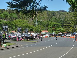
Kawerau hosts several exciting events each year. These include the National Woodskills Festival, the "King of the Mountain" race, and the Tarawera 100 motorcycle endurance race. Kawerau is also becoming a popular spot for white water competitions like kayaking and rafting. For example, it was a venue for the 2013 World Rafting Championships.
Kawerau Woodfest and Woodskills Competition
The National Woodskills Festival is a competition that celebrates amazing wood craftsmanship and art. Some people who compete are professionals, but many are amateurs who just love working with wood. The Woodskills Festival first started in Kawerau in 1989 as a local event. By 1991, it became so popular that it grew into a national competition, attracting artists from all over New Zealand.
Now, the competition has expanded into a bigger event called Kawerau Woodfest. It includes many skills from the forestry industry and takes over the town for a whole weekend. The annual Kawerau Woodfest brings hundreds of visitors to the town, making it Kawerau's biggest and most economically beneficial event. Besides the Woodskills Festival, there's also an Arts & Crafts Festival with displays open on Saturday and Sunday at different places around Kawerau.
Education in Kawerau
Kawerau has several schools for students of different ages:
- Kawerau Putauaki School is a primary school for Year 1 to 6 students.
- Kawerau South School is another primary school for Year 1 to 6 students.
- Te Whata Tau o Putauaki is a primary school for Year 1 to 8 students.
- Tarawera High School is the town's secondary school, for students from Year 7 to 13.
- The Kawerau Teen Parent Unit is located in an old school building, supporting young parents.
Famous People from Kawerau
- Danielle Hayes, a model
- Gill Gatfield, a sculptor
- John Rowles, a singer
- Ria van Dyke, a model
- Sarah Walker, a Women's BMX world champion
- William Warbrick, a rugby league player
 | James Van Der Zee |
 | Alma Thomas |
 | Ellis Wilson |
 | Margaret Taylor-Burroughs |


