Lac des Mille Lacs facts for kids
Quick facts for kids Lac des Mille Lacs |
|
|---|---|
| Location | Thunder Bay, Ontario, Canada |
| Coordinates | 48°50′57″N 90°30′38″W / 48.84917°N 90.51056°W |
| Type | Lake |
| Primary inflows | Savanne River |
| Catchment area | 1,774.55 km2 (685.16 sq mi) |
| Max. length | 30 km (19 mi) |
| Max. width | 20 km (12 mi) |
| Surface area | 245.1 km2 (94.6 sq mi) |
| Surface elevation | 457 m (1,499 ft) |
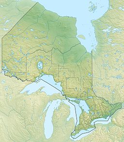
Lac des Mille Lacs is a large lake located in the western part of Thunder Bay District in northwestern Ontario, Canada. It's about 100 kilometres (62 mi) west of the city of Thunder Bay. This lake is an important part of the Nelson River drainage basin, which means its waters eventually flow into the Nelson River. It is also the starting point, or source, of the Seine River.
The lake is quite big, covering an area of 245.1 square kilometres (94.6 sq mi). The land area that drains water into the lake, called its drainage basin, is even larger at 1,774.55 square kilometres (685.16 sq mi). Several streams flow into Lac des Mille Lacs, including the Savanne River and McKay Creek in the northeast, Joe's Creek in the southwest, and Inwood Creek in the north. The only river that flows out of the lake is the Seine River. It starts at the northwest tip of the lake and flows towards Rainy Lake, eventually reaching Hudson Bay through the Nelson River. The lake has many different parts, including named bays and islands.
Contents
Getting to Lac des Mille Lacs
You can reach Lac des Mille Lacs by road. The Lac des Mille Lacs Road connects the lake to Highway 17. This highway is located near a town called Upsala.
The Lac des Mille Lacs Dam
A special structure called the Lac des Mille Lacs Dam controls the water flowing out of the lake into the Seine River. The Ontario Ministry of Natural Resources (OMNR) owns this dam. It is operated by Valerie Falls Limited Partnership, which is part of Brookfield Renewable Power.
History of the Dam
The very first dam at this spot was built in 1873. It was made of stone by Simon James Dawson to help boats travel more easily on the rivers downstream. In 1926, this stone dam was replaced with a wooden one. The new dam helped control water flow for making hydroelectric power. This power was generated downstream on the Seine River and Rainy River.
The dam you see today is made of concrete and was built in 1952. It has seven openings, each with eight logs that can be moved to control the water level. When all the logs are in place, the water level can reach 457 metres (1,499 ft). When all logs are removed, the water level drops to 454.6 metres (1,491 ft 6 in).
Impact on First Nations
The building of this dam, and others in the area, caused some challenges for the Lac des Mille Lacs First Nation. The dam led to flooding of their traditional lands, including a reserve area called Lac des Mille Lacs 22A1, which is on the shore of the lake. Because of this, many members of the First Nation no longer live on their traditional lands. They are now spread out across Northwestern Ontario. The First Nation is currently working with the Canadian and provincial governments to discuss a land claim related to these historical events.
Rivers Flowing into the Lake
Here are some of the streams and rivers that flow into Lac des Mille Lacs, listed in a clockwise direction starting from where the Seine River flows out:
- Inwood Creek
- McKay Creek
- Savanne River
- Joe's Creek
 | Precious Adams |
 | Lauren Anderson |
 | Janet Collins |


