Rainy River (Minnesota–Ontario) facts for kids
Quick facts for kids Rainy River |
|
|---|---|

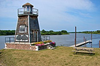
Rainy River at Barwick, Ontario
|
|
|
Mouth of the Rainy River
|
|
| Country | United States, Canada |
| State | Minnesota, Ontario |
| County | Lake of the Woods, Koochiching |
| Physical characteristics | |
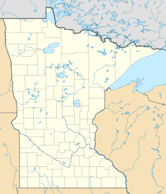
| Main source | Ranier, Minnesota 48°36′54″N 93°21′12″W / 48.6149353°N 93.3532024°W |
| River mouth | Wheeler's Point, Lake of the Woods 48°50′55″N 94°41′30″W / 48.8485930°N 94.6916009°W |
| Length | 137 miles (220 km) |
| Basin features | |
| Tributaries |
|
The Rainy River is a cool river that helps form part of the border between two countries: Canada and the United States. It flows between Northwestern Ontario in Canada and northern Minnesota in the U.S. This river is about 137 miles (220 km) long.
In French, it's called Rivière à la Pluie, and in the Ojibwe language, it's known as Gojiji-ziibi.
Contents
Exploring the Rainy River's Past
The Rainy River starts from the west side of Rainy Lake. Just like the river, the lake also has French and Ojibwe names. The lake is called lac à la Pluie in French and Gojiji-zaaga'igan in Ojibwe.
The river flows generally towards the west and northwest. It passes between several towns, including International Falls, Minnesota, and Fort Frances, Ontario. It also flows between Baudette, Minnesota, and Rainy River, Ontario.
Native American Connections
The Couchiching First Nation, a group of Ojibwe people, has a special connection to this river. This area was their traditional land for a very long time. The name of Koochiching County, Minnesota, actually comes from an Ojibwe term related to this region.
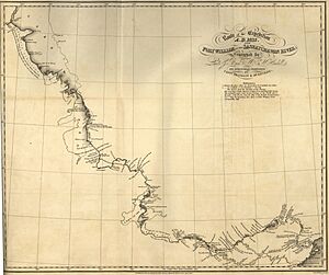
French explorers and settlers were the ones who first named Rainy Lake and the Rainy River. Later, when British settlers arrived, they translated these names into English, and that's how we got "Rainy River" and "Rainy Lake." The town of Rainy River, Ontario, was named much later, in the early 1900s.
River's Journey and Uses
The Rainy River eventually flows into the southern part of Lake of the Woods. This happens about 19 kilometres (12 mi) northwest of the towns of Baudette and Rainy River.
There's a dam on the river at International Falls. This dam is important because it uses the river's water to create hydroelectricity, which is a clean way to make power.
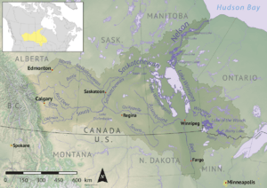
The area that collects water for the Rainy River, called its drainage basin, stretches far to the east. It reaches almost 100 kilometres (62 mi) west of Lake Superior. This vast area was once part of a huge piece of land given to the Hudson's Bay Company by the English Crown way back in 1670.
The river's water eventually travels through the Winnipeg River, then into Lake Winnipeg, and finally through the Nelson River all the way to Hudson Bay.
Bridges and Railways
Two international bridges cross the Rainy River, connecting Canada and the United States. These are the Baudette-Rainy River International Bridge and the Fort Frances-International Falls International Bridge.
A railway line, originally called the Ontario and Rainy River Railway, follows the Canadian side of the river. It opened in 1901 and is now part of the Canadian National Railway.

Fishing Fun on the Rainy River
The Rainy River is a popular spot for fishing! It's even home to a world record. A white sucker fish, weighing 6 pounds and 8 ounces, was caught here near Loman, Minnesota. This catch holds the IGFA (International Game Fish Association) all-tackle world record for that type of fish.
The river has also appeared in books! American author Tim O'Brien wrote a novel called The Things They Carried. One of the chapters in his book, "On the Rainy River," is named after this very river.
 | Aurelia Browder |
 | Nannie Helen Burroughs |
 | Michelle Alexander |


