
Fort Frances facts for kids
Quick facts for kids
Fort Frances
|
||
|---|---|---|
| Town of Fort Frances | ||
 |
||
|
||
| Nickname(s):
Fort
|
||
| Motto(s):
Industry and perseverance
|
||

Fort Frances
Location in Ontario
|
||
| Country | Canada | |
| Province | Ontario | |
| District | Rainy River | |
| Incorporated | 1903 | |
| Area | ||
| • Land | 25.51 km2 (9.85 sq mi) | |
| Population
(2016)
|
||
| • Total | 7,739 | |
| • Density | 303.4/km2 (786/sq mi) | |
| Demonym(s) | Fort Francians | |
| Time zone | UTC−6 (CST) | |
| • Summer (DST) | UTC−5 (CDT) | |
| Forward sortation area |
P9A
|
|
| Area code(s) | 807 | |
| Website | www.fort-frances.com | |

Fort Frances is a town in Northwestern Ontario, Canada. It is the main town in the Rainy River District. About 7,700 people lived there in 2016.
The town sits right on the border with the United States. It is where Rainy Lake narrows to become Rainy River. A bridge connects Fort Frances to International Falls, Minnesota. It is the fourth-largest town in Northwestern Ontario.
For a long time, the main employer was a paper mill. It closed in 2014. Now, a Canadian mining company called New Gold has a gold mine nearby. The mine started processing gold in 2017. Fort Frances is also a popular spot for fishing. It hosts a big annual bass fishing competition called the Fort Frances Canadian Bass Championship.
Contents
History of Fort Frances
When Was Fort Frances First Settled?

Fort Frances was the first European settlement west of Lake Superior. A French Canadian explorer named Pierre Gaultier de Varennes, sieur de La Vérendrye started it. In 1731, he built a fort called Fort Saint Pierre. This fort helped with the fur trade with local Indigenous peoples.
Later, in 1817, the Hudson's Bay Company (HBC) built a new fort there. This was after the War of 1812 changed the borders between Canada and the United States.
How Did Fort Frances Get Its Name?
In 1830, a leader from the Hudson's Bay Company named John Dugald Cameron named the trading post. He named it after Frances Ramsay Simpson. She was 18 years old and had just married George Simpson. George Simpson was the Governor of the Hudson's Bay Company. He visited the fort many times.
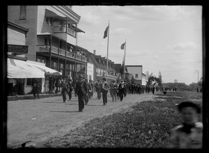
Important Events in Fort Frances History
The town officially became a town in 1903. In 2003, Fort Frances had a big party to celebrate its 100th birthday.
The main job for many people was at a pulp and paper mill. This mill started in the early 1900s. It was owned by different companies over the years. Most recently, Resolute Forest Products owned it. The mill employed about 700 people until it closed in 2014.
On June 25, 1946, a tornado hit the town. It caused a lot of damage.
In 2013, Fort Frances won a contest called the Kraft Celebration Tour. They got the most votes out of 20 communities.
On January 14, 2014, the paper mill officially announced it would close. This happened by the end of that month.
In December 2014, Tim Hortons filmed a TV commercial in Fort Frances. The commercial called Fort Frances "one of the coldest places in Canada." They decorated the local Tim Hortons with yarn and put a giant hat on the roof. Coffee was free that day!
In August 2015, the Seven Generations Education Institute hosted a big meeting. It was for Indigenous education leaders from all over the world.
Getting Around Fort Frances
Airports Near Fort Frances
There are three airports in the area. Two are in Canada, and one is in the United States.
- Fort Frances Municipal Airport
- Fort Frances Water Aerodrome (for floatplanes)
- Falls International Airport (in the US)
The Fort Frances Municipal Airport has flights to places like Kenora, Winnipeg, and Thunder Bay. The Falls International Airport has flights to Minneapolis–Saint Paul.
Highways in Fort Frances
Ontario Highway 11 and Ontario Highway 71 are the two main highways. Highway 71 ends in Fort Frances. Both highways are part of the Trans-Canada Highway. Highway 71 connects the town to Kenora. Highway 11 connects to towns like Devlin and Emo to the west, and Atikokan to the east.
Trains and Buses
The Canadian National Railway brings freight trains into Fort Frances. These trains cross the Fort Frances-International Falls International Bridge into the US.
You can also cross the International Bridge by truck or car.
A bus company called Caribou Coach used to have a route to Thunder Bay. This route stopped in October 2017. There is a taxi service that also goes to International Falls, Minnesota.
Weather in Fort Frances
Fort Frances has a humid continental climate. This means it has cold winters and warm summers. Temperatures can get very hot in summer, sometimes over 34 degrees Celsius. In winter, it can get very cold, similar to parts of Siberia.
Fort Frances holds a record for the hottest temperature ever in Ontario. On July 13, 1936, the temperature reached 42.2 degrees Celsius!
| Climate data for Fort Frances Municipal Airport, 1981−2010 normals, extremes 1892−present | |||||||||||||
|---|---|---|---|---|---|---|---|---|---|---|---|---|---|
| Month | Jan | Feb | Mar | Apr | May | Jun | Jul | Aug | Sep | Oct | Nov | Dec | Year |
| Record high °C (°F) | 10.0 (50.0) |
13.0 (55.4) |
26.4 (79.5) |
31.7 (89.1) |
35.0 (95.0) |
40.0 (104.0) |
42.2 (108.0) |
35.6 (96.1) |
35.6 (96.1) |
31.1 (88.0) |
22.8 (73.0) |
13.9 (57.0) |
42.2 (108.0) |
| Mean daily maximum °C (°F) | −9.5 (14.9) |
−5.3 (22.5) |
1.1 (34.0) |
10.5 (50.9) |
18.0 (64.4) |
22.6 (72.7) |
25.3 (77.5) |
24.0 (75.2) |
18.3 (64.9) |
10.2 (50.4) |
0.5 (32.9) |
−6.8 (19.8) |
9.1 (48.4) |
| Daily mean °C (°F) | −15.3 (4.5) |
−11.4 (11.5) |
−4.8 (23.4) |
4.0 (39.2) |
11.2 (52.2) |
16.3 (61.3) |
18.9 (66.0) |
17.7 (63.9) |
12.5 (54.5) |
5.2 (41.4) |
−3.6 (25.5) |
−11.6 (11.1) |
3.3 (37.9) |
| Mean daily minimum °C (°F) | −21.0 (−5.8) |
−17.4 (0.7) |
−10.6 (12.9) |
−2.5 (27.5) |
4.4 (39.9) |
9.9 (49.8) |
12.5 (54.5) |
11.3 (52.3) |
6.7 (44.1) |
0.1 (32.2) |
−7.6 (18.3) |
−16.5 (2.3) |
−2.6 (27.3) |
| Record low °C (°F) | −45.0 (−49.0) |
−45.5 (−49.9) |
−37.3 (−35.1) |
−28.5 (−19.3) |
−11.1 (12.0) |
−5.0 (23.0) |
0.6 (33.1) |
−4.0 (24.8) |
−7.8 (18.0) |
−16.7 (1.9) |
−38.0 (−36.4) |
−42.0 (−43.6) |
−45.5 (−49.9) |
| Average precipitation mm (inches) | 34.7 (1.37) |
21.9 (0.86) |
26.3 (1.04) |
41.2 (1.62) |
77.7 (3.06) |
119.0 (4.69) |
96.7 (3.81) |
91.6 (3.61) |
82.9 (3.26) |
56.5 (2.22) |
46.0 (1.81) |
31.9 (1.26) |
726.3 (28.59) |
| Average rainfall mm (inches) | 0.0 (0.0) |
2.1 (0.08) |
12.1 (0.48) |
30.9 (1.22) |
77.4 (3.05) |
119.0 (4.69) |
96.7 (3.81) |
91.6 (3.61) |
82.6 (3.25) |
53.3 (2.10) |
16.4 (0.65) |
2.7 (0.11) |
584.7 (23.02) |
| Average snowfall cm (inches) | 34.7 (13.7) |
19.8 (7.8) |
14.2 (5.6) |
10.3 (4.1) |
0.25 (0.10) |
0.0 (0.0) |
0.0 (0.0) |
0.0 (0.0) |
0.31 (0.12) |
3.3 (1.3) |
29.7 (11.7) |
29.2 (11.5) |
141.6 (55.7) |
| Average precipitation days (≥ 0.2 mm) | 8.1 | 6.4 | 6.1 | 7.3 | 13.4 | 13.3 | 12.9 | 11.7 | 12.6 | 11.6 | 8.1 | 8.0 | 119.4 |
| Average rainy days (≥ 0.2 mm) | 0.0 | 0.64 | 2.0 | 6.0 | 13.4 | 13.3 | 12.9 | 11.7 | 12.6 | 10.5 | 2.5 | 0.58 | 85.9 |
| Average snowy days (≥ 0.2 cm) | 8.1 | 6.0 | 4.2 | 2.0 | 0.12 | 0.0 | 0.0 | 0.0 | 0.08 | 1.5 | 6.2 | 7.5 | 35.6 |
| Source: Environment Canada | |||||||||||||
People of Fort Frances
| Census | Population |
|---|---|
| 1901 | 697 |
| 1911 | 1,611 |
| 1921 | 3,109 |
| 1931 | 5,470 |
| 1941 | 5,849 |
| 1951 | 8,038 |
| 1961 | 9,481 |
| 1971 | 9,947 |
| 1981 | 8,906 |
| 1991 | 8,891 |
| 1996 | 8,790 |
| 2001 | 8,315 |
| 2006 | 8,103 |
| 2011 | 7,952 |
| 2016 | 7,739 |
In 2016, Fort Frances had 7,739 people. This was a small decrease from 2011. Most people in Fort Frances are of European background (82%). About 17% are Aboriginal Canadian.
Fort Frances Symbols
The town's coat of arms has several symbols. It shows a bull moose and maple leaves. There is also a "Magneto" symbol, which stands for electricity and industry. You can see two men in a canoe and a white pine tree. The town's motto is "Industry and Perseverance."
Media in Fort Frances
Newspapers You Can Read
- Fort Frances Times - Comes out every week
- Fort Frances Today - Comes out every week
- Fort Frances Living - Comes out every week
- West End Weekly - Comes out every week
Online News and Social Media
- NWO Update
- Fort Frances Times Online
- Downtown Fort Frances on the Great Canadian Main Street Facebook page
TV Channels You Can Watch
The only local TV channel is Shaw TV on Shaw Cable channel 10. Other channels come from cities like Winnipeg and Edmonton. These include CBC, Ici Radio-Canada Télé, CTV, and Global.
Radio Stations You Can Listen To
- FM 89.1 - CKSB-9-FM (Ici Radio-Canada Première)
- FM 90.5 - CBQQ-FM (CBC Radio One)
- FM 93.1 - CFOB-FM, 93.1 The Border FM (plays popular music)
Schools in Fort Frances
Elementary and High Schools
The Rainy River District School Board runs these schools:
- Fort Frances High School
- Robert Moore School
- J.W. Walker School
The Northwest Catholic District School Board runs these schools:
- St Michael's School
- St Francis School
Colleges in Fort Frances
- Confederation College
- Seven Generations Education Institute
Famous People from Fort Frances
Many talented people have come from Fort Frances, especially in sports!
- Dave Allison - A former coach in the NHL.
- Mike Allison - Played for NHL teams like the Los Angeles Kings and Toronto Maple Leafs.
- Steve Arpin - A race car driver.
- Murray Bannerman - A former player for the Chicago Blackhawks.
- Duncan Keith - A famous NHL hockey player for the Chicago Blackhawks. He is one of the 100 Greatest NHL Players.
- Chris Lindberg - Won a silver medal in ice hockey at the 1992 Winter Olympics.
- Neil Sheehy - Played for NHL teams like the Calgary Flames.
- Timothy Sheehy - A former NHL player.
Things to See and Do in Fort Frances
Fort Frances has many interesting places to visit and fun activities.
- The Fort Frances Museum - Learn about the town's history.
- Fort Frances Library and Technology Centre - A great place to read and learn.
- The Border Land Arts Alliance - For art lovers.
- Tour de Fort - A local event.
- Pither's Point Park - A nice park to relax.
- LaVerendrye Parkway- The Sorting Gap Marina - Enjoy the waterfront.
- The Lookout Tower - You can tour this tower in the summer.
- The Tugboat Hallet - You can tour this old tugboat in the summer.
- Fort Frances Canadian Bass Championship - A big fishing competition in late July.
- Scott Street Shopping District - Go shopping!
- Kitchen Creek Golf Club - For golf fans.
- Heron Landing Golf Course - Another golf course.
- 8th Street Walking & Ski Trails - Great for walks or skiing.
- Little Beaver Snow Park - Fun in the snow.
- Rainy Lake Square - A town square.
- City Hall - The town's government building.
- Rendezvous Yacht Club - For boating.
- The Noden Causeway - A scenic road over the water.
- The Rainy Lake Nordic Ski Club - For cross-country skiing.
Sports in Fort Frances
Fort Frances is home to several sports teams.
Current Sports Teams
- Fort Frances Lakers (Junior ice hockey team)
- Fort Frances Thunderhawks (Senior ice hockey team)
Former Sports Teams
- Fort Frances Borderland Thunder (Junior ice hockey)
- Fort Frances Canadians (Senior ice hockey)
- Fort Frances Royals (Junior ice hockey)
Sports Facilities
- Memorial Sports Centre
- Couchiching First Nations Arena (also known as "The Duke") - located in nearby Couchiching First Nation.
