Laguna Creek watershed facts for kids
Quick facts for kids Laguna Creek watershed |
|
|---|---|

|
|
| Country | United States |
| State | California |
| Physical characteristics | |
| River mouth | San Francisco Bay 0 ft (0 m) |
The Laguna Creek watershed is an area of land in northern Alameda County, California. It covers about 25.1 square miles (100 km2) of land. A watershed is like a giant bowl that collects all the rain and snowmelt in an area. All this water then drains into a common stream, river, or lake.
This watershed collects water from the foothills of the Diablo Range. This mountain range is located south of Niles Canyon. The area around Mission Peak is also part of this watershed. Several creeks flow through this land. These include Agua Caliente, Canada del Aliso, Mission, Morrison, Sabercat, Vargas, and Washington creeks. All these creeks eventually flow into Laguna Creek. From there, the water continues into Mud Slough.
The creeks and the watershed get their water from winter and spring storms. Natural springs near Mission Peak also provide water. Many of these creeks can dry up when there hasn't been any rain.
Contents
Where Laguna Creek Flows
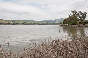
Morrison Creek and Mission Creek are two important streams in the watershed. They join together just before Mission Creek flows into Lake Elizabeth. This lake is located on the southern side of Fremont Central Park. A large part of what is now Fremont Central Park used to be a wetland called Stivers Lagoon.
After water leaves Lake Elizabeth, it splits into two paths. One path goes into Laguna Creek. The other path goes into Irvington Creek. Irvington Creek is also known as Line G. It acts as a bypass channel to help control floods from Laguna Creek.
History of Water in the Area
When Spanish settlers first arrived and built Mission San José, there was plenty of groundwater. This water was easily available from the sandy rock underground. Over time, as people built water systems and more homes and factories, the underground water levels dropped. This meant that natural springs dried up. Now, groundwater is mostly found only very close to the creeks.
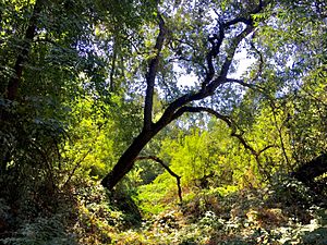
Before people settled here, the area was full of wild animals. Sabercat Creek got its name because ancient fossils of saber-toothed cats were found nearby. The watershed still has many plants and trees that are native to California. These include the valley oak, Frémont's cottonwood, and California sycamore.
Laguna Creek and the Bay
Mud Slough is where Laguna Creek's water finally reaches the San Francisco Bay. This happens near a place called Drawbridge, which is now a ghost town. Because Mud Slough is so close to the bay, its marshy end is affected by the ocean's tides. This means the water changes from fresh to slightly salty, and then to very salty.
The slough flows past large salt evaporation ponds. These ponds were created by the Leslie Salt Company to make salt from seawater. Mud Slough then joins a larger creek called Coyote Creek before flowing into the San Francisco Bay.
Laguna Creek is also a site for several projects that help control floods.
Images for kids
 | Kyle Baker |
 | Joseph Yoakum |
 | Laura Wheeler Waring |
 | Henry Ossawa Tanner |


