Laguna Heights, Texas facts for kids
Quick facts for kids
Laguna Heights, Texas
|
|
|---|---|

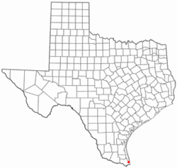
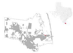
Location of Laguna Heights, Texas
|
|
 |
|
| Country | United States |
| State | Texas |
| County | Cameron |
| Area | |
| • Total | 0.59 sq mi (1.54 km2) |
| • Land | 0.59 sq mi (1.54 km2) |
| • Water | 0 sq mi (0.0 km2) |
| Elevation | 10 ft (3 m) |
| Population
(2020)
|
|
| • Total | 962 |
| • Density | 1,618/sq mi (624.7/km2) |
| Time zone | UTC-6 (Central (CST)) |
| • Summer (DST) | UTC-5 (CDT) |
| ZIP code |
78578
|
| Area code(s) | 956 |
| FIPS code | 48-40300 |
| GNIS feature ID | 1374433 |
Laguna Heights is a small community located in Cameron County, Texas, in the United States. It's a special kind of place called a "census-designated place" (CDP). This means it's an area identified by the government for statistics, but it doesn't have its own official city government.
In 2020, about 962 people lived in Laguna Heights. This was a big change from 2010, when the population was 3,488. The community is known for being very close to the beautiful Laguna Madre, a large body of water connected to the Gulf of Mexico.
History
Laguna Heights has a short but important recent history. On May 13, 2023, a strong tornado hit the area. This tornado, called an EF1, caused a lot of damage to homes and buildings. Tragically, one person lost their life, and 11 others were hurt. It was a very difficult time for the community.
Geography
Laguna Heights is in the eastern part of Cameron County. It sits right on the southern shore of Laguna Madre, which is a big, calm lagoon. This lagoon is connected to the much larger Gulf of Mexico.
The community is surrounded by other towns. To the south and east, you'll find the city of Port Isabel. To the west, there's the town of Laguna Vista.
Texas State Highway 100 runs through Laguna Heights. If you go east on this highway, it's about 3 miles (5 km) to the center of Port Isabel. If you continue further, it's about 6 miles (10 km) to South Padre Island, a popular beach destination. Going west on the highway, it's about 21 miles (34 km) to Interstate 69E, which connects to bigger cities like Harlingen and Brownsville.
The total area of Laguna Heights is about 0.59 square miles (1.54 square kilometers). All of this area is land.
Population and People
Laguna Heights first appeared as a census-designated place in the 1990 U.S. Census. It is part of the larger Brownsville–Harlingen metropolitan area. This means it's part of a bigger group of towns and cities that are connected economically.
The population of Laguna Heights has changed over the years:
| Historical population | |||
|---|---|---|---|
| Census | Pop. | %± | |
| 1990 | 1,671 | — | |
| 2000 | 1,990 | 19.1% | |
| 2010 | 3,488 | 75.3% | |
| 2020 | 962 | −72.4% | |
| U.S. Decennial Census | |||
As of the 2020 United States census, there were 962 people living in Laguna Heights. There were 575 households and 371 families. Most people in Laguna Heights are of Hispanic or Latino background.
Education
Children living in Laguna Heights attend schools that are part of the Point Isabel Independent School District.
Here are the schools they go to:
- Garriga Elementary School (for students in Kindergarten through 2nd grade)
- Derry Elementary School (for students in 3rd through 5th grade)
- Port Isabel Junior High School (for students in 6th through 8th grade)
- Port Isabel High School (for students in 9th through 12th grade)
All of these schools are located in the nearby city of Port Isabel.
In addition, the South Texas Independent School District also runs special "magnet schools" that serve the community. These schools often focus on specific subjects like science or technology.
See also
 In Spanish: Laguna Heights para niños
 | Selma Burke |
 | Pauline Powell Burns |
 | Frederick J. Brown |
 | Robert Blackburn |

