Lake Lorraine, Florida facts for kids
Quick facts for kids
Lake Lorraine, Florida
|
|
|---|---|

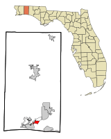
Location in Okaloosa County and the state of Florida
|
|
| Country | |
| State | |
| County | Okaloosa |
| Area | |
| • Total | 2.29 sq mi (5.93 km2) |
| • Land | 2.06 sq mi (5.33 km2) |
| • Water | 0.23 sq mi (0.60 km2) |
| Elevation | 26 ft (8 m) |
| Population
(2020)
|
|
| • Total | 7,142 |
| • Density | 3,470.36/sq mi (1,339.87/km2) |
| Time zone | UTC-6 (Central (CST)) |
| • Summer (DST) | UTC-5 (CDT) |
| FIPS code | 12-38287 |
| GNIS feature ID | 1867162 |
Lake Lorraine is a special kind of community in Okaloosa County, Florida, United States. It's called a census-designated place (CDP). This means it's an area that looks like a town but isn't officially governed by its own local government.
In 2020, about 7,142 people lived in Lake Lorraine. This was a small increase from 7,010 people in 2010. Lake Lorraine is part of a larger group of cities, including Crestview, Fort Walton Beach, and Destin, Florida.
Even though it's called Lake Lorraine, it uses the postal address and zip code of Shalimar. The area was once known for a freshwater lake. However, in the 1990s, the narrow strip of land separating it from the Choctawhatchee Bay broke open. This caused the lake to connect with the bay, changing its water.
Contents
Community History and Development
The Lake Lorraine area started to grow in the 1970s. A neighborhood was built around a golf course, with streets like Country Club Road circling it. During a tough economic time in 1976, some parts of the golf course area were left unfinished. These areas were later completed.
More homes and streets were added in the 1990s and 2000s. The area known as Black's Point, which used to be covered in woods, was developed. Its new streets were named after famous golfers.
There was once a special "backdoor" entrance to Eglin Air Force Base near Lake Lorraine. This gate was located off Davis Court. However, in the mid-1970s, it was closed. This happened because of increased security on the base and worries about too much traffic going through the quiet neighborhood streets.
Lake Lorraine During World War II
During World War II, the nearby Eglin Field (now Eglin Air Force Base) used the Choctawhatchee Bay for training. They had a very large target floating in the bay, just south of Black's Point. This area was known as Eglin water range 60 during the war.
Geography
Lake Lorraine is located at 30°26′30″N 86°34′13″W / 30.44167°N 86.57028°W.
The United States Census Bureau says that Lake Lorraine covers about 2.4 square miles (6.2 square kilometers). Most of this area, about 2.0 square miles (5.2 square kilometers), is land. The rest, about 0.3 square miles (0.8 square kilometers), is water.
Population Information
| Historical population | |||
|---|---|---|---|
| Census | Pop. | %± | |
| 1990 | 6,779 | — | |
| 2000 | 7,106 | 4.8% | |
| 2010 | 7,010 | −1.4% | |
| 2020 | 7,142 | 1.9% | |
| U.S. Decennial Census | |||
According to the census from 2000, there were 7,106 people living in Lake Lorraine. These people lived in 2,937 households, with 2,029 of them being families.
About 30.1% of the households had children under 18 living there. Many households, 54.9%, were married couples. About 23.8% of all households were made up of people living alone.
The population of Lake Lorraine was spread out by age. About 23.5% of the people were under 18 years old. About 28.9% were between 25 and 44 years old. The average age of people in Lake Lorraine was 38 years.
Notable Person
- General Chuck Horner - He was an important air commander during Desert Storm.
See also
 In Spanish: Lake Lorraine para niños

