Lands of Borland, Barony of Cumnock facts for kids
Quick facts for kids Lands of Borland |
|
|---|---|
 The site of Borland Castle |
|
| Council area | |
| Lieutenancy area | |
| Country | Scotland |
| Sovereign state | United Kingdom |
| Post town | Kilmarnock |
| Police | Strathclyde |
| Fire | Strathclyde |
| Ambulance | Scottish |
| EU Parliament | Scotland |
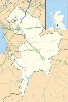
The Lands of Borland or Boreland (NS 5864 1742) were an important area in East Ayrshire, Scotland. This land included a castle and was part of the old Barony of Cumnock. It is located about two miles south of Cumnock.
From around the 1400s, a branch of the Hamilton family owned most of the land. Later, it passed to the Montgomeries and other families through marriage. For this article, we will use the spelling 'Borland'.
Contents
Exploring Borland's Past
It's a bit unusual for a place called 'Borland' to have a castle. The word 'Boor' meant a servant or serf. So, 'Borland' or 'Bordland' often referred to lands near a castle. These lands were given to servants or used to grow food for the castle's lord. Some people think the name might come from "wild boar," but that's less likely.
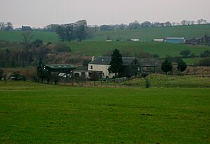
The old Dumfries Road used to run right through Borland Smithy, near where the castle was. Today, the road is a little to the east, but you can still see where the old one used to be. Borland Castle was one of three castles in the area of Old Cumnock. The others were Lefnoreis Castle and Terringzean.
The Castle and Its Land
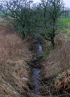
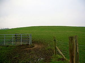
The castle, which was a fortified house, stood on a slightly raised area. It was between the old Borland Smithy (now East Borland Farm) and Borland Mill. Sadly, there are no castle remains visible today. A farmer removed the last walls before 1855. However, sometimes stones from the foundations are still hit when ploughing. In the 1800s, part of the old moat could still be seen. The Borland Burn was perfectly located to fill this moat with water.
The farmer in 1855 called it Borland House. But on several maps until 1821, it was clearly marked as a ruined castle.
Near the castle site is a sandy hill called Castle Hill or Knowe. Several gravel pits have changed the area. This spot might have been the site of an older fort or a castle mound. In 1939, archaeologists dug here. They found a wood-lined shaft in a sandpit. Inside it, they found a piece of a medieval jug. This suggests the site might have been used as a rubbish dump for Borland Castle's kitchen.
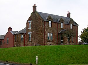
Inside the kitchen of East Borland Farm, there's a special stone above the fireplace. It's hidden by decorations now. This stone came from the old castle. It has the initials H. M. on the left and M. H. on the right, with the date 1677 in the middle. The stone is about three feet long and six inches tall. These initials belong to Hugh Montgomerie of Prestwickshaws and his wife, Margaret Hamilton.
Over time, the name Borland has been spelled in different ways. These include Burland, Boirlandis, Boirdland, Borlandis, and Brodland. In 1611, areas like Towlach, Garlaffen, and Sandochhill were part of the Lands of Borland. They were all within the Barony of Cumnock.
When Hugh Hamilton owned the Lands of Borland, they included many properties. These were Borland, Sannochhill, Smidieland, Rhyderstoun, Netherton, Midton, Watson, Borland Head, Borland Muir, Stay, Calloch Hill, and Roddinghead. His granddaughter, Margaret Hamilton, inherited these lands in 1699. They became part of her dowry when she married.
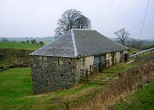
Borland Mill was likely the mill for the Lands of Borland. In 1832, it was called Smithy Mill, but usually, it used the Borland name. It got its water from the Black Loch, so it always had a good water supply.
Borland Chapel
The Lands of Borland also had a chapel before the Scottish Reformation. This chapel (NS594173) was located at a farm called Chapel House, which is now gone. A map by Robert Gordon from around 1636-1652 clearly shows a church or chapel site at Boirland. The 1857 OS map also marks the chapel's location. John Smith recorded that Borland Chapel was near the castle.
The chapel was also known as 'Hallow Chapel'. Its ruins could still be seen in 1837. However, by 1899, the stones had been taken away for other uses. A carved stone from this site, with circles carved into it, was built into the west wall of the old Chapel farmhouse. People also found human bones and skulls when ploughing. This might mean there was a burial ground there. Farming has changed the site of the farm and chapel quite a lot.
The Black Loch
This loch was part of the Lands of Borland. The Hamilton family owned it from the late 1300s to early 1400s. It's one of the few bodies of water that has water flowing out in two different directions!
Imagine a trout swimming up the River Ayr. It could then go into the Lugar Water at Barskimming. From there, it might enter the Black Loch through the Glaisnock Water. One outflow from the Black Loch would carry the trout into Creoch Loch, then into the Loch o' th' Lowes, and finally into the River Nith. This journey would end in the Solway Firth, after about seventy miles!
The Lairds of Borland
Around the year 1400, a branch of the Hamilton family took ownership of the lands of Borland. In 1551, George Hamilton and his son John received a special "Deed of Remission" from the Privy Council. This was like a pardon for supporting the Earl of Lennox during the Battle of the Butts in 1543. This battle was fought near Glasgow. It was unusual because the Earl of Lennox was usually an enemy of the Hamiltons. They fought against James Hamilton, who was the Regent of Scotland at the time.
A George Hamilton of Borland married Janet, the daughter of Keith of Galston. He was the second son of Sir David Hamilton of Cadzow. The Hamilton family owned the lands until 1669. That year, Hugh Hamilton of Borland left the lands to his granddaughter, Margaret. She was the heiress of this family branch. Hugh Montgomerie of Prestwickshaws married Margaret. He was a descendant of the Eglinton Montgomeries. He later sold his lands of Prestwickshaws to Robert Wallace.
In 1577, a man named John Hamilton died. In 1611, William Hamilton inherited Borland from his father, Patrick. Records also show a Hugh Hamilton in 1616 and a John Hamilton of Borland in 1650.
The Montgomeries of Borland held these lands until 1751. Then, the property passed to the Montgomeries of Coilsfield. They, along with McAdam of Waterhead, were trustees. They sold the lands to different people. In 1790, the Earl of Dumfries bought the lands. However, by the 1860s, the Marquis of Bute owned them.
William Montgomerie took over from his father, Hugh. He married Anne Hamilton of Letham. In 1711, he was a Commissioner of Supply for Ayrshire. John was William's son. He became a tax collector but did not live at Borland because his father had sold the lands.
What Old Maps Show
Old maps help us understand where Borland was and what it looked like. Blaeu's map from 1654 only shows an important place called 'Boirland'. Moll's map seems to show Borland near the river, but doesn't name it. Roy's military survey from 1747 only shows a 'Borland' site with some buildings inside a fence, and two other groups of buildings nearby.
Armstrong's map in 1775 only records 'Borlands'. Taylor and Skinner's maps from 1776 mark the 'Ruins of Borland Castle'. They show it near the 38-mile stone on the Dumfries Road. Ainslie's map from 1821 only shows a Borland Castle near the Borland Burn.
In 1832, Thomson's map shows Borland with a Smithy Mill and homes marked as Chapel, Netherton, and Midton. Borland Mains is shown some distance to the west of Borland. In 1857, the Dumfries Road still went through Borland Smithy. The site of Borland Castle is clearly marked near Castle Hill, which is next to the main railway line. Borland Mill was still used for grinding corn. The timber mill is shown opposite Borland Mains, near the Borland Burn, though a water supply isn't shown. The site of the chapel is also marked.
Small Discoveries at Borland
At Borland Smithy, which is now East Borland Farm, a nice stone axe head was found. It had a slanted cutting edge. Also found were finely decorated clay spindle whorls (used for spinning thread) and pieces of old urns. In 1898, two burial urns were discovered in the Castle Knowe.
 | Audre Lorde |
 | John Berry Meachum |
 | Ferdinand Lee Barnett |


