Langlo River facts for kids
Quick facts for kids Langlo |
|
|---|---|
|
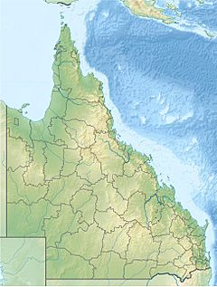
Location of Langlo River mouth in Queensland
|
|
| Country | Australia |
| State | Queensland |
| Region | South West Queensland |
| Physical characteristics | |
| Main source | Edinburgh Range northwest of Augathella 372 m (1,220 ft) 25°17′48″S 145°41′29″E / 25.29667°S 145.69139°E |
| River mouth | confluence with Warrego River southwest of Charleville 280 m (920 ft) 26°32′45″S 146°07′12″E / 26.54583°S 146.12000°E |
| Length | 440 km (270 mi) |
| Basin features | |
| River system | Darling River catchment, Murray–Darling basin |
| Tributaries |
|
The Langlo River is a river in Queensland, Australia. It is an important part of the huge Murray-Darling river system. This river system is one of the largest in the world. The Langlo River flows through the southwest part of Queensland.
Contents
Where the Langlo River Starts and Flows
The Langlo River begins high up in the Edinburgh Range. This area is near a place called Lumeah, which is northwest of Augathella. The river starts at an elevation of about 372 meters (1,220 feet) above sea level.
From its start, the Langlo River generally flows south. As it moves, it often splits into many smaller streams that weave together. These are called "braided channels." It flows through wide, flat plains where not many people live. It passes by areas known as Baykool and Nungil.
River's Journey and End Point
Further along its path, the river turns towards the southeast near Lynton Hills. It then crosses a main road called the Diamantina Developmental Road near Meecha. The Langlo River travels for about 440 kilometers (273 miles). During its journey, it drops about 92 meters (302 feet) in height.
Finally, the Langlo River joins another river called the Warrego River. This meeting point, or confluence, is southwest of Charleville. At this point, the river is about 280 meters (919 feet) above sea level. The Langlo River has seventeen smaller streams, or tributaries, that flow into it. One of the main ones is the Ward River.
The Land Around the River
The area around the Langlo River is mostly natural "downs country." This means it has rolling hills and open grasslands. This land is mainly used for grazing animals like cattle and sheep.
Plants and Rocks in the Area
The grasslands are covered with special types of grass. These include Flinders grass and Mitchell grass. You can also find rocky ridges and red, stony plains scattered throughout the area.
The ground beneath the river and its surroundings is made of different types of rock. Most of it is sandstone from the Middle Cretaceous period. There are also areas with limestone and mudstone.
 | Dorothy Vaughan |
 | Charles Henry Turner |
 | Hildrus Poindexter |
 | Henry Cecil McBay |


