Laurel River Lake facts for kids
Quick facts for kids Laurel River Lake |
|
|---|---|

Laurel River Dam and Lake
|
|
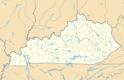
| Location | Laurel / Whitley counties, Kentucky, United States |
| Coordinates | 36°57′49″N 84°13′09″W / 36.9634910°N 84.2191634°W |
| Type | Reservoir |
| Basin countries | United States |
| Max. length | 19 mi (30 km) |
| Surface area | 5,600 acres (2,300 ha) |
| Average depth | 65 ft (20 m) |
| Max. depth | ca. 280 ft (85 m) |
| Water volume | 435,000 acre⋅ft (0.537 km3) |
| Shore length1 | 206 mi (332 km) |
| Surface elevation | 1,015 ft (309 m) |
| 1 Shore length is not a well-defined measure. | |
Laurel River Lake is a beautiful man-made lake located west of Corbin, Kentucky, in the U.S.. It was created in 1977 by the U.S. Army Corps of Engineers. The lake was formed on the Laurel River, which flows into the Cumberland River.
This large lake is nestled within the scenic Daniel Boone National Forest. It stretches across parts of both Laurel and Whitley counties.
Contents
Building Laurel River Lake
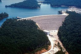
The creation of Laurel River Lake involved building a large dam. This dam is 282 feet (86 meters) tall. It is made from a mix of earth and rock. Construction of the dam took place between 1964 and 1974.
Generating Clean Energy
One important purpose of the dam is to produce electricity. This process is called Hydropower. Hydropower production at Laurel River Lake began in 1977. As of 2006, the dam produced about 67 gigawatt hours of hydroelectricity each year. This is enough power for many homes!
Managing the Lake and Forest
The Army Corps of Engineers and the Forest Service work together to manage Laurel River Lake. They also develop fun places for people to visit around the lake.
Who Does What?
Most of the lake area is managed by the Forest Service. It is part of the larger Daniel Boone National Forest. The Army Corps of Engineers is in charge of operating the dam itself. They also manage some of the recreation areas near the dam.
Lake Size and Features
Laurel River Lake collects water from a large area. This area, called its drainage basin, covers 282 square miles (730 square kilometers). The size of the lake can change depending on how much water it holds.
Dimensions of the Lake
The lake is usually about 19 miles (31 kilometers) long. It has a very long shoreline, stretching for 206 miles (332 kilometers). The total surface area of the lake is typically between 5,600 and 6,060 acres (23 to 25 square kilometers). When the lake is very full, for example, to help control floods, it can reach up to 6,650 acres (27 square kilometers). The amount of water the reservoir can hold is about 435,000 acre-feet.
 | Ernest Everett Just |
 | Mary Jackson |
 | Emmett Chappelle |
 | Marie Maynard Daly |


