Lawrence, Rusk County, Wisconsin facts for kids
Quick facts for kids
Lawrence, Wisconsin
|
|
|---|---|

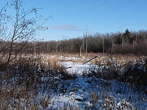
Much of Lawrence is wild land, accessed only by hunters and winter loggers who drive in over frozen swamps.
|
|

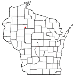
Location of Lawrence, Rusk County, Wisconsin
|
|
| Country | |
| State | |
| County | Rusk |
| Area | |
| • Total | 47.7 sq mi (123.6 km2) |
| • Land | 47.7 sq mi (123.6 km2) |
| • Water | 0.0 sq mi (0.0 km2) |
| Elevation | 1,224 ft (373 m) |
| Population
(2000)
|
|
| • Total | 240 |
| • Density | 5.0/sq mi (1.9/km2) |
| Time zone | UTC-6 (Central (CST)) |
| • Summer (DST) | UTC-5 (CDT) |
| Area code(s) | 715 & 534 |
| FIPS code | 55-42950 |
| GNIS feature ID | 1583535 |
| PLSS township | T34N R4W and western 2 miles of T34N R3W |
Lawrence is a small, quiet town located in Rusk County, in the northern part of Wisconsin, United States. It's a very rural area, meaning you'll find lots of farmland and forests instead of big cities. Back in 2000, about 240 people called Lawrence home.
Contents
Exploring Lawrence's Landscape
Lawrence is a town that measures about 8 miles by 6 miles. According to the United States Census Bureau, the total area of the town is about 47.7 square miles (123.6 square kilometers), and it's all land.
Rivers and Ridges in Lawrence
Several small streams, like branches of Main Creek, Little Jump River, and Alder Creek, flow through Lawrence. They generally move towards the west-southwest. The land here has many low, parallel ridges that run in the same direction. These ridges might be drumlins, which are small hills shaped by glaciers moving over the land a long time ago. Or, they could be the shape of the rock underneath the glacial till (the dirt and rocks left behind by glaciers).
Lawrence's Past: A Look Back in Time
Like most of northern Wisconsin, the area that is now Lawrence was once the home of the Ojibwe people before European settlers arrived.
Early Surveys and Descriptions
Some of the first European Americans to explore Lawrence were government surveyors. In 1847, they measured the outer edges of the six-mile squares that make up the town. They walked on foot, using a chain and compass. Later, in 1855, others returned to map all the section lines within those squares.
After their work, a surveyor wrote a description of the western part of what would become Lawrence. He noted that the area had several swamps that weren't good for farming. He also mentioned "Alder and Meadow Bottoms" that would flood with 1 to 2 feet of water, but the "Meadow Bottoms" were good for Hay. The land was mostly flat, with some higher areas that had decent soil. The surveyor described the area as heavily forested with trees like Hemlock, Yellow Birch, White Pine, and maple. He also mentioned thick undergrowth of Hemlock, Balsam, and Hazel. At that time, there were no buildings or improvements in the township.
How Lawrence Developed Over Time
Maps from 1880 and 1888 showed no signs of development or settlers in Lawrence. The closest activity was a logging road from Chippewa Falls that passed four miles to the west. This road led to logging camps on the Flambeau and then continued northeast to Phillips. Large areas of land were owned by companies like H.W. Sage & Co., Cornell University, Bond Bros., and Empire Lumber Co.
By 1901, a map showed a wagon road, which is now County B, coming from Glen Flora into the northwest part of Lawrence. A few settlers lived along this road. Another road, following the path of modern Highway 73, was drawn from north to south. Large landowners at this time included A.E. Walrath in the west and Cornell University in the east and middle.
Walrath: A Mill Town's Story
Walrath, which is now a ghost town (a town with no people left), was once a small mill town in Lawrence. It was first called Vallee. Alvin E. Walrath owned much of the land in Lawrence by 1901. He started a mill that cut chair parts from the trees in his forests. Walrath also built a boarding house and a store for his workers. Later, a box factory and a lath mill (which made thin strips of wood) were added.
By 1911, the Stanley, Merrill and Phillips railroad line reached Walrath from Jump River. At first, trains had to back in and out because there was no way for them to turn around. They would unload supplies and load wood products. Walrath even got a post office in 1916 and a school in 1919. Around 1920, Walrath tried to sell the land where trees had been cut down to new settlers. Eventually, the mills closed, and the railroad left. The Walrath school joined with Glen Flora's school around 1953. Today, not much is left of this little mill town.
Roads and Land in the Early 1900s
By 1914, maps showed more settlers in the northwest corner, near Glen Flora, and one in the northeast. A new road, similar to Hunter Lane today, entered the town from the southeast, with a few settlers living east of it. The Stanley, Merrill and Phillips Railroad also angled into the town from Jump River. Major landowners included A.E. Walrath, John S. Owen Lumber Company, and the Northwestern Lumber Co.
Between 1915 and 1920, Lawrence's modern road system started to take shape on maps, though they were likely still rough wagon tracks. Highway 73 was marked with its name. The northern two miles of the town were mostly divided into 40 and 80-acre farms. South of that, large parts of the town were still owned by A.E. Walrath and John S. Owen Lumber Co. A newspaper article from 1923 mentioned that most of the valuable timber in Rusk County would be gone within ten years.
Who Lives in Lawrence?
Let's look at the people who lived in Lawrence based on the census from 2000.
Population and Households
In 2000, there were 240 people living in Lawrence. These people lived in 90 households, and 56 of those were families. The population density was about 5.0 people per square mile (1.9 people per square kilometer). There were 111 housing units, which means homes, at an average of 2.3 per square mile. Most of the people in Lawrence (99.58%) were White, and a small number (0.42%) were Native American. About 1.67% of the population identified as Hispanic or Latino.
Out of the 90 households:
- 35.6% had children under 18 living with them.
- 54.4% were married couples living together.
- 6.7% had a female head of household with no husband present.
- 36.7% were not families.
- 30.0% of all households were made up of individuals living alone.
- 8.9% had someone living alone who was 65 years old or older.
The average household had about 2.67 people, and the average family had about 3.44 people.
Age and Income in Lawrence
The population in Lawrence was spread out across different age groups:
- 30.0% were under 18 years old.
- 11.7% were from 18 to 24 years old.
- 29.6% were from 25 to 44 years old.
- 19.6% were from 45 to 64 years old.
- 9.2% were 65 years old or older.
The average age in Lawrence was 31 years. For every 100 females, there were about 112.4 males. For every 100 females aged 18 and over, there were about 112.7 males.
The median income for a household in Lawrence was $35,313, and for a family, it was $35,972. Males earned a median income of $23,750, while females earned $21,750. The per capita income (income per person) for the town was $17,031. About 18.0% of families and 24.5% of the total population lived below the poverty line. This included 33.8% of those under 18, but none of those aged 65 or older.
See also
 In Spanish: Lawrence (Rusk) para niños
 | Bessie Coleman |
 | Spann Watson |
 | Jill E. Brown |
 | Sherman W. White |

