Lee (CDP), Massachusetts facts for kids
Quick facts for kids
Lee, Massachusetts
|
|
|---|---|

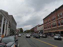
Main Street
|
|

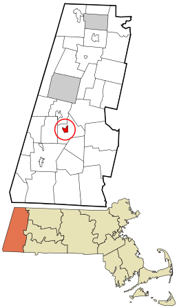
Location in Berkshire County and the state of Massachusetts.
|
|
| Country | United States |
| State | Massachusetts |
| County | Berkshire |
| Town | Lee |
| Area | |
| • Total | 1.36 sq mi (3.53 km2) |
| • Land | 1.32 sq mi (3.43 km2) |
| • Water | 0.04 sq mi (0.09 km2) |
| Elevation | 883 ft (269 m) |
| Population
(2020)
|
|
| • Total | 1,880 |
| • Density | 1,418.87/sq mi (547.95/km2) |
| Time zone | UTC-5 (Eastern (EST)) |
| • Summer (DST) | UTC-4 (EDT) |
| ZIP codes |
01238, 01264
|
| Area code(s) | 413 |
| FIPS code | 25-34620 |
| GNIS feature ID | 0607508 |
Lee is a special kind of community called a census-designated place (CDP). It is located within the larger town of Lee in Berkshire County, Massachusetts, United States. In 2020, about 1,880 people lived in this CDP. The entire town of Lee had a population of 5,943 people in 2010.
Contents
Exploring Lee's Location and Landscape
The Lee CDP is right in the middle of the town of Lee. You can find it at these coordinates: 42°18′24″N 73°14′50″W / 42.30667°N 73.24722°W.
Main Roads and Rivers
U.S. Route 20 goes through Lee. It is known as Main Street and Housatonic Street here. This road leads north to places like Lenox and Pittsfield. If you go south, it connects to Interstate 90, which is also called the Massachusetts Turnpike. This highway forms the southern edge of the CDP.
The Housatonic River is an important natural feature. It flows from north to south right through the center of Lee.
Size of the Area
The United States Census Bureau tells us how big the CDP is. It covers a total area of about 3.5 square kilometers (1.36 square miles). Most of this area, about 3.4 square kilometers (1.32 square miles), is land. A smaller part, about 0.1 square kilometers (0.04 square miles), is water. This means about 2.68% of the area is water.
People Living in Lee
| Historical population | |||
|---|---|---|---|
| Census | Pop. | %± | |
| 2020 | 1,880 | — | |
| U.S. Decennial Census | |||
Let's look at the population of Lee. In the year 2000, there were 2,021 people living in the CDP. These people lived in 901 households. A household is a group of people living in the same home.
Population Details
The population density was about 574 people per square kilometer (1,487 people per square mile). This tells us how many people live in a certain amount of space. There were also 953 housing units, which means homes or apartments, in the area.
People of different ages live in Lee. In 2000:
- About 21.8% of the people were under 18 years old.
- About 9.0% were between 18 and 24 years old.
- About 29.4% were between 25 and 44 years old.
- About 22.9% were between 45 and 64 years old.
- About 17.0% were 65 years old or older.
The average age of people in Lee was 39 years old. For every 100 females, there were about 89.4 males.
Households and Families
Out of the 901 households in 2000:
- About 27.0% had children under 18 living with them.
- About 41.4% were married couples living together.
- About 10.4% had a female head of the household with no husband present.
- About 44.4% were non-families, meaning people living alone or with others who are not related.
About 38.0% of all households were made up of individuals living alone. Also, 16.8% of households had someone living alone who was 65 years old or older. The average household had 2.20 people, and the average family had 2.88 people.
See also
 In Spanish: Lee (condado de Berkshire) para niños
 | Chris Smalls |
 | Fred Hampton |
 | Ralph Abernathy |

