Lee Vining Creek facts for kids
Quick facts for kids Lee Vining Creek |
|
|---|---|

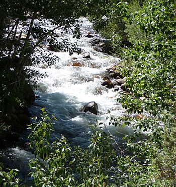
Lee Vining Creek near Mono Lake
|
|
| Country | United States |
| State | California |
| Physical characteristics | |
| Main source | Conness Lakes Sierra Nevada 10,617 ft (3,236 m) 37°58′36″N 119°18′23″W / 37.97667°N 119.30639°W |
| River mouth | Mono Lake 1 mi (1.6 km) north of Lee Vining 6,378 ft (1,944 m) 37°58′40″N 119°06′07″W / 37.97778°N 119.10194°W |
| Length | 16 mi (26 km), west-east |
| Basin features | |
| Basin size | 36 sq mi (93 km2) |
| Tributaries |
|
Lee Vining Creek is a stream about 16.2-mile-long (26.1 km) in Mono County, California. It flows into Mono Lake, which is a special type of lake called an endorheic basin. This means water flows into it but not out. Lee Vining Creek is the second largest stream that feeds Mono Lake. The largest is Rush Creek.
Contents
Where is Lee Vining Creek Located?
This creek starts high up in the Sierra Nevada mountains near Tioga Pass. This area is over 10,000 feet (3,000 m) above sea level. It is part of the Hoover Wilderness within the Inyo National Forest. This spot is also just outside the eastern edge of Yosemite National Park.
The Creek's Journey
The very beginning of Lee Vining Creek is fed by many high-altitude lakes. Saddlebag Lake is the biggest of these. The creek also gets water from permanent snowfields and the Conness Glacier. It flows southeast to Ellery Lake, which is a natural lake made bigger by a dam.
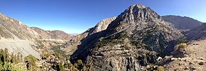
From Ellery Lake, the creek turns east. It then tumbles down Ellery Lake Falls into the deep Lee Vining Canyon. The creek continues flowing east out of the mountains. It passes by the small town of Lee Vining. Finally, the creek ends at a small sandy area on the western shore of Mono Lake.
How People Use Lee Vining Creek
Lee Vining Canyon is an important route for California State Route 120. This road, also known as Tioga Pass Road, is the main way to cross Yosemite. Building this road in the 1930s was very hard. The canyon walls are very steep and rugged. Route 120 meets U.S. Route 395 in Lee Vining. This is just north of where US 395 crosses Lee Vining Creek.
Generating Electricity
The creek's water is also used to make electricity. This happens at the Poole power plant. It is run by Southern California Edison and is located inside Lee Vining Canyon. Water is held back by dams at Ellery, Saddlebag, and Rhinedollar Lakes. This stored water is then released to create power. The water drops a total of 1,700 feet (520 m) to do this.
An older system was built in the 1920s. It had three power plants. Today, only one of them, Lee Vining No. 1, is still working.
Water for Cities
A part of Lee Vining Creek's water is sent to the Second Los Angeles Aqueduct. This happens near Lee Vining. The aqueduct carries water to cities in Southern California. However, taking water from Lee Vining Creek and other streams like Rush Creek and Mill Creek has caused problems.
This diversion has greatly reduced the amount of water flowing in the streams. It has also made the level of Mono Lake drop. This has harmed the delicate natural environment of the lake.
 | Delilah Pierce |
 | Gordon Parks |
 | Augusta Savage |
 | Charles Ethan Porter |


