Lemhi River facts for kids
Quick facts for kids Lemhi River |
|
|---|---|

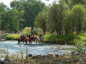
Historical reenactment on the Lemhi River
|
|
|
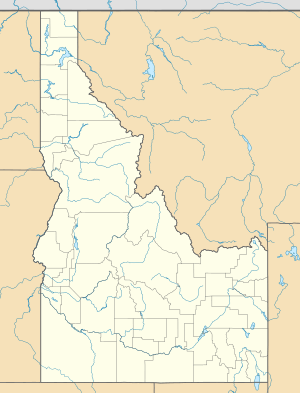
Location of the mouth of the Lemhi River in Idaho
|
|
| Country | United States |
| State | Idaho |
| Counties | Lemhi |
| Cities | Leadore, Salmon |
| Physical characteristics | |
| Main source | 5,954 ft (1,815 m) 44°40′56″N 113°21′17″W / 44.68222°N 113.35472°W |
| River mouth | Salmon River Salmon 3,900 ft (1,200 m) 45°11′17″N 113°54′23″W / 45.18806°N 113.90639°W |
| Length | 60 mi (97 km) |
| Basin features | |
| Basin size | 1,216 sq mi (3,150 km2) |
The Lemhi River is a river in Idaho, United States. It flows for about 60 miles (97 km) through a beautiful valley. This river is a branch, or tributary, of the Salmon River. The Salmon River then flows into the Snake River, which eventually joins the mighty Columbia River.
Contents
Where the Lemhi River Flows
The Lemhi River starts near a town called Leadore. It begins where several small streams meet. From there, the river generally flows northwest. It travels through the wide, flat area known as the Lemhi Valley.
The River's Path Through the Valley
As the Lemhi River moves, it has mountains on both sides. To its west is the Lemhi Range. To the east, you can see the Bitterroot Range and the Beaverhead Mountains. Finally, the Lemhi River meets the Salmon River in the city of Salmon.
How People Use the River's Water
The water from the Lemhi River and its smaller streams is very important. People use it for irrigation to help grow crops on farms. This means they take water from the river to water their fields.
The Impact of Irrigation on the River
Because so much water is taken for farming, the river changes. Many of the smaller streams that usually feed into the Lemhi River can dry up completely for parts of the year. This happens because their water is redirected to irrigate crops.
A Look Back in Time: The Lemhi River's History
The Lemhi River area has an interesting history, especially with famous explorers. In August 1805, the Lewis and Clark Expedition arrived here. They were exploring the western parts of the United States.
Lewis and Clark's Journey
Lewis and Clark crossed a high point called the Lemhi Pass. This pass is about 10 miles (16 km) east of the Lemhi River. There, they met a group of Shoshone Native Americans. Amazingly, one of the Shoshone leaders, named Cameahwait, was the brother of Sacagawea. Sacagawea was a very important guide and interpreter for the Lewis and Clark expedition.
Exploring the Salmon River
The expedition sent a small group, guided by a Shoshone named Swooping Eagle, to explore. They traveled north along the Lemhi River to the Salmon River. They hoped to find a way to travel by boat. However, they soon discovered that the Salmon River was too difficult to pass. It was too rough for boats and even hard to travel alongside on land. So, they had to turn back.
 | Sharif Bey |
 | Hale Woodruff |
 | Richmond Barthé |
 | Purvis Young |


