Leshara, Nebraska facts for kids
Quick facts for kids
Leshara, Nebraska
|
|
|---|---|
|
Village
|
|

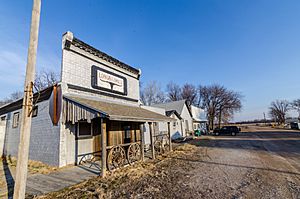
Main Street in Leshara, March 2017
|
|

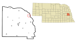
Location of Leshara, Nebraska
|
|
| Country | United States |
| State | Nebraska |
| County | Saunders |
| Area | |
| • Total | 0.07 sq mi (0.18 km2) |
| • Land | 0.07 sq mi (0.18 km2) |
| • Water | 0.00 sq mi (0.00 km2) |
| Elevation | 1,175 ft (358 m) |
| Population
(2020)
|
|
| • Total | 108 |
| • Density | 1,565.22/sq mi (604.17/km2) |
| Time zone | UTC-6 (Central (CST)) |
| • Summer (DST) | UTC-5 (CDT) |
| ZIP code |
68064
|
| Area code(s) | 402 and 531 |
| FIPS code | 31-26630 |
| GNIS feature ID | 2398425 |
Leshara is a small village located in Saunders County, Nebraska, United States. In 2020, about 108 people called Leshara home. It is a quiet place with a history tied to the early days of railroads in Nebraska.
Contents
Leshara's Story: How It Began
Leshara was founded in 1905. This happened when the Great Northern Railway decided to build a train station there. In early October, a company bought 50 acres of land from Joseph Lammel. They wanted to build a new town on this land.
By the end of that same month, the company started selling lots for businesses. Each lot cost $600. The very first business built in Leshara was a lumberyard. It was run by the Zaugg brothers, who came from Yutan. Later, in November, lots for homes also went on sale.
Leshara's name is a tribute to an important Pawnee chief. His name was Petalesharo, and he lived in the area during the 1800s.
Where is Leshara?
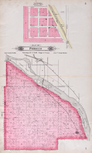
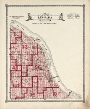
Leshara is located in Leshara Township. According to the United States Census Bureau, the village covers a total area of about 0.07 square miles (0.18 square kilometers). All of this area is land, meaning there are no large bodies of water within the village limits.
Who Lives in Leshara?
| Historical population | |||
|---|---|---|---|
| Census | Pop. | %± | |
| 1910 | 86 | — | |
| 1920 | 102 | 18.6% | |
| 1930 | 110 | 7.8% | |
| 1940 | 84 | −23.6% | |
| 1950 | 61 | −27.4% | |
| 1960 | 103 | 68.9% | |
| 1970 | 102 | −1.0% | |
| 1980 | 133 | 30.4% | |
| 1990 | 118 | −11.3% | |
| 2000 | 111 | −5.9% | |
| 2010 | 112 | 0.9% | |
| 2020 | 108 | −3.6% | |
| U.S. Decennial Census | |||
A Closer Look: 2010 Census
The census taken in 2010 showed that 112 people lived in Leshara. These people lived in 48 different homes, and 27 of these were families. The village had about 1600 people per square mile (617 people per square kilometer). There were 52 housing units in total.
Most of the people in the village (85.7%) were White. A smaller number were African American (1.8%), Native American (0.9%), or Asian (0.9%). Some people (8.0%) were from other races, and 2.7% were from two or more races. About 9.8% of the population identified as Hispanic or Latino.
Out of the 48 homes, 25.0% had children under 18 living there. About 43.8% were married couples living together. A small number of homes had a female head of household without a husband (4.2%) or a male head of household without a wife (8.3%). The remaining 43.8% were not families.
About 31.3% of all homes had only one person living in them. And 16.7% of homes had someone living alone who was 65 years old or older. On average, there were 2.33 people in each home, and 3.07 people in each family.
The average age of people in the village was 42 years old. About 17.9% of residents were under 18. Another 10.8% were between 18 and 24 years old. People aged 25 to 44 made up 27.7% of the population. Those aged 45 to 64 were 30.3%, and 13.4% were 65 years or older. The village had slightly more females (51.8%) than males (48.2%).
See also
 In Spanish: Leshara (Nebraska) para niños
 | Janet Taylor Pickett |
 | Synthia Saint James |
 | Howardena Pindell |
 | Faith Ringgold |


