Limmen Bight River facts for kids
Quick facts for kids Limmen Bight |
|
|---|---|
|
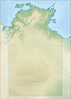
Location of the Limmen Bight River mouth in the Northern Territory
|
|
| Country | Australia |
| Territory | Northern Territory |
| Physical characteristics | |
| Main source | Favenc Range Australia |
| River mouth | Limmen Bight Gulf of Carpentaria, Australia 15°11′41″S 135°37′9″E / 15.19472°S 135.61917°E |
| Basin features | |
| Basin size | 15,938 km2 (6,154 sq mi) |
The Limmen Bight River is an important river in the Northern Territory, Australia. It flows through beautiful natural areas before reaching the sea.
Contents
Where the River Flows
The Limmen Bight River starts in the Favenc Range mountains. It begins near places called O.T. Downs and Broadmere Stations. From there, it flows north, getting bigger as many smaller streams join it.
As it moves, the river spreads out into many different channels. This creates a cool pattern that looks like a braid across the flat lands. It passes by landmarks like Sculthorpe Pound and Limmen Gate. The Tawallah Range of mountains is to its east.
The river continues its journey through the amazing Limmen National Park. It flows past a spot known as the Four Archers near Burketown Crossing. Finally, the river empties into the Limmen Bight, which is part of the larger Gulf of Carpentaria.
River Branches and Waterholes
Many smaller rivers and creeks, called tributaries, flow into the Limmen Bight River. There are fifteen of them! Some of these include October Creek, Balbirni Creek, and Nathan River.
The river also flows through a large, permanent billabong. A billabong is a waterhole that stays full of water even when the river might dry up in parts. This one is called Broadmere waterhole.
The River's Area
The land that collects water for the Limmen Bight River is called its catchment area. This area is huge, covering about 15,938 square kilometres (6,154 sq mi). That's a lot of land!
This catchment area is located between other big river systems. To the north and west are the Roper River and Towns River catchments. To the south is the McArthur River catchment, and to the east is the Rosie River catchment. All these rivers help shape the landscape of the Northern Territory.
The Limmen Bight River sends a lot of water into the sea each year. On average, it sends about 1,160 gigalitres (1.517×10⁹ cu yd) of water.
The River's Mouth
Where the river meets the sea is called its estuary. The Limmen Bight River's estuary is very large, covering about 62.1 square kilometres (24 sq mi) of open water. It is still in a very natural and untouched condition.
This part of the river is a delta, which means it has many channels because of the tides. Around the estuary, there are about 21.2 square kilometres (8 sq mi) of mangrove trees. Mangroves are special trees that grow in salty water and are important homes for many animals.
How the River Got its Name
The Limmen Bight River is named after the Limmen Bight, the large bay it flows into. The bight itself was named a long time ago in 1644.
It was named by a famous explorer named Abel Tasman. He named the bight after his own ship, which was called the Limmen.
 | Stephanie Wilson |
 | Charles Bolden |
 | Ronald McNair |
 | Frederick D. Gregory |


