Linden, Arizona facts for kids
Quick facts for kids
Linden, Arizona
|
|
|---|---|

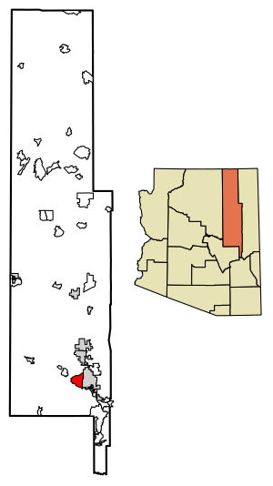
Location of Linden in Navajo County, Arizona.
|
|
| Country | United States |
| State | Arizona |
| Counties | Navajo |
| Area | |
| • Total | 30.21 sq mi (78.24 km2) |
| • Land | 30.20 sq mi (78.22 km2) |
| • Water | 0.01 sq mi (0.01 km2) |
| Elevation | 6,539 ft (1,993 m) |
| Population
(2010)
|
|
| • Total | 2,597 |
| • Density | 91.38/sq mi (35.28/km2) |
| Time zone | UTC-7 (MST) |
| ZIP code |
85901
|
| Area code(s) | 928 |
| FIPS code | 04-41085 |
| GNIS feature ID | 2582815 |
Linden is a small community in Navajo County, Arizona, United States. It's not a city with its own government, but rather an unincorporated community. This means it's governed by the county.
Linden is located just west of the city of Show Low, Arizona. It sits high up on the Mogollon Rim, which is a large cliff, at an elevation of over 6,000 feet (about 1,800 meters).
In June 2002, the community had to be evacuated because of a large wildfire called the Rodeo-Chediski fire. This fire sadly destroyed some homes in Linden.
Linden is mostly made up of large ranches and rural neighborhoods. Since there aren't many businesses in Linden itself, many people who live there work in or near the nearby city of Show Low.
The fire department that used to serve Linden has now joined with the fire departments of Show Low and Lakeside. This new group is called the Timber Mesa Fire and Medical District. Law enforcement in Linden is handled by the Navajo County Sheriff's Office and the Arizona Department of Public Safety.
Contents
Exploring Linden's Location
Arizona State Route 260 is the main road that goes through Linden. This road helps people get around the community.
Linden is known for its wide-open fields and gently rolling hills. The area has many different kinds of trees and plants. You can find tall Ponderosa Pine trees, smaller Pinyon pines, and Gambel oaks. There are also many types of Junipers, including those with shaggy bark and alligator bark.
People Living in Linden
| Historical population | |||
|---|---|---|---|
| Census | Pop. | %± | |
| 2010 | 2,597 | — | |
| U.S. Decennial Census | |||
Linden was first officially counted as a community in the 2010 United States Census. At that time, its population was 2,597 people.
Schools in Linden
The Show Low Unified School District serves the students who live in Linden.
Linden has its own school called Linden Elementary School. This school teaches students from kindergarten through sixth grade. After elementary school, students from Linden go on to Show Low Junior High School and then Show Low High School.
Discovering a Historic Site
A special place near Linden is called Roundy Crossing. This is an ancient site from the Mogollon culture, which was a group of Native American people.
At Roundy Crossing, scientists have found amazing petroglyphs, which are pictures carved into rocks. These carvings show the winter sky and are believed to be from the year 1168 AD. They even show a rare event where planets lined up in the sky.
When archaeologists dug at the site, they found the remains of an ancient village. This included a pueblo (a type of multi-story building), a kiva (a special room used for ceremonies), a ramada (a shaded structure), and a plaza (an open public space).
See also
 In Spanish: Linden (Arizona) para niños


