
List of Device Forts facts for kids
The Device Forts were a group of strong castles and blockhouses built by King Henry VIII to protect the coasts of England and Wales. These forts were designed to hold powerful cannons (artillery) and stop enemy ships from landing soldiers or attacking important harbors.
These castles were managed by captains chosen by the King. They had small teams of professional soldiers and gunners. If there was an emergency, local volunteers would join them. Building these forts was very expensive, costing about £376,000. Much of this money came from selling off the lands of old monasteries, which Henry VIII had closed down.
Over time, some of these Device Forts were left to fall apart and were stopped being used just a few years after they were built. Others stayed in use for a long time. They were important during the English Civil War, the Anglo-Dutch Wars, and the Napoleonic Wars. They were even updated with newer cannons and defenses throughout the 1800s.
However, by 1900, guns and ship armor had improved so much that most of the remaining Device Forts were too small to be useful for modern coastal defense. Even though some were used again during the Second World War, by the 1950s, they were no longer needed and were finally closed down. Over hundreds of years, the sea has worn away or completely destroyed some of these sites. But many others have been fixed up and are now open for people to visit as tourist attractions.
Contents
Famous Device Forts
Here are some of the most interesting Device Forts and their stories:
Brownsea Castle


Brownsea Castle was built between 1545 and 1547 on Brownsea Island to protect Poole Harbour. It was a stone blockhouse with a nearby hexagonal (six-sided) platform for cannons. The local town provided six soldiers and eight cannons for its defense. During the English Civil War, Parliament's forces took control of it. In the 1700s, it was turned into a country house. Today, it is a hotel for the John Lewis Partnership.
Calshot Castle


Built from 1539 to 1540 on Calshot Spit, Calshot Castle guarded Southampton Water. It had a main tower (keep) in the middle, surrounded by a wall and a moat (a ditch filled with water). It was very well-armed, with 16 soldiers and up to 36 cannons! In 1913, it became a base for seaplanes and was known as RAF Calshot until 1961. After a short time with the coastguard, it was opened to the public by English Heritage in the 1980s.
Camber Castle


Camber Castle, near Rye, was built between 1513 and 1543 to protect the Camber anchorage. It was rebuilt in 1539 and made even bigger from 1542 to 1543. It became a large, round fort with a central keep and five circular towers, made of stone and brick. It might have been used in 1545 when a French fleet attacked the coast. Over time, the coastline moved, leaving the castle far from the sea. It was closed in 1637.
Deal Castle


Deal Castle, in Deal, was built from 1539 to 1540 to protect The Downs, a safe place for ships. It had a main tower with six inner and outer towers, and 66 places for cannons. During the Second English Civil War, supporters of the King took it, but Parliament's forces recaptured it after several months. In the 1700s and 1800s, it was changed into a private house for the castle's captain and was no longer used for defense in 1904. The government restored it in the 1950s, and it's now a popular tourist spot.
Hurst Castle


Built from 1541 to 1544 on Hurst Spit, Hurst Castle protected The Solent. It had a central keep surrounded by three circular towers, making it one of the strongest forts on the coast. It was updated in the early 1800s and 1850s to hold heavier guns. In the 1860s, two long sections were added for huge 12.5-inch, 38-ton (317 mm, 39,000 kg) cannons! It was decommissioned in 1956 and is now owned by English Heritage.
Pendennis Castle


Pendennis Castle, in Falmouth, was built from 1540 to 1545 to guard Carrick Roads. It had a circular keep and a gun platform. In the late 1500s, it was expanded with large walls and towers. Pendennis was used during the English Civil War and was under attack in 1646. It was updated in the 1730s and 1790s, and even used during both World Wars. It was decommissioned in 1956 and is now managed by English Heritage as a tourist attraction. In 2011-12, over 74,000 people visited it.
Portland Castle


Portland Castle, on the Isle of Portland, was completed by 1540 to protect Portland Roads. This fan-shaped castle has a curved central tower and a gun battery, with two angled sections on the sides. During the English Civil War, it survived two attacks before finally giving up to Parliament in 1646. It was used as a fort until the Napoleonic Wars ended in 1815. After that, it was a private house, military housing, and storage before opening to the public in 1955.
St Mawes Castle


St Mawes Castle, also in Falmouth, was built from 1540 to 1542 to work with Pendennis Castle and protect Carrick Roads. It has a four-story central tower and three round towers sticking out. During the English Civil War, a Parliamentary army took it without a fight. It remained in use through the 1700s and 1800s, being updated for new weapons. It was disarmed in the early 1900s but briefly used again during the Second World War.
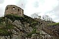
Sandsfoot Castle


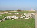
Sandsfoot Castle, near Weymouth, was finished by 1541 to protect Weymouth Bay. It was a blockhouse connected to an eight-sided gun room, looking out over the sea. More earth defenses were added around 1623. It changed hands several times during the English Civil War and was taken out of active service in 1665. It has suffered a lot from the sea wearing it away, and by the 1950s, the gun room had fallen into the sea.
Southsea Castle


Southsea Castle, in Portsmouth, was built in 1544 to protect The Solent. It had a keep, gun platforms, and angled towers, making it an early English example of a "trace italienne" style fort (a type of fortification designed to resist cannon fire). It saw a little action at the start of the English Civil War when Parliament's forces attacked it. The castle was expanded in the 1680s and redesigned again during the Napoleonic Wars and throughout the 1800s. It was decommissioned in 1960.
Walmer Castle


Walmer Castle, in Walmer, was built in 1539 to protect The Downs. It had a keep and four circular towers, covering about 0.61 acres. During the Second English Civil War, supporters of the King took Walmer, and Parliament's forces only recaptured it after several months of fighting. In the 1700s, Walmer became the official home of the Lord Warden of the Cinque Ports and was slowly changed from a military fort into a private house. It was decommissioned in 1904.
Yarmouth Castle


Yarmouth Castle, in Yarmouth, was built in 1545 to protect Yarmouth Harbour. It was a square fort for cannons, built around a central courtyard. It had an angled tower protecting the land side, which was a new design for England, showing early Italian influences. It remained in military and government use until the 1950s.
Images for kids
-
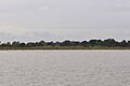
Brightlingsea Blockhouse
-

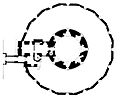
Calshot Castle plan
-

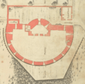
Camber Castle plan
-

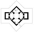
Deal Castle plan
-
Devil's Point Artillery Tower
-
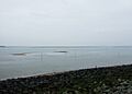
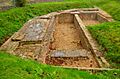
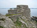
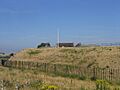
East Blockhouse
-
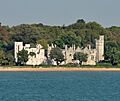
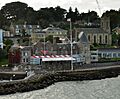
East Cowes Castle
-
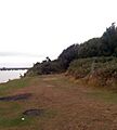
East Tilbury Blockhouse
-
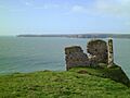
Remains of Gravesend Blockhouse
-

Gravesend Blockhouse plan
-
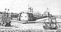
Hull Castle defenses
-
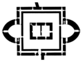
Hull Castle plan
-

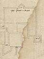
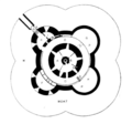
Hurst Castle keep plan
-
Little Dennis Blockhouse
-

Little Dennis Blockhouse plan
-

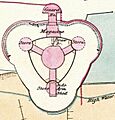
Mersea Fort plan
-
Netley Castle
-

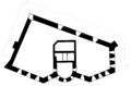
Netley Castle plan
-
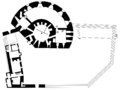
Pendennis Castle keep plan
-
Portland Castle plan
-
St Andrew's Castle
-
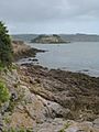
St Catherine's Castle
-
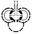
St Mawes Castle plan
-
St Osyth Blockhouse
-
Sandown Castle (Isle of Wight) plan
-
Sharpenrode Bulwark
-

Sandsfoot Castle plan
-
Sandgate Castle
-
Sandgate Castle plan
-
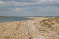
Sandown Castle (Kent) site
-
Sandown Castle (Kent) diagram
-
Southsea Castle plan
-

Walmer Castle plan
-
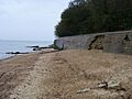
West Blockhouse
-
West Cowes Castle
-
West Cowes Castle plan
-
West Tilbury Blockhouse
-
West Tilbury Blockhouse plan
-

Yarmouth Castle plan


