List of National Natural Landmarks in Virginia facts for kids
Virginia is home to some truly special places called National Natural Landmarks. These are areas recognized by the United States National Park Service because they have amazing natural features, like unique caves, ancient forests, or important wildlife habitats. Think of them as nature's treasures! There are 10 of these incredible spots in Virginia, each one showing off a different part of our planet's natural beauty.
Contents
Discover Virginia's Natural Wonders
Virginia's National Natural Landmarks are like living museums. They help us understand Earth's history and protect important ecosystems. Let's explore some of these cool places!
Butler Cave-Breathing Cave
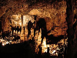
This landmark is actually two big cave systems located in Bath County. Inside, you can find a 40-foot waterfall, a natural bridge, and really cool crystal formations. There's even an underground lake! These caves are managed by a group called the Butler Cave Conservation Society.
Caledon Natural Area
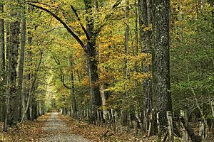
Found in King George County, Caledon Natural Area is an amazing example of an old-growth forest. This means it's a very old forest that hasn't been cut down much by people. It's filled with tall oak and tulip poplar trees, making it a fantastic place to see what forests looked like long ago. It's also a state park, so it's protected for everyone to enjoy.
Charles C. Steirly Natural Area
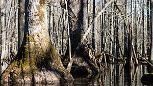
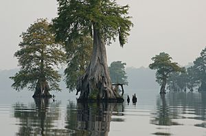
This small but mighty natural area in Sussex County protects a special kind of swamp forest. It's home to a nearly untouched stand of bald cypress and water tupelo trees. These trees thrive in wet, swampy conditions and create a unique habitat.
Grand Caverns
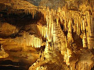
Located in Augusta County, Grand Caverns is a spectacular cave system. It's famous for its unique "shield formations," which are rare and look like ancient shields hanging from the cave ceiling. You can also see beautiful flowstone, draperies, stalactites (hanging from the ceiling), and stalagmites (growing from the floor).
Great Dismal Swamp
The Great Dismal Swamp, found near Suffolk City, is a huge wetland area. This landmark protects a part of the original, much larger Great Dismal Swamp. It's a vital home for many animals and plants, acting as a National Wildlife Refuge managed by the federal government.
Luray Caverns
In Page County, Luray Caverns is another incredible cave system. It's known for its stunning decorations, including cascades (like frozen waterfalls of rock), columns, stalactites, stalagmites, and clear pools. It's a privately owned cave, but open for visitors to explore its beauty.
Montpelier Forest
This mature forest is part of President James Madison's historic Montpelier estate in Orange County. It's mostly filled with tall tulip poplar trees and spicebush. This forest shows us what the land looked like when James Madison lived there, offering a glimpse into the past.
Rich Hole Wilderness
Located in Rockbridge County, Rich Hole is an excellent example of a "cove" hardwood forest. These forests are found in sheltered valleys and are known for their rich variety of hardwood trees. It's part of the George Washington National Forest, which means it's protected by the federal government.
Seashore Natural Area
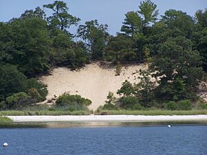
The Seashore Natural Area in Virginia Beach is special because of its parallel dunes. These sand dunes are covered with thick forests that have two different types of trees, some of which are usually found in warmer, "semitropical" places. It's a state park, preserving this unique coastal environment.
Virginia Coast Reserve
This reserve covers parts of Accomack and Northampton counties. It's a mostly untouched group of barrier islands and lagoons. These islands and the water around them are super important as a safe haven for many birds, including migratory shorebirds, waterfowl, and birds that nest in colonies. It's a private area, but its natural importance is recognized nationally.
 | James Van Der Zee |
 | Alma Thomas |
 | Ellis Wilson |
 | Margaret Taylor-Burroughs |


