List of places of worship in Reigate and Banstead facts for kids
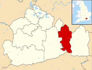
The area of Reigate and Banstead in Surrey, England, is home to over 80 places where people have worshipped. About 70 of these are still used for religious services today. Another 13 buildings used to be places of worship but are now used for other things.
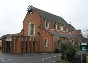
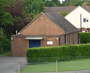
Most people living here are Christian, according to the 2011 census. So, most of the worship places are for Christian groups. However, there are also three mosques that opened after 1978. The Subud and Kosmon movements also have their own centres here. The Church of England has almost 30 churches. There are also six Roman Catholic churches. Many Methodists, Baptists, Evangelicals, Open Brethren, and the United Reformed Church have their own buildings. The Plymouth Brethren Christian Church has a large meeting hall in Horley and smaller ones nearby.
English Heritage has given "listed status" to 11 places of worship in Reigate and Banstead. A listed building is a special building that is important for its history or design. This helps to protect it. There are three levels of listed status:
- Grade I: Buildings that are extremely important.
- Grade II*: Buildings that are very important and special.
- Grade II: Buildings that are important to the country.
As of 2001, the area had 5 Grade I buildings, 18 Grade II* buildings, and 388 Grade II buildings. The local council also lists "locally listed buildings," which are important to the local area. There are 526 of these, including 12 places of worship.
Contents
Exploring Reigate and Banstead
Reigate and Banstead is one of 11 local areas in Surrey, a county in southeast England, just south of London. It covers about 12,913 acres (5,226 hectares). In 2011, its population was 137,835 people. This makes it Surrey's most populated local area. It also grew the fastest between 2001 and 2009. It shares borders with parts of London, and other areas in Surrey and West Sussex.
The area is mostly towns and suburbs. It has four main towns: Horley in the south, Redhill and Reigate in the middle, and Banstead in the northwest. About two-thirds of the people live in these towns. Reigate is very old, but Horley and Redhill grew because of the railways in the Victorian era. Banstead grew as London expanded. Some larger villages like Merstham are ancient. It became a quarrying centre and later had a big housing estate. Kingswood is known for its "leafy suburban surroundings." Tadworth also saw a lot of housing growth. Nearby Walton-on-the-Hill is a "pleasant Victorian village" with a church and a spiritual centre for the Kosmon movement.
Eight very old parish churches are still in the area. Reigate's St Mary's Church is one of the largest in Surrey. It has grown over many centuries since the 1100s. All Saints Church in Banstead might be even older, but most of it is from the 1200s. Walton-on-the-Hill's church was started in the early 1200s. Horley's St Bartholomew's Church has been there since the 1100s. Chipstead's church is from the 1100s and 1200s. Merstham's old church is from the 1100s. Gatton, a tiny village, had a church in 1086. Many of these old churches were changed a lot in Victorian times. St Peter's at Woodmansterne, also mentioned in 1086, was completely rebuilt in 1876.
During the 1800s and 1900s, many new Anglican churches were built as towns grew. In Reigate, St Mark (1860) and St Luke (1871) were added. St Philip (1863) was built as a smaller church for St Mark's. Redhill grew quickly because of the railway. So, St John the Evangelist (1843), St Matthew (1866), and Holy Trinity (1906) were built there. A church in Burgh Heath disappeared by the late 1800s. A new St Mary's was built in its place in 1908–09. In Kingswood, St Andrew's was built in 1848–52. At Lower Kingswood, the Church of the Wisdom of God opened in 1891. This church is special because it's built in a Byzantine style and has marble and old pieces from places like Ephesus and Constantinople.
Smaller Anglican churches were built in Tadworth (1912) and Nork (1930). Churches also appeared in Sidlow (1861) and South Merstham (1898). The South Merstham church was bombed in World War II and rebuilt in 1951. The Church of the Epiphany (1955) and St Peter's Church (1955) were built for new housing estates. However, both of these closed within 60 years. Horley also saw new churches, St Francis (1958) and St Wilfrid (1970). A church was finished in Salfords in 1967. On Reigate Heath, there are two unusual Anglican churches. One is a tin tabernacle from 1907. The other is an 18th-century windmill that became the Chapel of St Cross in 1880. English Heritage says this is "probably the only windmill in England in use as a church."
For a long time, Redhill was the only place for Roman Catholics to worship. Their first chapel was built in 1860. It was replaced by St Joseph's Church in 1898. This church was later replaced by a new one in the same spot in 1984. Reigate's Catholic church opened in 1938. The 1960s saw the fastest growth for Catholics here. Merstham's church was built in 1958–59. In Tadworth, a temporary church was replaced by St John the Evangelist's Church in 1966. Horley's Church of the English Martyrs also got a new building in 1962.
Redhill was also a main centre for Baptist worship. A town-centre chapel (1868) was replaced by a new building in 1961. The Redhill church helped start other Baptist churches in Merstham (1897), Earlswood (1909), and Reigate (1995). Strict Baptists have chapels in Redhill and near the Reigate border.
Many Methodist chapels existed in the area by the early 1900s. Today, Methodists still meet in Banstead, Horley, Redhill, and Reigate. Only the Reigate church still uses its original chapel from 1884. New churches were built in Banstead (1971), Horley (1960), and Redhill (1992). Some old chapels have closed. Earlswood's former Wesleyan chapel was bought by a Muslim group and became the Jamia Masjid Al Mustafa.
United Reformed Church congregations are in Banstead, Redhill, and Reigate. In Reigate, their old Victorian chapel was replaced by a 1970s building. Various Brethren groups are also strong here. Some churches, now called Evangelical, used to be Open Brethren, like Sandcross Church. Others, like Lee Street Church, Woodlands Chapel, and Shrewsbury Chapel, still are. The Plymouth Brethren Christian Church has a main meeting hall in Horley, registered in 1992. They also have two other meeting rooms in Earlswood.
Religious Beliefs in the Area
The 2011 census showed that 137,835 people lived in Reigate and Banstead. Here's how they identified their religion:
- Christian: 61.9%
- Muslim: 1.91%
- Hindu: 1.36%
- Buddhist: 0.45%
- Jewish: 0.21%
- Sikh: 0.15%
- Other religions: 0.35%
- No religion: 26.31%
- Did not state: 7.35%
The number of Christians was higher here than the average for England (59.38%). However, there were fewer Muslims, Jews, and Sikhs than the national average. The number of people with no religion was higher than the national average (24.74%).
How Churches are Organized
Anglican Churches
The Church of England churches in Reigate and Banstead are part of two different areas called dioceses. These are the Anglican Diocese of Southwark (based in London) and the Diocese of Guildford (based in Guildford, Surrey).
Five churches are part of Guildford's Epsom Deanery: Banstead, Burgh Heath, Nork, Tattenham Corner, and Walton-on-the-Hill. The rest, including churches in Reigate, Horley, Merstham, Redhill, and other villages, are part of Southwark's Reigate Deanery.
Roman Catholic Churches
The five Roman Catholic churches in the area are managed by the Roman Catholic Diocese of Arundel and Brighton, which has its cathedral in Arundel in West Sussex. The churches in Merstham, Redhill, and Reigate are grouped together in the Redhill Deanery. The churches in Banstead and Tadworth are in the Epsom Deanery.
Other Church Groups
The Baptist churches in Earlswood, Horley, Merstham, Redhill, and Reigate are part of the Gatwick Network of the South Eastern Baptist Association. Woodmansterne Baptist Church is part of the London Baptist Association.
For Methodists, the Sutton Methodist Circuit includes the Banstead and Tattenham Corner churches. The Redhill & East Grinstead Methodist Circuit covers the Horley, Redhill, and Reigate Methodist churches.
The United Reformed Church congregations in Banstead, Redhill, Reigate, and Walton-on-the-Hill are part of the Southern Synod.
Some Evangelical churches, like Lower Kingswood Evangelical Free Church, Merland Rise Church, and Tollgate Evangelical Church, are part of two groups: the Fellowship of Independent Evangelical Churches (FIEC) and Affinity. These groups help support and connect churches with similar beliefs. Lee Street Church in Horley is part of Partnership UK, which supports independent churches.
Special Buildings: Listed Status
Buildings with "listed status" are protected because they are important for their history or design.
| Grade | What it means |
|---|---|
| Grade I | Buildings that are super important, sometimes even known around the world. |
| Grade II* | Buildings that are very important and have special features. |
| Grade II | Buildings that are important to the country and have special interest. |
| Locally listed (L) | Buildings that the local council thinks are an important part of the area's history or look. |
Places of Worship Still in Use
| Name | Image | Location | Religion | Grade | Notes | Refs |
|---|---|---|---|---|---|---|
| All Saints Church | 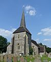 |
Banstead 51°19′20″N 0°12′03″W / 51.3221°N 0.2008°W |
Anglican | II* | This small stone church looks like it was restored in 1861. Inside, it has unique arches and an octagonal pillar. The tower has a shingled roof. The church dates from the late 1100s to early 1200s. | |
| ChristChurch Banstead |  |
Banstead 51°19′25″N 0°11′50″W / 51.3236°N 0.1971°W |
Evangelical | – | This church was built in 1971, replacing an older "tin tabernacle" from the early 1900s. It was first a non-denominational mission. It was renamed Banstead Baptist Church in 1960 and then ChristChurch in 2013. | |
| Banstead Methodist Church | 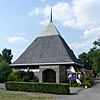 |
Banstead 51°19′06″N 0°12′47″W / 51.3184°N 0.2131°W |
Methodist | – | Methodists in Banstead first used a combined school and chapel. A church was built in 1934–35. This building was later found to be unsafe and was rebuilt in 1971 on the same spot. | |
| St Ann's Church |  |
Banstead 51°19′17″N 0°12′42″W / 51.3215°N 0.2116°W |
Roman Catholic | – | This brick church was built in 1950, replacing a temporary hut. It was designed by C.W. Glover and Partners. More parts were added in the 1960s and 1970s. | |
| Banstead United Reformed Church |  |
Banstead 51°19′29″N 0°11′37″W / 51.3248°N 0.1937°W |
United Reformed Church | – | This church started meeting in a school in 1940. A permanent church was finished in 1951 and later extended in 1957, 1962, and 2000. | |
| St Mary's Church |  |
Burgh Heath 51°18′26″N 0°13′04″W / 51.3073°N 0.2178°W |
Anglican | L | This church was built in 1908–09 by Whitfield and Thomas. It replaced a much older church that had disappeared. It is made of flint and stone. | |
| St John the Evangelist's Church |  |
Earlswood 51°13′46″N 0°10′35″W / 51.2294°N 0.1764°W |
Anglican | II* | Redhill's oldest church was built in three stages between 1842 and 1895. It features flint and limestone, with later additions of pale brick. It has a tall corner tower and spire. | |
| Earlswood Baptist Church |  |
Earlswood 51°13′48″N 0°10′00″W / 51.2301°N 0.1667°W |
Baptist | – | This church started as a mission in 1909. The original "tin tabernacle" was replaced by the current building in 1978. A church hall was added in 1997. | |
| Jamia Masjid Al-Mustafa | 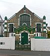 |
Earlswood 51°13′41″N 0°10′20″W / 51.2281°N 0.1722°W |
Muslim | – | This building was a Methodist church from 1900 to 1937. In 1978, a Muslim group bought it and turned it into a mosque. It can hold 500 people. | |
| Meeting Room |  |
Earlswood 51°13′56″N 0°10′01″W / 51.2321°N 0.1669°W |
Plymouth Brethren Christian Church | – | This Brethren meeting room opened in June 1966. It is connected to the main meeting hall in Horley. | |
| Meeting Room |  |
Earlswood 51°13′41″N 0°10′24″W / 51.2280°N 0.1732°W |
Plymouth Brethren Christian Church | – | This meeting room on Woodlands Road is also linked to the main meeting hall in Horley. It was registered in 1997. | |
| St Andrew's Church | 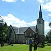 |
Gatton 51°15′39″N 0°10′25″W / 51.2608°N 0.1736°W |
Anglican | I | This 13th-century church was rebuilt in the 1700s and again in 1834. It was designed to look like a "picturesque Gothick" building. It has a very slim tower. | |
| Royal Alexandra and Albert School Chapel |  |
Gatton 51°15′45″N 0°10′26″W / 51.2624°N 0.1740°W |
Non-denominational | – | This chapel was built in 1956 for the school. It is also registered for public worship and marriages. | |
| St Margaret's Church |  |
Hooley 51°17′32″N 0°09′39″W / 51.2923°N 0.1608°W |
Anglican | I | Most of this large village church is from the 1200s. The tower was built in 1631. It is made of flint and stone. Norman Shaw added parts in 1883. | |
| St Bartholomew's Church | 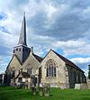 |
Horley 51°10′11″N 0°10′33″W / 51.1698°N 0.1758°W |
Anglican | I | This church is near the A23 road and the River Mole. It dates back to the 1300s. It was greatly restored in 1881, but some 14th-century parts remain. | |
| St Francis' Church |  |
Horley 51°10′15″N 0°09′27″W / 51.1708°N 0.1576°W |
Anglican | – | This church was built in 1958. It serves as both a worship centre and a hall. It has a simple L-shape. | |
| St Wilfrid's Church |  |
Horley 51°10′49″N 0°10′15″W / 51.1804°N 0.1707°W |
Anglican | – | Built in 1970, this church is made of concrete. It has an L-shape, connecting the church area and a hall. | |
| Horley Baptist Church (new building) |  |
Horley 51°10′31″N 0°10′26″W / 51.1753°N 0.1739°W |
Baptist | – | This new church opened in 2015, replacing an older building. It was built on the site of a former primary school. The new church cost £1.75 million. | |
| Horley Methodist Church |  |
Horley 51°10′22″N 0°10′03″W / 51.1727°N 0.1675°W |
Methodist | – | Horley's first Methodist church was for Primitive Methodists. The current church, a cross-shaped building, opened in 1960 due to a growing congregation. | |
| Gatwick Islamic Centre | 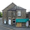 |
Horley 51°10′24″N 0°09′41″W / 51.1732°N 0.1613°W |
Muslim | – | This mosque and community centre opened in 2011. Before that, worshippers used rented halls for 11 years. It serves Muslims from Horley and nearby towns. | |
| Lee Street Church |  |
Horley 51°10′42″N 0°10′47″W / 51.1783°N 0.1798°W |
Open Brethren | – | This building, originally called Lee Street Hall, was registered for Open Brethren use in 1965. In 2002, it held Sunday services and Wednesday home groups. | |
| Grove Meeting Room |  |
Horley 51°10′10″N 0°09′33″W / 51.1695°N 0.1593°W |
Plymouth Brethren Christian Church | – | Plymouth Brethren have worshipped in Horley since 1911. A building on this site existed by 1963. It was registered for worship in 1984. | |
| Meeting Room |  |
Horley 51°10′35″N 0°11′05″W / 51.1765°N 0.1846°W |
Plymouth Brethren Christian Church | – | This meeting room on Whitmore Way is the main local centre for Plymouth Brethren worship. It was registered in 1992. | |
| Church of the English Martyrs |  |
Horley 51°10′30″N 0°10′17″W / 51.1751°N 0.1713°W |
Roman Catholic | – | This modern church was designed in 1961–62. It uses yellow brick and has triangular windows with stained glass. The bell tower is separate from the main octagonal building. | |
| St Andrew's Church | 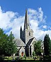 |
Kingswood 51°17′09″N 0°13′10″W / 51.2857°N 0.2195°W |
Anglican | II | This church was built between 1848 and 1852. Its design was based on a 14th-century church in Berkshire. It has a tall tower and spire in the centre. It is made of flint and stone. | |
| Church of the Wisdom of God |  |
Lower Kingswood 51°16′09″N 0°12′42″W / 51.2692°N 0.2116°W |
Anglican | I | This is a "most remarkable" church, especially inside. It was designed in 1891 in a Byzantine style. It has ancient capitals (tops of pillars) from churches in Ephesus and Constantinople. | |
| Lower Kingswood Evangelical Free Church |  |
Lower Kingswood 51°16′13″N 0°12′35″W / 51.2702°N 0.2097°W |
Evangelical | – | This church started as a mission hall. The original wooden building was replaced by a larger brick church in 2008. It opened on November 2, 2008. | |
| St Katharine's Church |  |
Merstham 51°16′07″N 0°09′07″W / 51.2687°N 0.1520°W |
Anglican | II* | This church is on the slopes of the North Downs, away from the town. It is a strong building made of local flint and stone. The tower was built in the 1220s. Many 13th-century parts are still inside. | |
| All Saints Church |  |
Merstham 51°15′24″N 0°09′02″W / 51.2566°N 0.1505°W |
Anglican | – | The first church here opened in 1898 but was destroyed by a bomb in 1942. A new brick church was built in 1951. | |
| Merstham Baptist Church |  |
Merstham 51°15′30″N 0°08′44″W / 51.2584°N 0.1456°W |
Baptist | – | A Baptist chapel was built in 1874. The congregation moved to a new site in 1958. The current building is being replaced, and the church meets in a temporary building. | |
| St Teresa's Church |  |
Merstham 51°15′34″N 0°08′42″W / 51.2594°N 0.1449°W |
Roman Catholic | – | This permanent Catholic church was founded in 1958. It was designed by Justin H. Alleyn using concrete and brick. The first service was held in 1959. | |
| St Paul's Church |  |
Nork 51°19′32″N 0°13′27″W / 51.3256°N 0.2242°W |
Anglican | – | This Anglican church for the Nork area dates from 1930. It was designed by W.E. Bowden. | |
| Holy Trinity Church |  |
Redhill 51°14′51″N 0°10′01″W / 51.2474°N 0.1669°W |
Anglican | – | This red-brick church was designed by R.H. Mew in 1906. An entrance porch was added in 1967. More work was done in 1991 and 2004. | |
| St Matthew's Church | 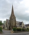 |
Redhill 51°14′27″N 0°10′20″W / 51.2407°N 0.1721°W |
Anglican | L | This town-centre church has a tall spire. It is made of Bargate stone and Reigate Stone. The entrance is at the base of the tower. | |
| Redhill Baptist Church |  |
Redhill 51°14′21″N 0°10′52″W / 51.2391°N 0.1810°W |
Baptist | – | This church was founded in 1864. A new building was put up in 1961 and was enlarged and updated in 2009 for £1.8 million. | |
| Redhill Methodist Church |  |
Redhill 51°14′33″N 0°10′07″W / 51.2424°N 0.1687°W |
Methodist | – | This is the only open Methodist church in Redhill. It was built in 1992, replacing several older Methodist chapels. | |
| Al-Yaqeen Masjid |  |
Redhill 51°14′31″N 0°10′14″W / 51.2419°N 0.1705°W |
Muslim | – | This building on Warwick Road is now a small mosque. It was originally built as a Plymouth Brethren meeting room in 1968. | |
| Shrewsbury Chapel |  |
Redhill 51°14′19″N 0°10′48″W / 51.2385°N 0.1800°W |
Open Brethren | – | This chapel, first known as Shrewsbury Hall, was registered for marriages in 1895. In 2002, it held two Sunday services and one on Wednesday evenings. It was refurbished in 2019–20. | |
| Redhill Tabernacle | 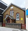 |
Redhill 51°14′26″N 0°10′09″W / 51.2406°N 0.1691°W |
Redeemed Christian Church of God | II | This building was a Strict Baptist church until the early 2000s. It is now used by the RCCG Pentecostal group. It was built in 1858. | |
| St Joseph's Church |  |
Redhill 51°14′44″N 0°09′48″W / 51.2456°N 0.1632°W |
Roman Catholic | – | This modern church opened in 1988. It replaced two older churches, with the first dating back to 1860. | |
| Salvation Army Hall |  |
Redhill 51°14′19″N 0°10′14″W / 51.2385°N 0.1705°W |
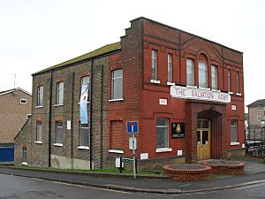
Salvation Army | – | This Salvation Army centre has been in use since 1911. It was registered for marriages in 1935. | |
| Hope Chapel |  |
Redhill 51°14′15″N 0°10′53″W / 51.2375°N 0.1815°W |
Strict Baptist | – | This chapel was founded in 1876 by a Strict Baptist pastor. It was registered for marriages in 1880. | |
| Redhill United Reformed Church | 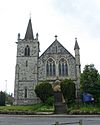 |
Redhill 51°14′14″N 0°10′56″W / 51.2371°N 0.1823°W |
United Reformed Church | L | This church was built in 1901–02. It became the Redhill United Reformed Church in 1987 when two congregations joined together. | |
| Reigate Mill Church | 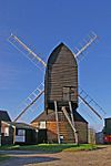 |
Reigate 51°14′11″N 0°14′00″W / 51.2363°N 0.2333°W |
Anglican | II* | This windmill from 1765 had its base converted into a chapel in 1880. It is now called Reigate Mill Church. It is thought to be the only windmill in England used as a church. | |
| St Mary Magdalene's Church |  |
Reigate 51°14′12″N 0°11′50″W / 51.2367°N 0.1973°W |
Anglican | II* | This large church, one of Surrey's biggest, started around 1200. It was restored in the 1800s. It is made of Reigate stone and has a mix of architectural styles. | |
| Reigate Heath Church |  |
Reigate 51°14′17″N 0°13′27″W / 51.2380°N 0.2243°W |
Anglican | – | This is a "tin tabernacle" with a wooden frame. It opened in 1907, and regular services have been held there since. | |
| St Mark's Church |  |
Reigate 51°14′36″N 0°12′12″W / 51.2432°N 0.2034°W |
Anglican | L | This church was built in 1860. It has a Decorated Gothic Revival style. It includes a nave, chancel, aisles, transepts, and a tower. | |
| St Philip's Church |  |
Reigate 51°14′31″N 0°12′42″W / 51.2420°N 0.2117°W |
Anglican | L | This church opened in 1863 as a smaller church for St Mark's. It was funded by W. Phillips. It became its own separate parish in 1992. | |
| Reigate Methodist Church | 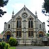 |
Reigate 51°14′14″N 0°12′33″W / 51.2373°N 0.2091°W |
Methodist | L | This church was built in 1884 of Reigate stone. It replaced an older Methodist chapel. | |
| Woodlands Chapel |  |
Reigate 51°13′56″N 0°11′55″W / 51.2321°N 0.1987°W |
Open Brethren | – | This Brethren hall was registered for worship in 1964. In 2002, it held three Sunday services and one weekday service. | |
| Friends Meeting House |  |
Reigate 51°14′14″N 0°11′38″W / 51.2372°N 0.1939°W |
Quaker | – | Quakers have met in Reigate since the 1600s. The current meeting house, an octagonal room, was built in 1984. It is attached to sheltered housing. | |
| Church of the Holy Family |  |
Reigate 51°14′29″N 0°12′26″W / 51.2414°N 0.2072°W |
Roman Catholic | – | This Catholic church was designed in 1938. It is made of red brick and stone. It has a striking corner tower with a copper spire. | |
| Christ the King Church |  |
Salfords 51°12′14″N 0°10′00″W / 51.2040°N 0.1667°W |
Anglican | – | This church was built between 1958 and 1967 by local volunteers. It has a cross-shaped structure with a steep timber roof. | |
| Emmanuel Church |  |
Sidlow 51°12′28″N 0°11′56″W / 51.2078°N 0.1989°W |
Anglican | L | This flint-built church was designed in 1861. It has a nave, chancel, corner tower, and a bellcote on the roof. | |
| Tollgate Evangelical Church |  |
South Earlswood 51°12′58″N 0°10′30″W / 51.2161°N 0.1749°W |
Evangelical | – | This church, originally called Tollgate Hall, replaced an earlier mission hall in 1952. | |
| St Luke's Church |  |
South Park 51°13′36″N 0°12′31″W / 51.2268°N 0.2087°W |
Anglican | L | This church, built in 1871, is made of Reigate stone. It has a nave, chancel, and side chapel. The west end was rebuilt in 1986. | |
| Subud Hall |  |
South Park 51°13′29″N 0°12′32″W / 51.2246°N 0.2090°W |
Subud | – | This building was a Congregational mission hall and school from the 1880s. The Subud movement later acquired it and established their worship place here in 1988. | |
| Reigate Park Church |  |
South Park 51°13′45″N 0°12′18″W / 51.2291°N 0.2050°W |
United Reformed Church | – | This church in the South Park area opened in 1975. It replaced an older church that was demolished in 1973. | |
| Church of the Good Shepherd |  |
Tadworth 51°17′23″N 0°14′09″W / 51.2897°N 0.2359°W |
Anglican | L | This Anglican church was designed by Charles Barry in 1912. It was extended in 1963. It is made of brown brick and stone. | |
| Merland Rise Church |  |
Tadworth 51°18′05″N 0°14′04″W / 51.3014°N 0.2344°W |
Evangelical | – | This church started as the Tattenham Corner Evangelical Free Church. It was registered for worship and marriages in 1967. | |
| St John the Evangelist's Church |  |
Tadworth 51°17′30″N 0°14′13″W / 51.2916°N 0.2370°W |
Roman Catholic | – | This permanent Catholic church opened in 1966. It is a "well-built and dignified church" of pale brick. It has a carved statue of its saint. | |
| Bethel Chapel | 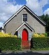 |
Tadworth 51°17′15″N 0°13′54″W / 51.2874°N 0.2316°W |
Strict Baptist | – | This chapel was built in 1883, replacing an older one from 1822. The first service was held in 1883. It was registered for marriages in 1905. | |
| St Mark's United Church |  |
Tattenham Corner 51°18′32″N 0°13′54″W / 51.3090°N 0.2317°W |
Anglican/Methodist | – | This church was built as an Anglican church in 1967. After a Methodist church closed, St Mark's became a joint church for both groups. | |
| St Peter's Church |  |
Walton-on-the-Hill 51°16′54″N 0°14′48″W / 51.2818°N 0.2468°W |
Anglican | II* | This 15th-century church has been restored several times. It has a "small but remarkable" lead font from the 1150s, possibly Britain's oldest. | |
| Kosmon Sanctuary | Walton-on-the-Hill 51°16′59″N 0°15′04″W / 51.2830°N 0.2510°W |
Kosmon Church | – | This spiritual movement's centre is part of a building on the Walton Manor estate. It was registered for worship in 1963 and for marriages in 1999. | ||
| Christchurch United Reformed Church |  |
Walton-on-the-Hill 51°16′58″N 0°14′40″W / 51.2829°N 0.2444°W |
United Reformed Church | – | This church started as a "tin tabernacle" mission chapel in 1885. A new building was needed by 1908 and was registered for marriages in 1912. | |
| Reigate Baptist Church |  |
Woodhatch 51°13′31″N 0°11′47″W / 51.2252°N 0.1965°W |
Baptist | – | This church was started from the Redhill Baptist church in 1995. The permanent church and community centre opened in 2005. | |
| Sandcross Church |  |
Woodhatch 51°13′17″N 0°12′23″W / 51.2213°N 0.2063°W |
Evangelical | – | This church started as a mission chapel during World War II. A wooden church was built in 1947, and a new building was erected in 1957. | |
| St Peter's Church |  |
Woodmansterne 51°19′27″N 0°10′08″W / 51.3242°N 0.1690°W |
Anglican | L | This church was completely rebuilt in 1876–77. No original parts survive except for one window and a piscina (a basin for washing sacred vessels). | |
| Woodmansterne Baptist Church |  |
Woodmansterne 51°18′58″N 0°10′00″W / 51.3160°N 0.1667°W |
Baptist | – | The current church was built in 1936. It started from a group of Baptists meeting in Coulsdon in 1907. It has been expanded for its growing congregation. |
Former Places of Worship
| Name | Image | Location | Religion | Grade | Notes | Refs |
|---|---|---|---|---|---|---|
| St John's Mission Hall |  |
Earlswood 51°13′43″N 0°09′59″W / 51.2285°N 0.1663°W |
Anglican | – | This mission hall was built in 1910. Services continued until at least 1978. It became a nursery school after being sold in 1995. | |
| Horley Baptist Church (old building) |  |
Horley 51°10′36″N 0°10′04″W / 51.1768°N 0.1677°W |
Baptist | – | This building from 1881 became too small by 2010. A new, larger church was built elsewhere. The old church was sold in 2013 and is now a nursery school. | |
| Southlands Christian Church | 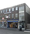 |
Horley 51°10′23″N 0°09′42″W / 51.1731°N 0.1616°W |
Non-denominational | – | This church started in 2003. It used a building in Salfords that was destroyed by fire. Later, it used part of an office building in Horley, but this is no longer used for worship. | |
| Margery Mission Hall | 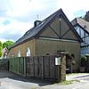 |
Margery 51°15′40″N 0°12′23″W / 51.2610°N 0.2065°W |
Congregational | – | This was a Congregational mission chapel opened in 1885. It served Margery and Mogador. It had a popular Sunday school. | |
| Meadvale Hall |  |
Meadvale 51°13′41″N 0°11′14″W / 51.2280°N 0.1872°W |
Anglican | – | This 19th-century Anglican mission hall was used as a church until at least 1962. It later became a community hall and nursery school. | |
| Meadvale Methodist Church | 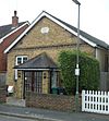 |
Meadvale 51°13′39″N 0°11′19″W / 51.2274°N 0.1885°W |
Methodist | L | This mid-19th-century chapel for Primitive Methodists was registered for marriages until 2003. It is now a house. | |
| Jireh Strict Baptist Chapel |  |
Meadvale 51°13′42″N 0°11′20″W / 51.2282°N 0.1889°W |
Strict Baptist | – | This chapel was built around 1854. It was used by Strict Baptists until 2006, when the new Reigate Baptist Church opened. | |
| Canada Hall |  |
Merstham 51°15′23″N 0°09′03″W / 51.2565°N 0.1508°W |
Anglican | – | After All Saints Church was bombed in WWII, Canadian soldiers helped build this temporary replacement. It served as an Anglican church and later a church hall. | |
| Church of the Epiphany |  |
Merstham 51°15′44″N 0°08′30″W / 51.2621°N 0.1417°W |
Anglican | – | This church was founded in 1955 for a new housing estate. It closed in January 2015 because repairs were too expensive. | |
| Mugswell Mission |  |
Mugswell 51°16′40″N 0°11′48″W / 51.2777°N 0.1966°W |
Anglican | – | This small wooden building was provided around 1900 for Anglican worshippers. It was used for religious services until at least 1962 and is now a village hall. | |
| Kingdom Hall |  |
Reigate 51°14′32″N 0°12′02″W / 51.2421°N 0.2006°W |
Jehovah's Witnesses | – | This building was used by Jehovah's Witnesses from 1960 to 1995. They now use a new Kingdom Hall near Gatwick Airport. | |
| Lesbourne Road Primitive Methodist Chapel | 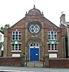 |
Reigate 51°14′02″N 0°12′02″W / 51.2339°N 0.2006°W |
Methodist | L | This locally listed building was built in 1870. It was used as a chapel until 1948 and is now a warehouse. | |
| St Peter's Church |  |
Woodhatch 51°13′17″N 0°11′49″W / 51.2213°N 0.1969°W |
Anglican | – | This church, designed by E.F. Starling, served housing estates in Reigate from 1955 to 2008. The Diocese sold it in 2010. |
 | Bayard Rustin |
 | Jeannette Carter |
 | Jeremiah A. Brown |


