Reigate facts for kids
Quick facts for kids Reigate |
|
|---|---|
| Town | |
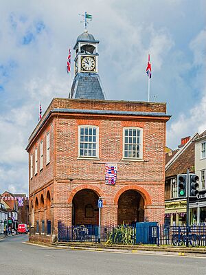 Old Town Hall, High Street |
|
| Population | 21,820 (electoral definition) or 22,123 (Built-up Area) |
| OS grid reference | TQ2649 |
| • London | 19 mi (30 km) N |
| District |
|
| Shire county | |
| Region | |
| Country | England |
| Sovereign state | United Kingdom |
| Post town | Reigate |
| Postcode district | RH2 |
| Dialling code | 01737 |
| Police | Surrey |
| Fire | Surrey |
| Ambulance | South East Coast |
| EU Parliament | South East England |
| UK Parliament |
|
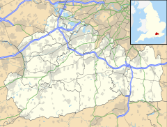
Reigate (pronounced RY-gate) is a town in Surrey, England. It's about 30 kilometers (19 miles) south of central London. The town's history goes way back! It was first mentioned in the Domesday Book in 1086 as Cherchefelle. Its modern name, Reigate, appeared around the 1190s.
People have lived in the Reigate area for a very long time. The oldest signs of human activity are from the Paleolithic (Old Stone Age) and Neolithic (New Stone Age) periods. During the time of Roman Britain, people made tiles just northeast of where the town center is today.
A special type of castle, called a motte-and-bailey castle, was built in Reigate in the late 1000s or early 1100s. It was first made of wood, but later, its walls were rebuilt with stone. An Augustinian priory (a type of monastery) was also started south of the town center in the early 1200s. This priory was later closed during the English Reformation and turned into a private home. The castle was also left to fall apart around the same time.
For many years, Reigate was mostly a farming town. A weekly market started by 1279 and continued until 1895. Farmers grew crops like oats, hops, and flax. In the 1700s, the town's economy slowed down because new turnpike roads (toll roads) made it easier to bring in cheaper goods from other places. But when the railways arrived in the mid-1800s, Reigate started to grow again. More land became available for building houses, especially after the priory estate was sold in 1921.
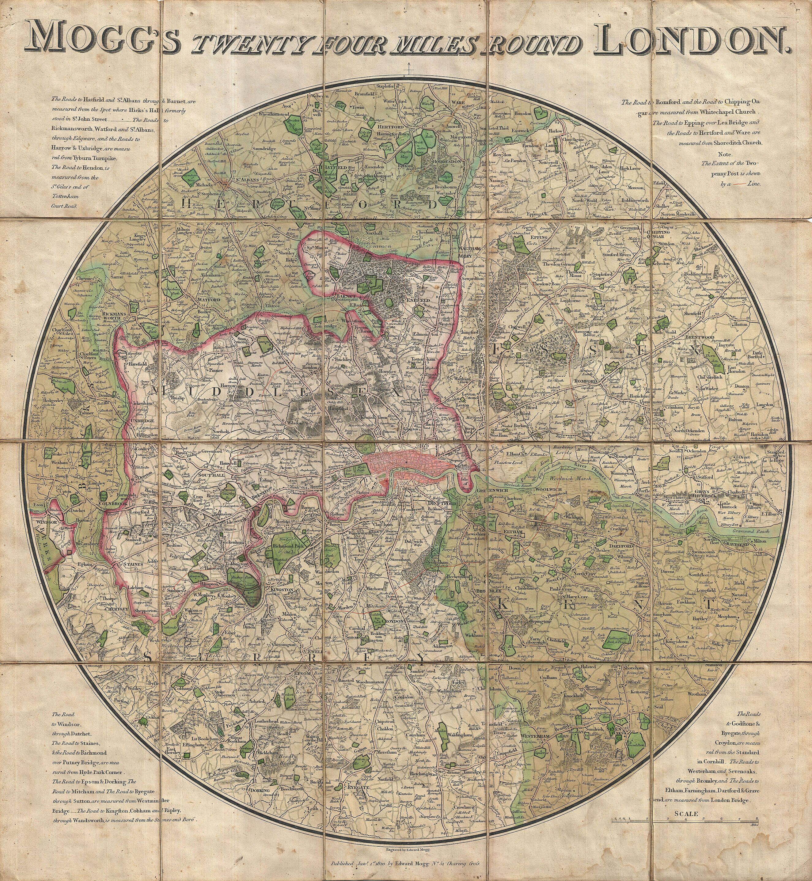
Today, Reigate is part of the London commuter belt, meaning many people who live here travel to London for work. Since 1974, it has been part of the Reigate and Banstead borough. The North Downs, a range of hills north of Reigate, are mostly owned by the National Trust. This includes Colley Hill and Reigate Hill, which are both quite high up!
Contents
- What's in a Name? The History of Reigate's Name
- Reigate's Location and Landscape
- Reigate's Story Through Time
- Reigate's Population and Homes
- Public Services in Reigate
- Reigate's Economy and Businesses Today
- Getting Around Reigate
- Learning in Reigate: Schools and Colleges
- Places of Worship in Reigate
- Culture and Arts in Reigate
- Sports in Reigate
- Important Buildings and Landmarks in Reigate
- Parks and Open Spaces in Reigate
- Famous People from Reigate
- See also
What's in a Name? The History of Reigate's Name
In the Domesday Book of 1086, Reigate was called Cherchefelle. Later, in the 1100s, it was known as Crichefeld and Crechesfeld. These names likely meant "open space by the hill or burial mound."
The name "Reigate" first appeared in writings around the 1190s. Other similar names were used later, like Reigata (1170), Regate (1203), and Raygate (1235). The name "Reigate" probably comes from two old words: the Old English word rǣge, meaning "roe deer," and the Middle English word gate, which could mean an enclosed gate or a mountain pass. This suggests it might have been a place where deer were hunted through a pass.
There's also a place called Woodhatch nearby. Its name might come from the Old English word hæc, meaning "gate," so it could mean "gate to the wood." This "wood" might have been the Weald, a large wooded area.
Reigate's Location and Landscape
Where is Reigate?
Reigate is in the middle of Surrey, about 30 kilometers (19 miles) south of central London. It's also only about 14 kilometers (9 miles) north of Gatwick Airport. The town sits in a valley called the Vale of Holmesdale, just below the North Downs hills. The town center is about 80 meters (260 feet) above sea level. Small streams like the Wallace Brook flow through the area, eventually joining the River Mole.
What is Reigate's Geology Like?
The ground in Reigate is made up of different types of sedimentary rock (rock formed from layers of sediment). For example, Woodhatch sits on Weald Clay, which is mostly mudstone from the early Cretaceous period. Much of Reigate is on layers of the Lower Greensand Group, which includes sandy parts and clayey parts. Reigate Heath and the town center are on sandy layers called Folkestone Beds.

In the past, people dug up the Weald clay to make bricks. Sand for building was also dug from pits near the town. Special "silver sand" found in the Folkestone Beds was even quarried to make glass! The caves under Reigate Castle might have been dug for this purpose before being used as cellars. There's also evidence that ironstone (a rock containing iron) was dug here, but this stopped by 1650.
A type of stone called Reigate Stone was mined from medieval times until the mid-1900s. It was used to build many local buildings, like the castle, Reigate Priory, and St Mary's Church. North of the town, you can still see old chalk pits. People probably made lime (a material used in building) at the base of Colley Hill.
Reigate's Story Through Time
Early History of Reigate
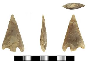
The very first sign of humans in Reigate is a stone axe from the Paleolithic (Old Stone Age), found in 1936. Later, Neolithic (New Stone Age) tools made of flint have been found on Colley Hill. From the Bronze Age, a gold ring and a spearhead were found in Priory Park. The eight burial mounds (called barrows) on Reigate Heath are also from this time.
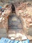
During the Roman period, the Doods Road area was a place where tiles were made. In 2014, archaeologists found a kiln (an oven for baking clay) from the 2nd or 3rd century. They found different types of Roman tiles there. Coins from various Roman emperors found in the area show that Romans were active here throughout their time in Britain.
The old name Cherchefelle suggests that people started living permanently in Reigate during Anglo-Saxon times. The main settlement was probably near the parish church, east of the modern town center.
How Reigate Was Governed
Reigate is mentioned in the Domesday Book of 1086 as Cherchefelle. It was owned by William the Conqueror. The area had two mills, land for farming, woodlands, and pastures. It was part of a larger area called the Reigate Hundred.
In 1295, the Borough of Reigate was formed. It used to elect two Members of Parliament (MPs) to the House of Commons. Later, in 1832, it lost one MP. In 1868, Reigate lost its right to elect MPs due to corruption, but it got it back in 1885.
Around 1090, the land of Cherchefelle was given to William de Warenne, 1st Earl of Surrey. He helped Reigate grow. The castle was built soon after, and the modern town started in the late 1100s. An Augustinian priory was founded in 1240. By 1276, a regular market was held in the town.
Over time, local government changed. By the early 1600s, the parish was divided into "Borough of Reigate" (the town center) and "Reigate Foreign" (the surrounding areas). These two parts were reunited in 1863 as a Municipal Borough with an elected council. In 1933, the Borough grew to include other nearby towns.
In 1974, the Local Government Act 1972 created the Reigate and Banstead Borough Council. This council has been based at the Reigate Town Hall in Castlefield Road ever since.
Reigate Castle: A Look Back
Reigate Castle was built in the late 1000s or early 1100s, probably by William de Warenne, 2nd Earl of Surrey. It was a motte-and-bailey castle, meaning it had a mound (motte) with a tower and a courtyard (bailey) surrounded by a fence. It was first made of wood, but its walls were rebuilt with stone about 100 years later. A moat (a ditch filled with water) was dug on one side, and a dry ditch around the rest. The castle's large size shows it was meant to be both a fort and a home for the lord.
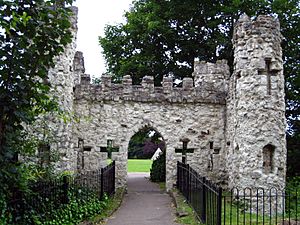
After the dissolution of the monasteries, the lords of the manor moved to Reigate Priory. The castle was left to decay. Much of its stone was probably taken to build other local structures. Around 1777, a man named Richard Barnes built a new gatehouse that looked like an old ruin (a "folly") using the remaining stone. A century later, the Borough Council leased the castle grounds and turned them into a public garden. You can even take tours of the caves under the castle today!
Reigate Priory: From Monastery to School
The Augustinian priory in Reigate was likely founded by William de Warenne, 5th Earl of Surrey, before 1240. At first, it was called a hospital, but later it became a religious institution. It was built south of the modern town center, and fish ponds were created in its grounds.
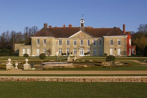
In 1541, Henry VIII gave the former priory to William Howard, 1st Baron Howard of Effingham. The old church was turned into a private home, and most of the other buildings were torn down. The priory changed owners several times. In 1921, after the death of Lady Henry Somerset, the estate was sold off, and much of the land was used for building houses.
The last private owner was Peter Beatty. In 1948, the borough council bought the grounds to keep them as a public park. Also in 1948, the Reigate Priory County Secondary School opened in the main priory building. In 1993, the Reigate Priory Junior School moved into the priory building.
Travel and Roads in Reigate's Past
In medieval times, the main road north from Reigate went over Colley Hill towards Kingston upon Thames. From there, goods could be moved by the River Thames. The local manor was supposed to keep the roads in good condition, but repairs didn't happen very often. In 1555, the responsibility for roads moved to the local parish.
The first turnpike trust (a group that built and maintained roads by charging tolls) in Surrey was created in 1697. It improved the road south from Woodhatch. Another turnpike was approved in 1755 to improve the route from Sutton to Povey Cross, near Horley. This involved building a new road north from Reigate over Reigate Hill. A large cut was made at the top of the hill to break up the chalk. This new route was finished in 1756.
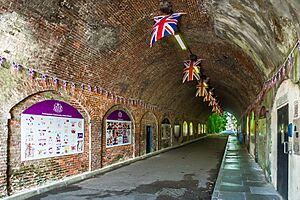
In the early 1800s, two big improvements were made to the roads in the town center. First, in 1815, the Wray Stream was put into a culvert (an underground pipe) to improve drainage. Second, Reigate Tunnel, the first road tunnel in England, was built. It opened in 1823 and goes under the castle, connecting Bell Street to London Road. It helped traffic avoid tight turns, but now it's only used by people walking.
The first train station for the Reigate area opened in 1841 at Hooley. The railway line through Reigate itself opened in 1849. This line was built to offer another way to get from western England to the Channel ports. The section of line from Reigate to Redhill was electrified (made suitable for electric trains) on January 1, 1933.
In February 1976, Reigate got connected to the UK motorway system when the M25 motorway opened between Reigate Hill and Godstone.
Reigate's Economy and Businesses
For most of its early history, Reigate was a farming town. In the early 1600s, the area started to focus on producing oatmeal for the Royal Navy. By 1710, many people worked in processing cereals, but this trade slowly disappeared by the mid-1700s.
The market in Reigate was first recorded in 1279. It was held weekly on Saturdays. The market later moved to the High Street. Selling cattle stopped in the late 1800s, and the market closed completely in 1895.
Reigate has two old windmills that are still standing: one on Reigate Heath and another on Wray Common. In the past, there were at least three other windmills and many animal-powered mills for oatmeal. There were also watermills along the southern edge of the parish.
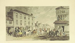
When the Reigate Hill turnpike opened in 1755, it made it easier to transport goods to London. However, this actually hurt the local economy at first because goods made elsewhere became cheaper. So, the population didn't grow much between the 1720s and 1821. But in the late 1700s, the town started to recover as it became a popular stopping point on the London to Brighton coaching route.
How Reigate Grew: Residential Development
Reigate really started to grow after the railways arrived in the 1840s. At first, new buildings were mostly in the eastern part of the parish. A new settlement, first called Warwick Town, grew in the 1820s and 1830s. In 1856, the post office moved its local branch there, and the area became known as Redhill. Throughout the late 1800s, Redhill expanded towards Reigate, and now the two towns are connected.
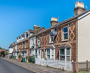
A new housing area called Wray Park was built north of Reigate town center in the 1850s and 1860s. St Mark's Church was built for this new community. Doods Road was built around 1864, followed by Somers Road. In 1863, the National Freehold Land Society started building houses in the Glovers Field estate and at South Park.
At the end of the 1800s, large estates were broken up, making more land available for building. A big development happened in 1921 when the Reigate Priory estate was sold. This allowed people who were leasing properties to buy them, and it opened up more land for new homes.
In the early 1900s, South Park continued to expand. The sale of Woodhatch Farm in the 1930s also led to more housebuilding. More expansion in Woodhatch happened in the 1950s with the building of council housing.
Reigate During Wartime
Even though there wasn't much fighting in Surrey during the English Civil War, Reigate had to provide soldiers for the Parliamentarian army. Troops were stationed in the town, and by 1648, people were getting very unhappy about it. A Royalist leader, Henry Rich, 1st Earl of Holland, gathered a force and marched to Reigate. His men took things from local homes and briefly took over the half-ruined castle.
In September 1914, during the First World War, Reigate became a garrison town, meaning soldiers were stationed here. Members of the London's Own Territorials stayed in the area for training. Reigate railway station was even closed for a while to save resources during the war.
By the end of the First World War, Reigate had three temporary hospitals for injured soldiers. These hospitals treated soldiers who came back from overseas and those stationed locally.

At the start of the Second World War in September 1939, about 5,000 evacuees from London were sent to Reigate and Redhill. The caves under Reigate Castle were turned into public air raid shelters. The first bombing raid on the town happened on August 15, 1940. Later in the war, in 1944, a V-1 flying bomb destroyed the Tea House café on Reigate Hill.
For much of the war, Reigate was the main base for the South Eastern Command of the British Army. This command was partly housed in special tunnels dug under Reigate Hill in 1939 by Welsh miners. These tunnels had four large underground halls connected by passageways. The entrances to these tunnels were destroyed in 1968 for safety reasons.
During the Second World War, the town's defense was mainly handled by the 8th Surrey Battalion of the Home Guard. Tank traps were also put in the castle grounds as part of the town's defenses. Before going to the Western Front, the 1st Battalion of the Hastings and Prince Edward Regiment (part of the Canadian Army) was camped nearby. On March 19, 1945, a U.S. Air Force B17G plane crashed into Reigate Hill in bad weather. Two memorial benches shaped like wing tips were put at the crash site 70 years later.
Reigate's Population and Homes
In the 2011 Census, the population of the Reigate built-up area, which includes Woodhatch, was 22,123 people.
| Population | Households | % Owned outright | % Owned with a loan | hectares | |
|---|---|---|---|---|---|
| Reigate and Woodhatch | 22,123 | 9,036 | 34.5 | 38.5 | 316 |
| Regional average | 35.1 | 32.5 |
| Detached | Semi-detached | Terraced | Flats and apartments | Caravans/temporary/mobile homes/houseboats | Shared between households | |
|---|---|---|---|---|---|---|
| Reigate and Woodhatch | 2,487 | 2,853 | 1,378 | 2607 | 6 | 9 |
Across the South East Region, 28% of homes were detached houses and 22.6% were apartments.
Public Services in Reigate
Utilities: Water, Gas, and Electricity
The Reigate Water Works Company started in 1858 to provide drinking water to the town. It was later bought by the East Surrey Water Company. The first sewerage system in Reigate was installed in 1876.
Reigate Gas Company was formed in 1838 and opened a gasworks a year later. It first supplied gas for 28 street lights. By 1860, a larger facility was needed due to more demand from homes. In 1921, the Reigate company was taken over by the Redhill Gas Company.
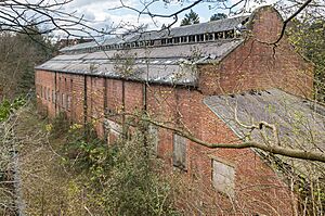
An electricity generating station was built in a former sand quarry in 1897. It closed in 1936. Reigate was connected to the National Grid (the main electricity supply network) in 1926.
Emergency Services: Police, Fire, and Ambulance
The Borough police force started in 1864. The police station moved a few times before a new one opened in Reigate Road in 1972. This was when the Borough force merged with the Surrey Constabulary.
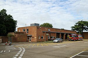
In 1809, two fire engines were given to the town, and six men were chosen to operate them. The fire brigade grew to 12 members by 1854. A new fire station opened in 1901. Today, the fire authority for Reigate is Surrey County Council, and the fire service is Surrey Fire and Rescue Service. The South East Coast Ambulance Service also has a community response post at the fire station.
Healthcare in Reigate
The closest accident & emergency department (for urgent medical care) is at East Surrey Hospital, about 6 kilometers (3.7 miles) away. As of 2023, the main doctor's office (GP practice) is in Yorke Road.
Reigate's Economy and Businesses Today
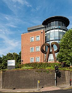
Many companies have had their headquarters or major offices in Reigate. For example, the airline Air Europe once had its main office here. Redland plc, a large building materials company, was also based in Reigate. Its former headquarters are now used by the insurance company esure.
Canon UK had its headquarters on the southern edge of Reigate. This building, opened in 2000, has won awards for its design and environmental friendliness.
The European headquarters of Kimberly-Clark (a company that makes paper products) are on London Road, near Reigate railway station. Further along London Road, you can find the former European headquarters of Willis Towers Watson, a global advisory and solutions company.
Pilgrim Brewery, the first new brewery in Surrey in over 100 years, was founded in 1982 and moved to West Street in 1984.
Getting Around Reigate
Public Transport: Trains and Buses
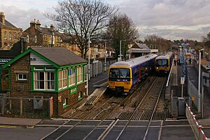
Reigate railway station is just north of the town center. Southern trains run services to London Victoria and East Croydon. Great Western Railway runs trains to Reading and Gatwick Airport.
Reigate is also connected by bus to Redhill and other nearby towns and villages. Bus companies like Compass Bus, London General, Metrobus, and Southdown serve the town. Routes 420 and 460 link the town to the East Surrey Hospital, and the 460 also goes to Gatwick Airport.
Cycle Routes and Walking Paths
The Surrey Cycleway, a route for bikes, goes through Woodhatch.
The Greensand Way, a long-distance walking path about 174 kilometers (108 miles) long, passes through Reigate Park. The North Downs Way, another long-distance path, crosses Colley Hill and Reigate Hill.
Learning in Reigate: Schools and Colleges
Maintained Schools
Reigate has several primary schools. Dovers Green School and Wray Common Primary School are part of the Greensand Multi-Academy Trust. Sandcross Primary School is part of the Everychild Trust.
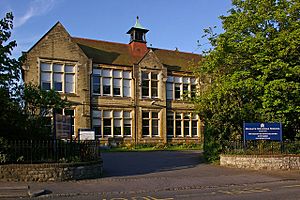
Reigate Parish Church Primary School started as the Reigate National School. It moved locations a few times and is now on Blackborough Road.
Reigate Priory Junior School began as a non-religious school in 1852. It moved to the priory building in 1993. This school teaches children aged 7 to 11.
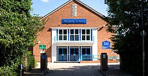
Reigate School is a secondary school in Woodhatch for students aged 11 to 16. It is part of the Greensand Multi-Academy Trust and opened in 1958 as Woodhatch County Secondary School.
The Royal Alexandra and Albert School has a long history, starting as an orphanage in London in 1759. It moved several times and merged with another orphanage in 1949. Today, it's a coeducational boarding school for children aged 7 to 18, located at the Gatton Park estate.
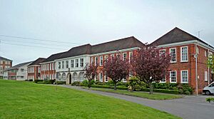
Reigate College is a coeducational sixth form college for students aged 16 to 19. It opened in 1976. The main building was originally built in 1927 for the Reigate County School for Girls.
Independent Schools
Micklefield School was founded in 1910 and moved to its current site in Somers Road in 1925. It is now a coeducational independent day school for children aged 2 to 11.
Reigate St Mary's School started in 1950 as the choir school for St Mary's Church. It became coeducational in 2003. It is a day school for children aged 2 to 11.
Reigate Grammar School dates back to 1675. It became a grammar school in 1861. The school became independent in 1976 and started admitting girls to the sixth form that same year, becoming fully coeducational in 1993. It has merged with other schools and now teaches about 1,500 students aged 3 to 18.
Dunottar School was founded in 1926. It moved to its current site in 1933. Today, Dunottar is a coeducational independent day school for children aged 11 to 18.
Other Schools
Reigate Valley College at Sidlow helps students who have had behavioral issues in regular schools. There are also two schools in Reigate for students with special educational needs: Brooklands School and Moon Hall College.
Places of Worship in Reigate
Church of St Mary Magdalene
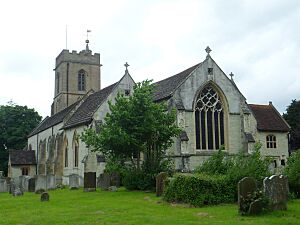
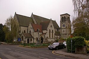
The first mention of a church in Reigate is from the late 1100s. The oldest parts of today's St Mary's Church are from around 1200. The church was made bigger several times in the medieval period. It was also rebuilt in Victorian times.
Inside the church, you can see a medieval rood screen (a screen separating parts of the church). There are also monuments from the 1600s and 1700s.
Reigate Mill Church
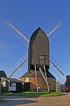
Reigate Heath Windmill was built around 1765. It stopped working by wind in 1862. The lower brick part of the windmill was turned into a small church (a chapel of ease) for St Mary Magdalen in 1880. Services are held here in the summer. It's believed to be the only windmill in England used as a church!
Reigate Heath Church
Reigate Heath Church, on Flanchford Road, was built in 1907. It's made of corrugated galvanised iron and is a typical example of the "tin tabernacles" built around that time.
St Mark's Church
St Mark's Church, in Alma Road, opened in 1860 for a new housing area. It was built using Reigate Stone. The church was badly damaged during the Second World War.
St Philip's Church
St Philip's Church, northwest of the town center, was built in 1863. It started as a small church for St Mark's.
St Luke's Church
St Luke's Church, south of the town, opened in 1871. It's built from Reigate Stone in the Gothic style.
Reigate Methodist Church
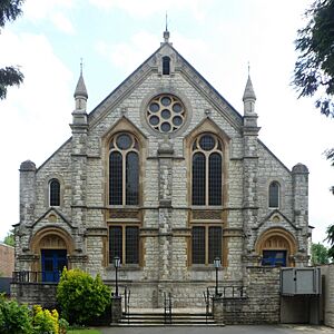
Even though John Wesley, the founder of Methodism, visited Reigate several times, the first Methodist chapel wasn't built until 1858. The current church on the High Street was built in 1884.
Catholic Church of the Holy Family
The Catholic Church of the Holy Family was built in Yorke Road in 1939.
Culture and Arts in Reigate
Art in Reigate

The Reigate Priory Museum has a portrait from the early 1500s of John Lymden, the last Prior of Reigate. The Town Hall displays several artworks by different artists. There are also public art pieces in the town, like a statue of the famous ballet dancer, Margot Fonteyn, which was put up in 1980.
Reigate in Books
Reigate is the setting for the Sherlock Holmes short story "The Adventure of the Reigate Squire". This story is part of The Memoirs of Sherlock Holmes by Sir Arthur Conan Doyle.
Sports in Reigate
Football
Reigate Priory F.C. (Football Club) was founded in 1870, just seven years after The Football Association was created. They have always played their home games at their ground in Park Lane.
South Park F.C. was founded in 1897. They play their home games in Whitehall Lane.
Cricket
Reigate Priory Cricket Club was founded in 1852. It's believed that cricket has been played in the town since the 1770s.
Golf
Reigate Heath Golf Club started in 1895. It has a 9-hole course. The club was officially opened in 1897.
The 18-hole Reigate Hill Golf Club course was designed by David Williams. It opened in November 1995.
Rugby Union
Old Reigatian R.F.C. (Rugby Football Club) was founded in 1927. They play their home games on Park Lane.
Field Hockey
Reigate Priory Hockey Club is part of the South East Hockey league.
Important Buildings and Landmarks in Reigate
Cranston Library
The Cranston Library opened in 1701 and is the oldest public lending library in England. It was started by Andrew Cranston, who was the Vicar of Reigate. It has over 2,000 books, mostly from the 1600s and 1700s. It's located on the first floor of St Mary Magdalene's Church.
Town Hall
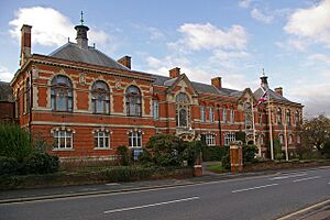
The current town hall was finished in 1901. It was designed in the Arts and Crafts style. When it first opened, it also had the police station and courts. Since 1974, it has been the main office for the Reigate and Banstead Borough Council.
Old Town Hall
The old town hall, at the east end of the High Street, was built around 1728. It stands where a chapel once was. This building was the headquarters of the Reigate Municipal Borough Council until 1901.
Reigate Fort
Reigate Fort, on Reigate Hill, is one of 13 London Defence Positions built in the 1890s. These were designed as small forts for soldiers, in case of an invasion. Reigate Fort was finished in 1898 and is one of the largest. It had an earth rampart (a defensive wall) and a clear view over Reigate. It was no longer needed by 1907. During the First World War, it was used to store ammunition. The fort was restored in the early 2000s and is now open to the public.
Reigate Hill Footbridge
Reigate Hill Footbridge carries the North Downs Way walking path over the A217 road. It was completed in 1910 and is one of the earliest reinforced concrete bridges in England. It replaced an older chain suspension bridge built in 1825.
Wray Common Windmill
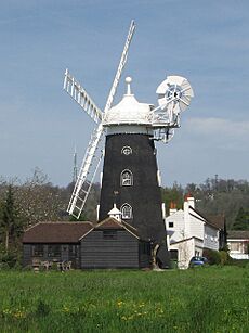
Wray Common Windmill was built in 1824. It's a tower mill made of tarred bricks. It was used to grind corn until 1895. In the 1960s, it was turned into a four-story private home. It was restored between 2004 and 2007, and new, non-working sails were added.
Parks and Open Spaces in Reigate
Castle Gardens were created in the 1870s and cover about 2 hectares (5 acres). They were leased to the Borough Council in 1873 and bought by the council in 1921. A stone pyramid on top of the castle mound acts as an entrance to the Barons' Cave below.

Colley Hill, northwest of the town, is part of the North Downs hills. Part of it was given to the council in 1910, and the rest was bought by the National Trust in 1913. The Inglis Memorial, originally a drinking fountain for horses, has a beautiful blue and gold mosaic ceiling.
Lower Gatton Park, about 3 kilometers (2 miles) north of Reigate, is a large parkland area of about 234 hectares (578 acres). It used to be a medieval deer park. It was designed by Capability Brown in the 1760s and 1770s and includes a large ornamental lake. The park is open to the public on the first Sunday of each month from February to October.
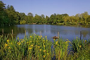
The southern part of Priory Park was bought in 1920 and given to the Borough Council to be kept as a public park. The rest of the 58-hectare (143-acre) priory grounds were bought by the council in 1948. In 2007, the council started a restoration project, partly funded by a lottery grant. The park has a cafe, a children's play area, tennis courts, a skate park, walking trails, formal gardens, and a lake.
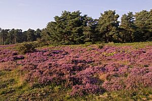
Reigate Heath is a 65-hectare (160-acre) Site of Special Scientific Interest west of the town center. It has open heath and acid grassland habitats with plants like common heather and bell heather. It also has Alder woodland and a marshy meadow with special plants like southern marsh orchid.
South Park, west of Woodhatch, is a 4.25-hectare (10.5-acre) recreation ground. It has sports pitches and a children's playground. A new pump track for mountain bike and BMX riders opened in December 2021. The park has been protected by the Fields in Trust charity since 1934.
Famous People from Reigate
- John Foxe (1516/17–1587) - a writer who worked as a tutor at Reigate Castle.
- John Parsons (1639–1717) - a businessman and politician who was Lord Mayor of London in 1703. He lived at Reigate Priory.
- Ann Alexander (1774/5–1861) - a banker who lived in Reigate for much of her life.
- George William Alexander (1802–1890) - a banker and generous person, son of Ann Alexander.
- William Harrison Ainsworth (1805–1882) - a historical novelist who lived in Reigate later in his life.
- George Luxford (1807–1854) - a botanist who wrote about the plants in the Reigate area.
- Anne Manning (1807–1879) - a novelist who lived on Reigate Hill.
- James Cudworth (1817–1899) - a railway engineer.
- Francis Frith (1822–1898) - a photographer who started his publishing company in Reigate.
- Edward Frankland (1825–1899) - a chemist who had his own lab on Reigate Hill.
- Margaret Crosfield (1859–1952) - a geologist who lived in the town for most of her life.
- Edward Ayearst Reeves (1862–1945) - a geographer.
- Fred Streeter (1879–1975) - a gardener and broadcaster who worked in Reigate when he was young.
- H. M. Bateman (1887–1970) - a cartoonist and illustrator who lived in Reigate for 14 years.
- Cliff Michelmore (1919–2016) - a broadcaster.
- Bob Doe (1920–2010) - a Battle of Britain flying ace born in Reigate.
- Ray Alan (1930–2010) - a ventriloquist and writer.
- Piers Morgan (b. 1965) - a broadcaster, journalist, and writer born in Reigate.
- Max Chilton (b. 1991) - a racing driver born in Reigate.
See also
 In Spanish: Reigate para niños
 | Janet Taylor Pickett |
 | Synthia Saint James |
 | Howardena Pindell |
 | Faith Ringgold |


