London metropolitan area facts for kids
Quick facts for kids
London metropolitan area
|
|
|---|---|

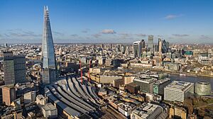
Skyline of Central London
|
|

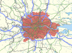
Map of the London area, with the metropolitan area as defined by the London Travel to Work Area highlighted in red.
|
|
| Sovereign state | |
| Country | |
| Area | |
| • Metro | 8,917 km2 (3,443 sq mi) |
| Population | |
| • Metro | 14,900,000 |
| • Metro density | 1,660/km2 (7,430/sq mi) |
| GDP | |
| • Metro | US$978.402 billion (nominal) int$1.064 trillion (PPP) |
The London metropolitan area is a huge area around London, England. It includes London itself and many towns and cities nearby. People often call it the London commuter belt. This is because many people who live in these towns travel into London for work.
This area is defined in different ways. It usually includes the main urban area of London. It also covers places that share London's services and transport. And, of course, it includes towns where it's easy to travel to London for work.
Contents
What is the London Metropolitan Area?
The London metropolitan area is not a fixed place with clear borders. Its size changes as transport gets better. When it's easier to travel, people can live further away from the city. This means the area keeps growing.
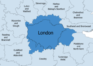
Today, this area covers a lot of South East England. It also includes parts of the East of England. These areas include counties like Hertfordshire, Buckinghamshire, Berkshire, Surrey, Kent, and Essex. Sometimes, it also includes parts of Hampshire, West Sussex, East Sussex, Bedfordshire, and Northamptonshire.
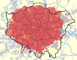
In 2011, about 18.8 million people lived in Greater London and the nearby counties. Much of the countryside in this area is protected. It's part of the Metropolitan Green Belt. This belt helps stop cities from growing too much. It keeps green spaces for nature and recreation.
How is the London Area Defined?
There are different ways to define the London metropolitan area. These definitions help experts understand how people live and work around London.
London Travel to Work Area
One way to define the area is by how people travel to work. The Office for National Statistics uses a "Travel to Work Area" (TTWA). This area is where:
- At least 75% of people living there also work there.
- At least 75% of people working there also live there.
In 2005, about 9.29 million people lived in the London TTWA. This area is not exactly the same as Greater London. For example, some parts of Greater London, like Uxbridge, are not in this TTWA. But some towns outside Greater London, like Dartford, are included.
London's Larger Urban Zone
Another definition is the "Larger Urban Zone" (LUZ). This was created by Eurostat in 2004. It helps compare big city areas across Europe.
Based on the 2001 census, London's LUZ had about 11.9 million people. This made it the biggest metropolitan area in the European Union before Brexit. This zone includes many districts around London. However, some large towns like Reading and Luton are just outside this specific zone.
Major Towns in the Commuter Belt
The London commuter belt includes many towns and cities. These are often within about 40 miles (64 km) of central London. Some of the bigger towns further out include Aylesbury, Reading, Aldershot, and Maidstone.
Here are some of the largest urban areas in the London Commuter Belt:
The "Second Commuter Belt"
Some real estate agents talk about a "second commuter belt." This area is even further from central London. It can be up to about 55 miles (89 km) away. Towns in this outer belt might include Bedford, Brighton, Cambridge, Hastings, Margate, Milton Keynes, and Oxford.
See also
 In Spanish: Área metropolitana de Londres para niños


