Reading, Berkshire facts for kids
Quick facts for kids
Reading
Borough of Reading
|
||
|---|---|---|
|
Town, borough and unitary authority
|
||
|
|
||
|
||
| Motto(s):
A Deo et Regina
With God and Queen |
||
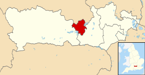
Borough of Reading shown within Berkshire
|
||
| Sovereign state | United Kingdom | |
| Constituent country | England | |
| Region | South East England | |
| Ceremonial county | Berkshire | |
| Historic county |
|
|
| Admin HQ | Reading | |
| Settled | 871 or earlier | |
| Town status | 1086 or earlier | |
| Areas of the town |
List
Calcot (Village)
Caversham (Village) Caversham Heights Caversham Park Village Central Reading Christchurch Meadows Coley Coley Park Earley (Town) (part) East Reading Emmer Green Fords Farm Green Park Holybrook Katesgrove Lower Caversham Lower Earley (part) Newtown Norcot Purley-on-Thames (Village) Sandford (part) Sonning (Village) (part) Southcote Tilehurst (Village) (part) West Reading Whitley Whitley Wood Winnersh (Village) (part) Woodley (Town) (part) |
|
| Government | ||
| • Type | Unitary authority | |
| • Body | Reading Borough Council | |
| Elevation | 200 ft (61 m) | |
| Population
(2005 est.)
|
||
| • Borough | 161,780 | |
| • Rank | 119th (of 326) (borough) | |
| • Urban | 337,108 | |
| Demonym(s) | Redingensian | |
| Ethnicity (2021) | ||
| • Ethnic groups |
List
|
|
| Religion (2021) | ||
| • Religion |
List
39.6% Christianity
36.3% no religion 15.2% other 8.9% Islam |
|
| Time zone | UTC+0 (GMT) | |
| • Summer (DST) | UTC+1 (BST) | |
| Postal code |
RG
|
|
| Area code(s) | 0118 | |
| Grid Ref. | SU713733 | |
| ONS code |
|
|
| ISO 3166-2 | GB-RDG | |
| NUTS 3 | UKJ11 | |
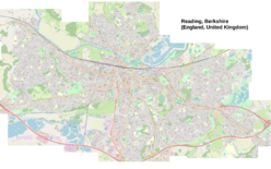
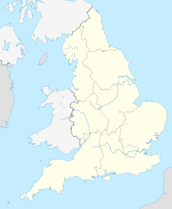
Reading (![]() i/ˈrɛdɪŋ/ RED-ing) is a lively town and borough in Berkshire, England. It's known as the county town of Berkshire. Reading is located in the Thames Valley, where the River Thames and River Kennet meet. It's about 64 kilometers (40 miles) west of London.
i/ˈrɛdɪŋ/ RED-ing) is a lively town and borough in Berkshire, England. It's known as the county town of Berkshire. Reading is located in the Thames Valley, where the River Thames and River Kennet meet. It's about 64 kilometers (40 miles) west of London.
Reading is a big hub for business, especially in information technology and insurance. It's also a popular shopping spot, with places like The Oracle mall. The town is home to the University of Reading. Every year, it hosts the famous Reading Festival, one of the UK's biggest music events. Reading also has a professional association football team, Reading F.C., and many other sports teams.
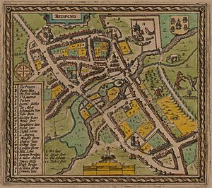
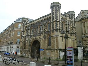
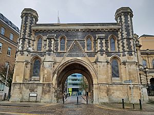
The town of Reading has a long history, dating back to the 8th century. It was an important trading and religious center in the Middle Ages. Reading Abbey, one of the largest and richest monasteries in medieval England, was located here. You can still see parts of the 12th-century abbey gateway and old ruins today. By 1525, Reading was the biggest town in Berkshire. It was also the tenth wealthiest town in England based on taxes.
The English Civil War in the 17th century greatly affected Reading. There was a major siege and trade suffered. However, Reading played a key role in the Glorious Revolution of 1688. The only major battle of that revolution happened on its streets. In the 18th century, a large ironworks started in Reading. The town also became famous for its brewing industry. The 19th century brought the Great Western Railway. This helped the town's brewing, baking, and seed-growing businesses grow. Reading quickly became a major manufacturing center.
Contents
History of Reading
Reading might have existed during the Roman times as a trading port. But the first clear proof of Reading as a settlement is from the 8th century. Back then, it was called Readingum. This name likely comes from the Readingas, an Anglo-Saxon tribe. Their name means Reada's People in Old English.
In late 870, an army of Danes invaded Wessex and set up camp in Reading. On January 4, 871, King Ethelred and his brother Alfred the Great tried to break the Danes' defenses but failed. This was the first Battle of Reading. The Anglo-Saxon Chronicle describes this battle. This is the earliest known written record of Reading. The Danes stayed in Reading until late 871 before moving to London.
After the Battle of Hastings and the Norman conquest of England, William the Conqueror gave land in Reading to Battle Abbey. The Domesday Book of 1086 clearly called Reading a borough. It mentioned six mills in the town. King Henry I founded Reading Abbey in 1121. He was buried there. He also gave the abbey his lands in Reading.
We don't know how badly the Black Death affected Reading in the 14th century. But we do know that the abbot of Reading Abbey died from it in 1361. The Abbey was mostly destroyed in 1538 during King Henry VIII's dissolution of the monasteries. The last abbot, Hugh Faringdon, was found guilty of treason and executed in front of the Abbey Church.
By 1525, Reading was the biggest town in Berkshire. Tax records show it was the 10th largest town in England by wealth. By 1611, over 5,000 people lived there. The town became rich from its cloth trade. A local merchant named John Kendrick made a large fortune from this.
Reading was important during the English Civil War. A Royalist army took control of the town in 1642. But Parliamentary forces successfully attacked in April 1643 during the Siege of Reading. The town's cloth trade was badly hurt. Reading's economy didn't fully recover until the 20th century.
Reading also played a big part in the Glorious Revolution of 1688. The second Battle of Reading was the only major fight of that time.
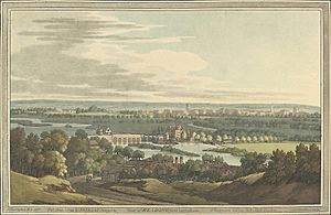
The 18th century saw a large ironworks start in Reading. The brewing industry also grew, making Reading famous. Better turnpike roads helped Reading become a key stop on major routes from London. In 1723, the Kennet Navigation opened. This allowed boats to travel on the River Kennet to Newbury. This new route helped the town's trade. After the Kennet and Avon Canal opened in 1810, barges could travel from Reading to the Bristol Channel. From 1714, Reading and Abingdon shared the role of county town of Berkshire.
In the 19th century, Reading grew fast as a manufacturing center. The Great Western Railway arrived in 1841. The South Eastern Railway followed in 1849. Then came the London and South Western Railway in 1856. Reading became the sole county town of Berkshire in 1867. This was officially approved in 1869. The town became a county borough in 1888. Reading became famous for its "Three Bs": beer (from Simonds' Brewery), bulbs (from Suttons Seeds), and biscuits (from Huntley and Palmers).
Reading continued to grow in the 20th century. In 1911, it took over Caversham across the River Thames. Reading did not suffer much damage during the two World Wars. However, many citizens were killed or injured. A notable air raid happened on February 10, 1943. A single Luftwaffe plane attacked the town center. This resulted in 41 deaths and over 100 injuries.
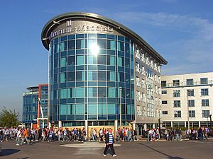
The Lower Earley development, built in 1977, was one of Europe's largest private housing projects. It expanded Reading's urban area to the M4 motorway. More housing and large supermarkets have been built on the edges of Reading. The Oracle, a major shopping center, opened in 1999. It is named after a 17th-century workhouse that was once on the site. It has three floors of shops and created 4,000 jobs.
Reading is one of the largest urban areas in the UK without city status. Reading has tried to become a city three times: in 2000, 2002, and 2012. All three attempts were unsuccessful.
How Reading is Governed
Local government for Reading is handled by Reading Borough Council. Since 1998, this council has been a unitary authority. This means it provides all local government services. There are no civil parishes within the borough. Some of Reading's outer suburbs are outside the borough. They are in West Berkshire and Wokingham. These outer suburbs have their own local councils.
Reading has elected at least one Member of Parliament since 1295. Since the 2024 general election, Reading is divided into three parliamentary areas. These are Reading Central, Reading West and Mid Berkshire, and Earley and Woodley.
Reading has courts for both criminal and civil cases. The Reading Crown Court handles criminal justice. The County Court deals with civil cases. Smaller issues are handled in a local magistrates' court.
Reading's Administrative History
Reading was an ancient borough. It was called a borough in the Domesday Book of 1086. Reading Abbey first controlled the borough. The town slowly gained more independence from the abbey from the 13th century. This happened especially after its merchant guild received a royal charter in 1253. After the abbey closed in 1538, the borough got a new charter in 1542. Queen Elizabeth I set the borough boundaries in 1560.
The borough was updated in 1836. It became a municipal borough under the Municipal Corporations Act 1835. The borough boundaries were expanded in 1887. This included areas like Southcote and Whitley. In 1889, Reading became a county borough. This meant its council could provide county-level services. It was independent from Berkshire County Council.
The borough boundaries were expanded again in 1911. This included Caversham from Oxfordshire. It also included most of Tilehurst to the west. In 1974, local government was changed. Reading became a non-metropolitan district. Berkshire County Council then provided county-level services.
In 1998, the borough council became a unitary authority again. This gave it back the powers it had as a county borough. Reading's boundaries south of the Thames have not changed since 1911. However, the urban area has grown far beyond these boundaries.
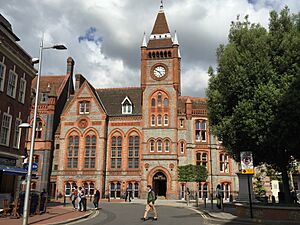
Before the 16th century, Reading's town administration was in the Yield Hall. This was a guild hall by the River Kennet. Later, the town council moved to a new town hall. This was built by adding a floor to the refectory of the Hospitium of St John, part of Reading Abbey. For about 400 years, this was the site of Reading's government. Today's Reading Town Hall stands there. In 1976, Reading Borough Council moved to the new Reading Civic Centre. In 2014, they moved again to offices on Bridge Street.
Geography and Climate
Reading is about 58 kilometers (36 miles) west of central London. It is 39 kilometers (24 miles) southeast of Oxford. The center of Reading sits on a low ridge between the River Thames and River Kennet. This location was important for its history as a river port.
As Reading has grown, its suburbs have spread out. They reach areas like Calcot and Tilehurst to the west. To the south and southeast, they extend to Whitley Wood and Lower Earley. North of the Thames, they reach Caversham Heights and Emmer Green.
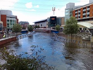
The areas next to Reading's two rivers sometimes experience flooding. However, during the major UK floods in 2007, very few properties in Reading were affected.
Reading has a maritime climate. This means it has mild temperatures throughout the year. Rainfall is generally moderate. The highest temperature recorded locally was 36.4°C (97.5°F) in August 2003. The lowest was -14.5°C (5.9°F) in January 1982.
| Climate data for Reading | |||||||||||||
|---|---|---|---|---|---|---|---|---|---|---|---|---|---|
| Month | Jan | Feb | Mar | Apr | May | Jun | Jul | Aug | Sep | Oct | Nov | Dec | Year |
| Mean daily maximum °C (°F) | 7.7 (45.9) |
8.0 (46.4) |
10.8 (51.4) |
13.5 (56.3) |
17.0 (62.6) |
20.0 (68.0) |
22.4 (72.3) |
22.1 (71.8) |
19.0 (66.2) |
14.9 (58.8) |
10.7 (51.3) |
7.9 (46.2) |
14.5 (58.1) |
| Mean daily minimum °C (°F) | 1.9 (35.4) |
1.7 (35.1) |
3.4 (38.1) |
4.7 (40.5) |
7.7 (45.9) |
10.6 (51.1) |
12.7 (54.9) |
12.5 (54.5) |
10.3 (50.5) |
7.6 (45.7) |
4.4 (39.9) |
2.2 (36.0) |
6.7 (44.1) |
| Average rainfall mm (inches) | 61.0 (2.40) |
41.2 (1.62) |
44.5 (1.75) |
48.0 (1.89) |
46.4 (1.83) |
44.6 (1.76) |
46.0 (1.81) |
52.3 (2.06) |
50.3 (1.98) |
71.8 (2.83) |
66.3 (2.61) |
62.9 (2.48) |
635.3 (25.02) |
| Average rainy days (≥ 1 mm) | 11.2 | 9.1 | 9.7 | 9.3 | 8.8 | 7.7 | 7.7 | 7.9 | 7.9 | 10.5 | 10.7 | 10.6 | 111.1 |
| Mean monthly sunshine hours | 56.8 | 76.0 | 109.0 | 160.6 | 188.2 | 189.1 | 197.3 | 191.6 | 138.0 | 106.4 | 63.1 | 46.9 | 1,523 |
People and Diversity in Reading
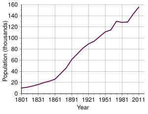
In mid-2018, the Borough of Reading had about 175,000 people living there. The wider urban area had a population of 318,014 in 2011. This grew to an estimated 337,108 by mid-2018.
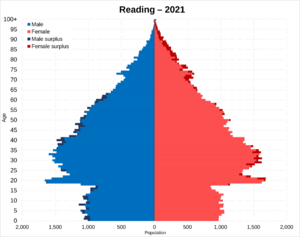
According to the 2021 census, Reading is a very diverse place. About 67.1% of the population is White. About 17.7% are Asian, and 7.2% are Black. Around 5.1% are of Mixed backgrounds. In 2010, it was reported that people in Reading spoke 150 different languages. Reading has a large Polish community.
Religious Beliefs in Reading
Reading is home to people of many different faiths. In 2021, about 39.6% of people identified as Christian. A large group, 36.3%, said they had no religion. About 15.2% followed other religions, and 8.9% were Muslim.
Reading's Economy
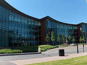
Reading is a major business center in the Thames Valley and Southern England. Many British companies have their main offices here. Also, many international companies have their UK offices in Reading. It's a big shopping destination too.
Reading is close to London, but many people travel into Reading for work. About 30,000 people arrive in Reading for work each morning. Major companies like Microsoft, Oracle, and Hibu (formerly Yell Group) have their headquarters in Reading. The insurance company Prudential has a big office here. PepsiCo and Wrigley also have offices in the town.
Reading has a long history in the information technology industry. This is because companies like International Computers Limited and Digital Equipment Corporation were here early on. Other tech companies in Reading include Huawei Technologies, Pegasystems, CGI Inc., Cisco, and Ericsson. These companies are located in business parks like Thames Valley Park and Green Park Business Park.
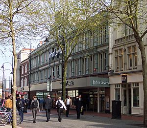
Reading town center is a major shopping area. In 2007, it was ranked 16th among the best retail centers in the UK. The main shopping street is Broad Street. It connects The Oracle mall and Broad Street Mall. Broad Street became a pedestrian-only area in 1995. Reading has three major department stores: John Lewis & Partners, Debenhams (now closed), and House of Fraser. The Waterstone's bookstore on Broad Street is in an old chapel from 1707. Besides the big malls, Reading has smaller shopping arcades with unique stores. There is also a street market and a farmers' market.
Culture and Fun in Reading
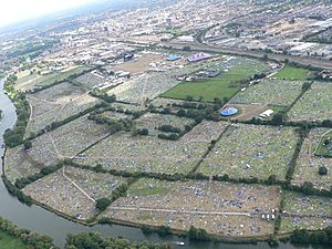
Every year, Reading hosts the Reading Festival. This festival has been running since 1971. It takes place on the August bank holiday weekend. It is one of the largest music festivals in the UK, after Glastonbury Festival. The festival is held at Little Johns Farm in Reading. For about 20 years, Reading also hosted the WOMAD Festival.
The Reading Beer Festival started in 1994. It is now one of the biggest beer festivals in the UK. It happens at King's Meadow for five days before the May Day bank holiday. Reading also hosts Reading Pride, an annual LGBT festival in Kings Meadow.
The Royal County Theatre, built in 1895, was on Friar Street. It burned down in 1937. Inside the town hall is a 700-seat concert hall. It has a famous Father Willis organ. Reading's theatre venues include The Hexagon and South Street Arts Centre. Reading Repertory Theatre is based at Reading College. Its Royal Patron is Prince Edward, Duke of Edinburgh.
Amateur theatre groups in Reading include Progress Theatre. This group has its own 97-seat theatre. Rabble Theatre and Reading Rep offer classic and modern plays. Jelly is an artist-led group that helps people access the arts. The name for a person from Reading is Redingensian. This name is used for the local rugby team, Redingensians R.F.C., and former students of Reading School.
Famous Landmarks in Reading
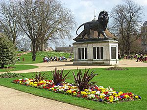
The Maiwand Lion in Forbury Gardens is a well-known symbol of Reading. It honors the 328 officers of the Royal Berkshire Regiment who died in the Battle of Maiwand in 1880. Reading has many other public art pieces. The Blade is a 14-story building finished in 2009. It is 86 meters (282 feet) tall and can be seen from far away. Jacksons Corner, with its famous sign, was once home to Jacksons department store.
Reading has six Grade I listed buildings. These are very important historical buildings. They include Reading Abbey, the Abbey Gateway, Greyfriars Church, St Laurence's Church, Reading Minster, and a barn at Chazey Farmhouse.
Local Media
Reading has a local newspaper called the Reading Chronicle. It comes out on Thursdays. The town's other local newspaper, the Reading Post, stopped printing in 2014. It became an online-only news source called getreading. A local company, the Two Rivers Press, publishes books about local history and art.
Three local radio stations broadcast from Reading: BBC Radio Berkshire, Heart South, and Greatest Hits Radio Berkshire and North Hampshire. Local TV news is provided by BBC South and ITV Meridian. Reading also has a local TV station, That's Thames Valley.
Public Services in Reading
Parks and Green Spaces
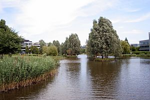
Reading has over 100 parks and playgrounds. This includes 8 kilometers (5 miles) of paths along the rivers. In the town center, you'll find Forbury Gardens. This public park is on the site of the old Reading Abbey. The largest park in Reading is Prospect Park. It was bought by the town in 1901. Palmer Park in east Reading was given to the town by the owners of Huntley & Palmers in 1889.
There are many open spaces along the River Thames in Reading. These include Thameside Promenade, Caversham Court, and Christchurch Meadows. Reading also has five local nature reserves. These are special areas for wildlife.
Healthcare Services
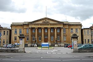
The main National Health Service (NHS) hospital in Reading is the Royal Berkshire Hospital. It was founded in 1839 and has been expanded many times. Berkshire Healthcare NHS Foundation Trust runs Prospect Park Hospital. This hospital specializes in care for people with mental health and learning disabilities. Reading also has three private hospitals.
Utilities and Energy
Thames Water Utilities Limited provides water and sewerage services. Reading's water mostly comes from underground aquifers, so it is hard.
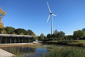
For electricity and gas, consumers can choose their supplier. SSEN manages the local electricity network. SGN manages the gas network. A notable part of Reading's energy system is a 2 megawatt Enercon wind turbine at Green Park Business Park. It can power over a thousand homes. Reading Hydro also runs a small hydroelectric power station on the Thames.
The dialling code for landline phones in Reading is 0118. BT provides phone and ADSL broadband internet. Parts of Reading have cable services from Virgin Media. Hyperoptic also offers very fast fiber internet.
Education in Reading
Reading School is a state grammar school. It was founded in 1125, making it the 16th oldest school in England. There are six other state secondary schools and 38 state primary schools in the borough. There are also several private schools and nurseries.
Reading College has offered further education since 1955. It has over 8,500 students. English language schools in Reading include Gateway Languages and Eurospeak Language School.
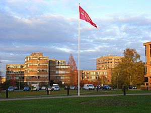
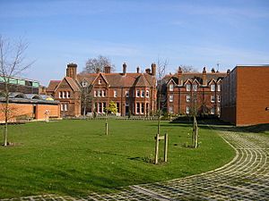
The University of Reading started in 1892 as part of Oxford University. It moved to its London Road Campus in 1904. Then it moved to its main Whiteknights Campus in 1947. The Henley Management College became part of the university in 2008. The University of West London also has a presence in Reading, mainly for nursing students.
Libraries and Museums
The Reading Borough Libraries service began in 1877. The main library moved to a new building on King's Road in 1985.
The Reading Museum opened in 1883. It has exhibits on Reading's history and finds from Calleva Atrebatum. It also has a full-size copy of the Bayeux Tapestry and an art collection. The Museum of English Rural Life focuses on farming and the countryside in England. It is run by the University of Reading. The university also runs the Ure Museum of Greek Archaeology, the Cole Museum of Zoology, and the Harris Botanic Gardens. The small Riverside Museum at Blake's Lock tells the story of Reading's two rivers. The Museum of Berkshire Aviation has a collection of aircraft.
Transport in Reading
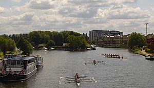
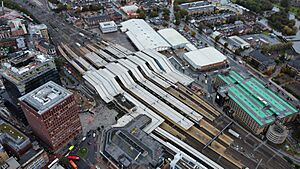
Reading's location west of London makes it an important part of the UK's transport system.
River Travel
Reading grew as a river port where the River Thames and River Kennet meet. Both rivers are navigable. Today, boats are mainly used for fun. Scheduled boat services operate on the Thames near Caversham Bridge.
Road Travel
Reading was a major stop on the old Bath Road (A4). This road went from London to Bristol. Now, the M4 motorway handles long-distance traffic. It passes close to Reading and has three exits (J10-J12) for the town. Other main roads serving Reading include the A33 and A329. Reading has an Inner Distribution Road (IDR), which is a ring road for local traffic. The River Thames is crossed by Reading and Caversham road bridges. Several bridges cross the Kennet, including the old High Bridge.
Reading has two park and ride sites. Mereoak is south of M4 Junction 11. Another site is near Winnersh Triangle railway station.
Rail Travel
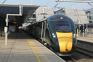
Reading is a major railway junction. Reading station is a key transfer point and terminus. The station was redeveloped for £850 million, finishing in 2015. This helped ease congestion. Railway lines connect Reading to Paddington and Waterloo in London. Other stations in the Reading area include Reading West and Tilehurst.
Reading is the western end of the Elizabeth line. This line provides services to London Paddington. You can travel from Reading across London to Abbey Wood and Shenfield.
Air Travel
There used to be two airfields near Reading, but they are now closed. The closest international airport is London Heathrow, about 32 kilometers (20 miles) away. An express bus service called RailAir connects Reading with Heathrow. You can also take the Elizabeth line to Hayes & Harlington and change for a train to Heathrow. This journey takes about 45 minutes by rail.
Public Transport
Local public transport is mainly by road. This can sometimes be affected by traffic jams. Reading Buses provides a frequent local bus network. It is one of the few remaining municipal bus companies in the country. Other bus operators also serve Reading. ReadiBus offers on-demand transport for people with limited mobility.
Bike Sharing
In March 2011, Reading Borough Council approved a bike sharing scheme. It was similar to the London Cycle Hire Scheme. It had 1,000 bicycles at up to 150 docking stations. However, this scheme ended in March 2019. The company could not cover the costs or find a sponsor.
Religion in Reading
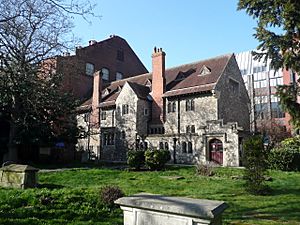
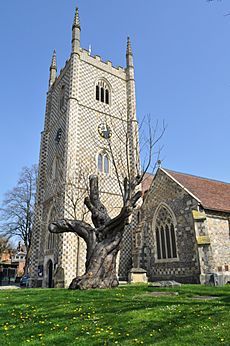
Reading Minster, also known as the Minster Church of St Mary the Virgin, is Reading's oldest church. It was founded by the 9th century or even earlier. Although Reading Abbey later became more important, Reading Minster has regained its significance since the Abbey's destruction.
Reading Abbey was founded by King Henry I in 1121. He was buried there. The abbey was a major pilgrimage site in medieval England. It held over 230 relics, including the hand of St. James. Today, only the inner walls of the abbey buildings remain. There is also a restored inner gateway and the intact hospitium.
The medieval town of Reading had three parish churches: Reading Minster, St Giles' Church, and St Laurence's Church. All are still used by the Church of England. Franciscan friars built a friary in the town in 1311. After the friars left in 1538, the building was used as a hospital and a jail. It was restored as the Church of England parish church of Greyfriars Church in 1863.
The Bishop of Reading is a suffragan bishop in the Church of England's Diocese of Oxford. The bishop is based in Reading. There are 18 Church of England parish churches in Reading.
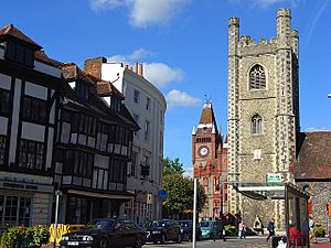
St James's Church was built on part of the abbey site between 1837–40. This marked the return of the Roman Catholic faith to Reading. There are now 8 Roman Catholic parish churches in Reading.
Reading has had an organized Jewish community since 1886. The Reading Hebrew Congregation opened in 1900. It is a Grade 2-listed historical building. The Jewish Community of Berkshire (JCoB) was formed in 2015. It provides Jewish education for children and other services. Reading also has a Liberal Jewish community.
There is one mosque in Reading, the Central Reading Mosque. The Abu Bakr Islamic Centre on Oxford Road was approved in 2002. Construction began in 2006. A second Islamic center in eastern Reading has also been approved.
Reading also has places of worship for other religions. These include a Mahayana Buddhist center, a Hindu temple, a Sikh gurdwara, a Salvation Army citadel, a Quaker meeting house, and a Christadelphian Hall.
Sports in Reading
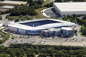
Reading is home to Reading Football Club. This association football club is nicknamed The Royals. It was formed in 1871. The club plays at the 24,161-seat Select Car Leasing Stadium. Reading F.C. played in the Premier League for two seasons after winning the 2005–06 Football League Championship. They returned to the Premier League for the 2012–2013 season but were relegated again.
Reading Town Football Club, formed in 1966, was dissolved in 2016. Reading City Football Club now plays at Scours Lane, renamed Rivermoor Stadium.
Reading has three semi-professional rugby clubs: Reading Abbey RFC, Rams RFC, and Reading RFC. The Reading Rockets are the town's semi-professional basketball team. They play in the second-tier English Basketball League Division 1. They play home games at the Rivermead Leisure Complex. The town also has Australian Rules football team Reading Kangaroos and American football team Berkshire Renegades.
Palmer Park Stadium has a velodrome and athletics track. It is used by Reading Athletic Club. Reading Hockey Club has teams in both the men's and women's England Hockey Leagues.
Rowing is popular in Reading. The Reading Rowing Club and the Reading University Boat Club are both by Caversham Bridge. The Redgrave Pinsent Rowing Lake in Caversham is used for training by the Great Britain National Squad. The annual Reading Town Regatta takes place near Thames Valley Park. The Reading Amateur Regatta happens in June.
Reading used to have a motorcycle speedway team, Reading Racers. They raced at Tilehurst Stadium and later Smallmead Stadium. The team is currently inactive, waiting for a new stadium. The Reading Racers reformed in 2016 and won the Southern Developmental League in 2017.
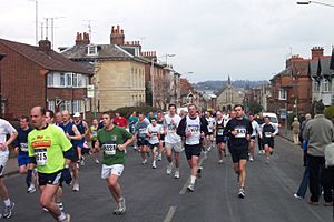
The Reading Half Marathon is held on the streets of Reading every March. It has 16,000 competitors. It started in 1983 and has happened every year except 2001 (due to foot-and-mouth disease), 2018 (snow), and 2020 (COVID-19). The British Triathlon Association was formed in Reading in 1982. Britain's first triathlon took place near Reading in 1983. Thames Valley Triathletes, based in Reading, is Britain's oldest triathlon club. The Hexagon hosted the snooker Grand Prix tournament from 1984 to 1994.
Famous People from Reading
Many notable people have come from Reading. You can find a list of them in the main article.
Reading's Twin Towns
Reading is twinned with these towns:
- Düsseldorf, Germany (since 1947, officially since 1988)
- Clonmel, Ireland (since 1994)
- San Francisco Libre, Nicaragua (since 1994)
- Speightstown, Barbados (since 2003)
Two suburbs in Dunedin, New Zealand, are named after places in Reading. These are Caversham and Forbury. They were named by William Henry Valpy, an early New Zealand settler from Reading.
|
See also
 In Spanish: Reading para niños
 | Valerie Thomas |
 | Frederick McKinley Jones |
 | George Edward Alcorn Jr. |
 | Thomas Mensah |


