Godalming facts for kids
Quick facts for kids Godalming |
|
|---|---|
| Market town and civil parish | |
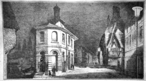
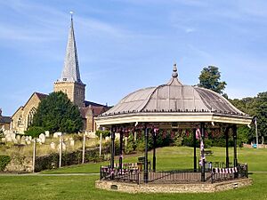
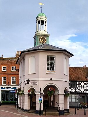 The Pepperpot, High Street |
|
| Area | 9.68 km2 (3.74 sq mi) |
| Population | 21,804 (civil parish 2011) or 22,689 (built-up area) |
| • Density | 2,252/km2 (5,830/sq mi) |
| OS grid reference | SU968437 |
| • London | 49 km (30 mi) NE |
| Civil parish |
|
| District | |
| Shire county | |
| Region | |
| Country | England |
| Sovereign state | United Kingdom |
| Post town | Godalming |
| Postcode district | GU7 |
| Dialling code | 01483 |
| Police | Surrey |
| Fire | Surrey |
| Ambulance | South East Coast |
| EU Parliament | South East England |
| UK Parliament |
|
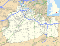
Godalming is a historic market town and civil parish in southwest Surrey, England. It is about 30 miles (49 km) southwest of central London. The town is located in the Borough of Waverley, where the Rivers Wey and Ock meet.
The civil parish of Godalming covers about 3.74 sq mi (9.7 km2). It includes smaller areas like Farncombe, Binscombe, and Aaron's Hill. Much of the land here is made of Lower Greensand Group rock layers. A special type of stone called Bargate stone was dug up locally until World War II.
People have lived in the Godalming area since the Paleolithic (Stone Age). The land above the Wey floodplain at Charterhouse was first settled in the middle Iron Age. The town we know today likely started in the 6th or early 7th centuries. Its name probably comes from an Anglo-Saxon landowner.
For a long time in the Middle Ages, Godalming was known for making kersey, a blue woollen cloth. However, this industry slowly faded away. In the 17th century, the town started making knitted textiles, especially hosiery (socks and stockings).
Godalming has always benefited from being on the main road from London to Portsmouth Dockyard. Transport improved greatly in the 18th century. A turnpike road (a toll road) opened in 1749. The Godalming Navigation, a canal, was built in 1764.
The town grew a lot in the mid-19th century. This was helped by the first railway station opening in 1849. Also, Charterhouse School moved here from London in 1872. Godalming also claims to be the first place in the world with a combined public and private electricity supply.
Many buildings in the town centre are from the 16th and 17th centuries. The unique Pepperpot building was built in 1814. It replaced the old medieval market house and held the town's council meetings.
Famous people from Godalming include Jack Phillips, the senior wireless operator on the RMS Titanic. Another was the mountaineer George Mallory. James Oglethorpe, who founded the Colony of Georgia in America, was born here in 1696. Godalming still has friendly ties with the U.S. state and its cities of Savannah and Augusta.
Contents
- Understanding the Name of Godalming
- Godalming's Location and Landscape
- Godalming's Past: A Look at History
- Community and Services
- Getting Around Godalming
- Learning in Godalming: Schools and Colleges
- Places of Worship
- Culture and Arts
- Sports and Leisure
- Important Buildings and Landmarks
- Parks and Green Spaces
- Famous People from Godalming
- See also
Understanding the Name of Godalming
The oldest record of Godalming is from around 1000 AD. It appears as Godelmingum in the will of Alfred the Great. In the Domesday Book of 1086, it was called Godelminge.
The second part of the name, —ingas, means "people of" or "family of" in Old English. The first part, Godhelm, might refer to an Anglo-Saxon person. Some people think Godhelm could have been an early name for the River Ock. People from Godalming are sometimes called "Godhelmians".
Other local place names also have old meanings. Binscombe and Busbridge are first mentioned in the 13th century. Their names likely come from Old English names like Byden and Beohrtsige. Catteshall might mean "hill of the wild cat" or "hill belonging to someone named Catt". Farncombe means "valley of the ferns". Frith Hill might come from the Middle English word frith, meaning "woodland".
Godalming's Location and Landscape
Where is Godalming?
Godalming is in the Borough of Waverley in southwest Surrey. It is about 49 km (30 mi) from central London. The town is also about 4 mi (6.4 km) from Guildford. Godalming is in the valley of the River Wey. This river flows north through Guildford to join the River Thames at Weybridge.
The main street in Godalming runs roughly east to west. It connects an old river crossing point to the road leading south over Holloway Hill. The town is almost completely surrounded by the Metropolitan Green Belt. The beautiful Surrey Hills National Landscape is to the north and west.
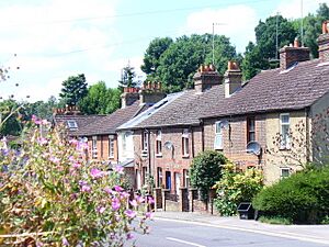
Godalming Civil Parish covers a total area of 3.74 sq mi (9.7 km2). It includes areas like Binscombe, Frith Hill, and Charterhouse (north of the river). To the south are Aaron's Hill, Ockford Ridge, and Crownpits. Most of Busbridge is also within Godalming Civil Parish. Farncombe, north of the town, feels like its own village with local shops. Godalming has good transport links to London and Portsmouth by train and road.
Rivers and Flooding
At the west end of town, the River Wey meets the River Ock. The Ock starts at Witley to the south. The main parts of Godalming and Farncombe are separated from the Wey by its floodplain. This area includes the water meadows known as the Lammas Lands.
There have been serious floods in the area in 1968, 1990, 2000, 2013, and 2020. New defences were built in 2018–19. These included a 525 m (1,722 ft) flood wall and two pumping stations.
Godalming's Geology
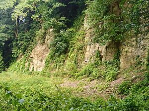
Godalming is on the northwestern side of the Weald. It mainly sits on rock layers from the Lower Greensand Group, which formed in the early Cretaceous period. Atherfield Clay is found in the far north of the parish at Binscombe. There used to be a brickworks there.
Holloway Hill and much of the town centre are on the Hythe Beds. This is a sandy layer with some sandstone and chert. Fossils of molluscs like Ostrea macroptera and Exogyra sinuata are found here.
Frith Hill and Charterhouse are on the Bargate Beds, which are rich in iron. This layer contains Bargate stone, a dark, honey-coloured sandstone. It was quarried until World War II at several places in the parish. River gravels are found in the valleys of the Wey and Ock. Alluvial deposits of sand and silt are in the Wey's floodplain.
Godalming's Past: A Look at History
Early Times
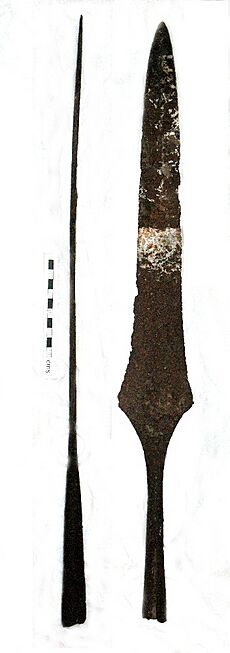
[[Annotated image | image = A Bronze Age barbed and tanged arrowhead, Godalming.jpg | image-width = 250 | image-left = -25 | image-top = 0 | width = 225 | height = 138 | caption = Bronze Age arrowhead, found in Godalming in 2017 ]] The earliest signs of human activity in Godalming are from the Stone Age. Paleolithic hand axes and Mesolithic flint tools have been found. In 2017, a schoolboy found a Bronze Age arrowhead. He gave it to Godalming Museum.
The higher ground at Charterhouse was lived on during the middle Iron Age. People likely continued to live there into the early Roman period. A small farmstead might have been there in the late first century AD. There was also a villa at Binscombe.
The Anglo-Saxon settlement of Godalming probably started in the 6th or early 7th centuries. It was in the area around the parish church. The oldest stone in the church is from around 820–840 AD. The base of the church tower is Anglo-Saxon.
The first written record of Godalming is from Alfred the Great's will in 880 AD. He left the settlement to his nephew. By the end of the Anglo-Saxon period, Godalming was the main town of the Godalming Hundred. This area stretched from Puttenham to Chiddingfold.
How Godalming Was Governed
In the Domesday Book of 1086, Godalming is called Godelminge. It was owned by Ranulf Flambard. The manor had enough land for 25 plough teams. It included meadows, woodland, three mills, and two churches.
The Manor of Godalming was split into two parts in the late 11th century. The King's Manor was held by the Crown. In 1221, it was given to the Bishop of Salisbury. It stayed with the Bishop until 1541, then returned to the Crown. Elizabeth I sold it to George More in 1601.
The second part, the Rectory Manor, was given to Salisbury Cathedral by Henry I in the early 12th century. It stayed with the dean and chapter until the mid-19th century.
Godalming received its first charter from Edward I on June 7, 1300. This allowed a weekly market and an annual fair. Elizabeth I confirmed the market in 1563. In 1575, she made Godalming a self-governing borough. A "warden" (like a mayor) was elected each year.
In 1620, Francis Bacon set rules for the town's government. The warden and eight assistants were in charge. A bailiff was also appointed.
Modern local government started in the 19th century. Under the Municipal Corporations Act 1835, Godalming became a borough with a mayor and elected councillors. In 1974, Godalming merged with other areas to form Waverley District. Godalming Town Council was then created as the local government for the civil parish.
Godalming's Businesses and Industries
Edward I granted Godalming the right to hold a market in 1300. It probably took place near Church Street and the High Street. The market was held on Wednesdays. It stopped around 1879. Fairs were also held, but they ended by the early 20th century.

Three watermills are mentioned in the Domesday Book for Godalming. These were likely Catteshall, Hatch, and Westbrook Mills on the River Wey. Hatch Mill might be the oldest mill site. Catteshall Mill was used for grinding corn until 1836.
Godalming's wealth in the Middle Ages came from the wool trade. The North Downs had good land for sheep. There was also Fuller's earth nearby, used for cleaning wool. The Wey River provided water and power for fulling mills. Godalming specialized in making kersey, a blue cloth. This industry declined in the 17th century.
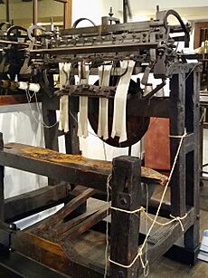
As cloth making decreased, Godalming started producing knitted and woven textiles. A cottage industry grew in the 17th century. Families worked at home making wool, silk, and cotton clothes. Hosiery (socks) was knitted using a stocking frame. Later, factories like George Holland's (around 1790) and Pitchers (1885) made knitted goods. Pitchers is known for inventing a machine to make the cable stitch.
Leather production was important from the 15th to mid-20th centuries. Tanneries were in Ockford Road, Meadrow, and Catteshall Lock. The last leather producer closed in 1952.
Godalming was also a key centre for papermaking. In the early 17th century, mills produced "whited brown paper". Papermaking continued at Catteshall Mill until 1928.
Travel and Communication
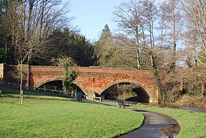
An old ford across the Wey was used by the 12th century. A bridge was also there, but the ford was used except during floods. The road through Godalming was made a turnpike in 1749. The current Town Bridge was built in 1782.
The River Wey has been used for boats since ancient times. The River Wey Navigation opened in 1651, connecting Guildford to the Thames. This helped Godalming's economy.
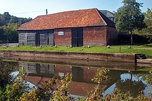
The Godalming Navigation was built in 1764, extending the river southwards. It had four locks. A 10-acre (4.0 ha) wharf was built near the town centre. The navigation was busiest in the 1810s. After the railway arrived in 1849, river transport declined. The last commercial shipments from Godalming were in 1925. The Godalming Navigation is now owned by the National Trust.
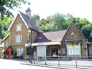
The first railway station in Godalming opened in 1849. It was the end of the line from Guildford. Ten years later, the line to Havant was built. This new line connected to the Guildford branch. The current Godalming railway station opened in 1859. Farncombe railway station opened in 1897. The line was doubled in 1871 and electrified in 1937.
Roads improved in the late 19th century. Borough Road and Borough Bridge were built to connect Charterhouse School to the town. The Guildford and Godalming bypass (now the A3) opened in 1934. In the 1990s, Flambard Way was built to take traffic around the town centre.
Town Growth and Housing
The basic layout of Church Street, High Street, and Bridge Street probably existed by the 13th century. The Saxon settlement was in the Church Street area. Godalming grew along the High Street in the 11th and 12th centuries. The town didn't expand much in the early modern period, but some oldest buildings are from the 16th century. Binscombe village grew around Binscombe Farm in medieval times.
Godalming started to grow in the mid-19th century. This was due to the railway (1849) and Charterhouse School moving there (1872). Cottages were built at Crownpits in the 1880s. Farmland south of the town was sold for development. Many houses were built by the end of the century.
Farncombe also grew in the early Victorian era. Terraced housing, semi-detached houses, and larger villas were built. Charterhouse and Furze Hill were part of Deanery Farm until 1865. Then, land was sold for Charterhouse School. Housing was built in the 1870s. More housing was built in the 1980s and early 21st century.
The first council housing in Godalming was built in 1920 in Farncombe. The Ockford Ridge estate was completed in 1931. After World War II, the Aaron's Hill development was built. The Binscombe estate was constructed in the 1950s.
Godalming During the World Wars
During the First World War, soldiers stayed at nearby Witley Camp. A canteen was set up for them at Godalming station. Allotments were planted for food. The Red Cross opened a hospital at Charterhouse School in 1914.
In the Second World War, the 4th Battalion of the Surrey Home Guard defended Godalming. 213 bombs fell on the town, including two V-1 flying bombs. No civilians were killed. Children were evacuated to Busbridge. St Thomas's Hospital Medical School was also evacuated to Godalming. A British Restaurant opened for cheap meals. A factory in Catteshall Lane made barrage balloons and life jackets.
Community and Services
Public Utilities
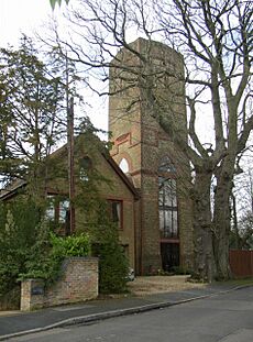
For most of its history, Godalming residents got water from rivers or wells. In the early 19th century, a hand pump was installed near the Pepperpot. Around 1880, water pipes were installed, fed from a water tower on Frith Hill. The town council bought the water tower in 1899. A new reservoir opened in 1974.
The town's sewerage system was built in 1894. Before this, waste water went into cesspits, which contaminated wells. This caused outbreaks of cholera and typhoid.
The Godalming Gas and Coke Company started in 1825. Gas was used for street lighting from 1836 to 1881. The gasworks closed in 1957.
Godalming claims to be the first town with a combined public and private electricity supply. In 1881, a generator powered by waterwheels at Westbrook Mill provided electricity. It powered arc lights in the town centre. The system had mixed success. The electricity supply stopped in 1884, and the town went back to gas lighting.
A second power station opened in Borough Road in 1902. It was connected to the National Grid in 1932. The power station closed in 1949.
Emergency Services
In the 17th century, the town had a "bedle" or "bellman" to catch troublemakers. By 1762, a uniformed town watchman was employed. The borough police force formed in 1836. In 1889, it became part of the Surrey Constabulary. The police station closed in 2012. Today, Surrey Police is responsible for policing.
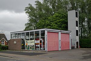
The first fire station was built in Moss Lane in 1816. It had a manual fire pump. The town fire brigade was formally started in 1870 as volunteers. In 1894, the borough took over the brigade. The firefighters were paid for each incident. The brigade moved to a new station in Queen Street in 1904. It became part of the National Fire Service during World War II. In 1948, Surrey Fire and Rescue Service was formed. The fire brigade moved to the current station in Bridge Road in 1972.
Godalming Ambulance Station is in Catteshall Lane. It is run by the South East Coast Ambulance Service.
Healthcare Services
The Meath Epilepsy Charity was founded in 1892 by Mary Jane Brabazon, Countess of Meath. She bought Westbrook House and opened a "Home of Comfort for Epileptic Women and Girls". By 1920, The Meath cared for 87 patients. In 2020, it supported 82 adults with epilepsy. Changing Perceptions, in Godalming High Street, is a social enterprise run by The Meath.
The nearest hospital with an A&E (Accident and Emergency) is the Royal Surrey County Hospital. It is about 6.3 km (3.9 mi) from Godalming. The town has two GP (General Practitioner) practices. One is at Catteshall Mill and the other at Binscombe.
Getting Around Godalming
Bus and Train Travel
Godalming has several bus routes connecting it to nearby towns and villages. Operators include Compass Bus, Stagecoach, and the Compo Community Bus.
South Western Railway runs all train services from both Godalming and Farncombe stations. Trains go to London Waterloo via Guildford. They also go to Portsmouth Harbour via Haslemere. There is a taxi rank at Godalming station.
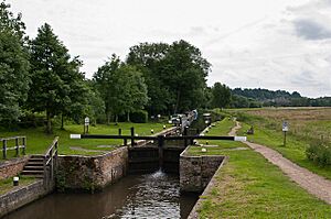
The River Wey can be used by boats from Godalming northwards to Weybridge. The National Trust manages the river for navigation. The head of navigation is at Godalming Wharf. Catteshall Lock is the southernmost lock on Britain's connected inland waterways.
Cycling and Walking Paths
The Farnham Link of the Surrey Cycleway goes through Godalming. It runs from Charterhouse, through the town centre, to Holloway Hill. The final stage of the Tour of Britain 2012 cycling race passed through Godalming.
The Fox Way is a 39 mi (63 km) footpath that goes around Guildford. It follows the towpath of the Wey Navigation from Catteshall to Town Bridge. Then it goes north of the town centre towards Eashing.
Learning in Godalming: Schools and Colleges
Early Schools in Godalming
There were likely small schools in Godalming in the 16th and 17th centuries. The first record of formal education is from 1715. It mentions a school for 50 poor boys. The National school opened in Mint Road in 1813. It later moved and is now called Green Oak School.
A British school opened in 1812. It educated children aged 6 to 13. The building was rebuilt in 1872 and is now a nursery school. Busbridge School was founded in 1865. St John's School, Farncombe, opened in 1856.
Maintained Schools and Colleges
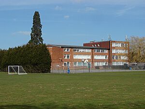
Broadwater School is in the north of the parish. It was built in 1967. The school teaches about 570 students aged 11 to 16. It joined the Greenshaw Learning Trust in 2020.
Godalming College is south of the town centre. It started in 1975 on the campus of the former Godalming Grammar School. It is a state-maintained college for 16–19-year-olds.
Independent Schools
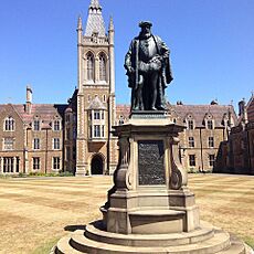
Charterhouse School was founded in London in 1611. It moved to Godalming in 1872. The main school buildings were designed by Philip Charles Hardwick. The chapel was built in 1927 as a memorial to students who died in World War I. Girls were first accepted into the sixth form in 1971. The school became fully coeducational in September 2023.
St Hilary's Preparatory School is an independent school for boys and girls aged 2–11. It was founded in 1927 and moved to Holloway Hill in 1936. The school merged with St Edmund's School, Hindhead in November 2024.
Places of Worship
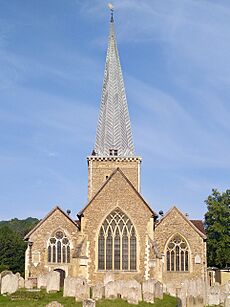
The oldest parts of the Parish Church of St Peter and St Paul are from the 9th century. The church is on a knoll above the River Wey. This was likely the site of the original settlement. The church was rebuilt in the 13th century. It was restored by George Gilbert Scott in the 19th century.
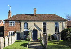
Quaker meetings were held in Binscombe by 1656. The Meeting House on Mill Lane was built in the 1710s. It still has its original wooden panelling and benches.
Meadrow Unitarian Chapel opened in 1789 as a General Baptist chapel. It had a pool for immersion baptism. In the early 19th century, the church became Unitarian.
Methodism started in Godalming in 1826. The congregation moved to the Bridge Road Church in 1903.
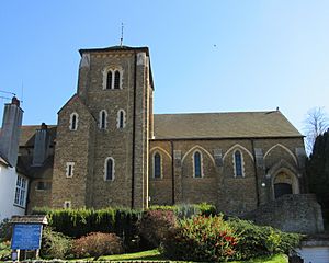
Busbridge Parish Church was designed by George Gilbert Scott and consecrated in 1867. The windows were designed by Edward Burne-Jones.
The first Catholic church was a temporary iron church built in 1899. The new church, St Edmund's, was completed in 1906. It was designed by Frederick Walters.
Culture and Arts
Art in Godalming
Godalming Museum has paintings by James Peel and Gertrude Jekyll. It also has a sculpture of George Frederic Watts by Louis Reid Deuchars. The Tate gallery has an oil painting by J. M. W. Turner called Godalming from the South (1805).
Godalming in Books, Film, and TV
In Charles Dickens' Nicholas Nickleby, Nicholas and Smike stay in Godalming. Part of Bulldog Drummond by Sapper takes place here. Binscombe is a location in The Hog's Back Mystery (1933) by Freeman Wills Crofts.
Ian Fleming's James Bond short story, "Quantum of Solace", mentions Godalming. The comic novel The Return of Reginald Perrin by David Nobbs jokes about mentioning Godalming more than any other book.
The 2006 romantic comedy film, The Holiday, and the 2022 TV series, Inside Man, include scenes filmed in Godalming.
Music and Theatre
Godalming Band has been active since 1937. It performs regularly at local places, including the Godalming Bandstand.
The Godalming Youth Orchestra started in 1979. It welcomes young musicians aged 8 to 17. The Godalming Theatre Group was founded in 1964. They perform musicals, plays, and pantomimes. They often perform at Charterhouse School.
Sports and Leisure
Leisure Centre
Godalming Leisure Centre at Broadwater Park opened in 2012. It replaced an older centre from the 1970s. It has a 25-meter pool, a teaching pool, a gym, a sauna, and a soft play area.
Football Clubs

Godalming Town F.C. was founded in 1950. They play their home games at Meadrow in Farncombe. The stadium is named after Bill Kyte, a long-time supporter.
Old Carthusians F.C. was started in 1876 by former Charterhouse School students. They won the FA Cup in 1881. In 2022, they play in the Arthurian League at the school's playing fields.
Cricket Clubs
Cricket has been played in Godalming since at least 1767. The town team started playing at Holloway Hill Recreation Ground by 1883. The current Godalming Cricket Club was formed in 1926.
Farncombe Cricket Club was founded in 1938. They play at Broadwater Park. The first cricket match at Broadwater Park was in 1850.
Other Sports
Guildford R.F.C. was formed in 2002. This was after Guildford & Godalming and Old Guildfordians rugby clubs merged. They play their home games at the Broadwater Sports Club.
The Godalming Angling Society started in 1882. They have rights to fish Broadwater lake and a stretch of the River Wey.
There are two flat green lawn bowls clubs. Holloway Hill Bowls Club and Godalming and Farncombe Bowling Club. The Godalming and Farncombe club is the second oldest bowling club in Surrey.
Important Buildings and Landmarks
Community Hubs
Godalming Youth Centre opened in 1962. It was named after Wilfrid Noyce, a mountaineer and Charterhouse teacher, who died that year. The centre was renovated in 2015–2016.
The Denningberg Centre opened in 1974. It is a day centre for people over 55. It is run by volunteers and has a cafe.
The Old Mill is a day centre run by the National Autistic Society. It offers activities and courses for people with autism.
Town Halls and Godalming Museum
The former town hall, called The Pepperpot, is an octagonal building in the High Street. It was built in 1814 on the site of the old market house. The ground floor has arches. The upstairs rooms were used for council meetings until 1908.
Godalming Borough Hall, on Bridge Street, was built as a public hall in 1861. It was extended in 1906. The council started meeting there in 1908.
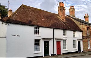
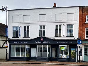
Godalming Museum opened in 1921 in The Pepperpot. In 1987, it moved to 107–109 High Street. This is a timber-framed house from the 1440s. The museum has many items about local history and the Arts and Crafts movement.
Memorials and Tributes
Jack Phillips, the chief radio operator of RMS Titanic, was born in Farncombe. He stayed at his post sending distress calls until the ship sank. A memorial cloister and garden were built in his honour. A brass plaque is also in Farncombe church.
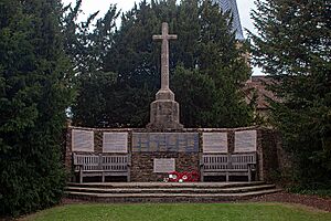
Godalming War Memorial was dedicated in 1921. It is a Latin cross in the churchyard of St Peter and St Paul. It lists the names of 109 local people who died in the Second World War. Those who died in the First World War are remembered inside the church.
Busbridge War Memorial is in the churchyard of St John the Baptist Church. It was designed by Edwin Lutyens. It is a 7 m-tall (23 ft) cross. It was dedicated in 1922.
Other Important Buildings
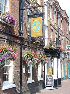
The King's Arms and Royal Hotel is an old coaching inn in the High Street. It is first mentioned in the 17th century. In 1698, Peter the Great stayed there. A plaque was put up in 1998 to mark 300 years since his visit. Much of the hotel is from the mid-18th century.
The Red House, on Frith Hill, was built in 1899 by architect Edwin Lutyens. It was for a retired teacher from Charterhouse School. It is made of red brick.
Wyatt's Almshouses were built in 1622 by Richard Wyatt. They provided homes for ten poor men. A chapel was also included. The ten homes were changed into eight apartments in 1959. New bungalows were added in the 1960s.
Parks and Green Spaces
Broadwater Park
Broadwater Park is a 29 ha (72-acre) recreation ground northeast of Farncombe. It was owned by the More Molyneux family for a long time. Cricket was played there from 1827. In 1936, some of the land was bought by the Mayor of Godalming and given to the town. In 1938, part of it was named a King George's Field. Today, the park is owned by the borough council. It has woodlands, grasslands, sports pitches, and tennis courts.
Other Open Spaces
The Lammas Lands are a 31.8 ha (79-acre) area of floodplain on the north bank of the River Wey. From medieval times, it was used as a hay meadow. After the hay was cut, local residents could graze their cattle there. These rights ended in 1808. Today, the Lammas Lands are a Site of Nature Conservation Interest. They have over 108 species of flowering plants, including black knapweed and marsh marigold. Many types of insects have also been found there.
Holloway Hill Recreation Ground was bought by the Godalming Recreation Club Company in 1896. It has been used for cricket since before 1883. During World War I, it was used for allotments. In 1921, the town council bought the land. Since 2015, it has been protected by the charity Fields in Trust.
Famous People from Godalming
- Jonas Moore (1617–1679) – a mathematician and surveyor.
- John Balchen (1670–1744) – an Admiral in the Royal Navy.
- James Oglethorpe (1696–1785) – an army officer who founded the Colony of Georgia in America.
- Mary Toft (around 1703–1763) – a woman famous for a strange medical hoax.
- Owen Manning (1721–1801) – a clergyman and historian of Surrey.
- Alfred Russel Wallace (1823–1913) – a biologist who developed the theory of evolution at the same time as Charles Darwin.
- Julius Caesar (1830–1878) – a cricketer.
- George Mallory (1886–1924) – a teacher and mountaineer, famous for his attempts to climb Mount Everest.
- Jack Phillips (1887–1912) – the senior wireless operator on the RMS Titanic.
- Aldous Huxley (1894–1963) – a famous writer and philosopher.
- Nick Clarke (1948–2006) – a broadcaster.
- Mick Mills (born 1949) – a former England football team captain.
- Elspeth Beard (born 1959) – an architect and motorcyclist, the first British woman to ride a motorcycle around the world.
- Matt Parker (born 1980) – a mathematician, author, and comedian.
See also
 In Spanish: Godalming para niños
 | Isaac Myers |
 | D. Hamilton Jackson |
 | A. Philip Randolph |


