Tilbury facts for kids
Quick facts for kids Tilbury |
|
|---|---|
 The Port of Tilbury |
|
| Population | 12,450 (2011) |
| OS grid reference | TQ639761 |
| Unitary authority | |
| Ceremonial county | |
| Region | |
| Country | England |
| Sovereign state | United Kingdom |
| Post town | TILBURY |
| Postcode district | RM18 |
| Dialling code | 01375 |
| Police | Essex |
| Fire | Essex |
| Ambulance | East of England |
| EU Parliament | East of England |
| UK Parliament |
|
Tilbury is a port town located in Thurrock, Essex, England. It was built as a separate town in the late 1800s. Before that, most of the land was part of Chadwell St Mary. Tilbury is home to a fort from the 1500s and an old ferry that crosses the river.
The town is part of the famous Port of London. It has a very important deep-water port which helps the local economy. Tilbury is about 24 miles (38.5 km) east of central London. It is also the most southern point in Essex.
Contents
What's in a Name?
The name Tilbury comes from the nearby villages of East and West Tilbury. The word "Tilbury" comes from an old Saxon word, burgh. This word means "fortified place" or a place with a fort. It might have belonged to someone named Tila. In the 700s, it was spelled "Tilaburg". Later, in the Domesday Book, it was "Tilberia".
A Look Back in Time
Tilbury's story is closely linked to where it is located. On the other side of the River Thames is Gravesend. This town has always been an important link for travel. A ferry has crossed the river here for a long time. This is because the river is quite narrow at this spot.
Long ago, there is proof that Romans lived here. At that time, the sea levels were lower. This made the marshy areas good for living. There might have been a Roman village where Tilbury Docks are today.
In the 1100s, the river was changed. People built banks along the river and enclosed marsh areas. This helped the river flow better. It also created more useful land on the marsh. However, it was not a very healthy place to live. People often got sick from something called "the Essex ague."
In 1588, Queen Elizabeth I visited Tilbury. She came ashore to see her main army. This army was gathered at the nearby village of West Tilbury. She gave a famous speech there.
In 1852, a law allowed the building of the London Tilbury and Southend Railway. A short branch line was added to use the ferry across the Thames. A pier was built nearby for steamboats. The train station opened in 1854. It was first called Tilbury Fort. In 1936, its name changed to Tilbury Riverside railway station.
A few houses were built for the railway workers. But Tilbury did not become a real town until the docks were built. Thousands of workers came to build the docks. They lived in temporary homes or traveled from other towns. After the docks were finished, more permanent houses were built.
The Tilbury Ferry: Crossing the River
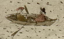
The Tilbury–Gravesend Ferry has been running for a very long time. A map from 1571 shows two jetties. One jetty on the north side led to a road across the marsh. There were also houses on the marsh. The marsh was important for sheep farming. The ferry was likely used to carry animals and wool across the river. Even though old drawings show small boats, the busy Gravesend market encouraged a lot of trade.
Tilbury Fort: Protecting London
The way the river curves and narrows here made it a good spot for forts. These forts helped protect London from invaders. The first permanent fort at Tilbury was built in 1539 by King Henry VIII. It was called the "Thermitage Bulwark." This fort was designed to fire cannons across the river. It worked with a similar fort in Gravesend.
In 1588, during the Spanish Armada, the fort was made stronger. Earthworks and a fence were added. A barrier of chains and ship masts was stretched across the Thames to Gravesend. The fort was rebuilt later under King Charles I. Today, English Heritage looks after this historic fort.
Where is Tilbury?
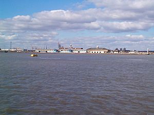
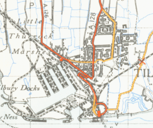
Tilbury is on the north bank of the River Thames. At this point, the river narrows to about 800 yards (730 meters) wide. To the north of the town are old marshlands. Beyond that, the land is higher. This is where the villages of Chadwell St Mary, West, and East Tilbury are located. The town itself is north of the London-Southend railway line. Tilbury is located east of London, the capital of England.
Important places in Tilbury include the docks and the cruise-ship landing stage. There are two churches in Tilbury: St John's (Church of England) and Our Lady Star of the Sea (Roman Catholic). There is also a Convent of Mercy and a synagogue in Dock Road.
Tilbury has several schools. These include Lansdowne Primary School, St Mary's RC Primary School, and Tilbury Pioneer Academy. The Gateway Academy is the main secondary school for Tilbury and nearby areas. USP College (Palmers Campus) is also close by.
How Tilbury Works: Port and Transport
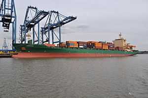
The Port of Tilbury handles many different types of goods. This includes wood, cars, and shipping containers. It is one of Britain's three main container ports, along with Southampton and Felixstowe. Tilbury is the main UK port for importing paper, including newsprint. The old passenger landing stage is now the London Cruise Terminal. However, trains no longer stop there.
In the past, most people in Tilbury worked at the docks. This was before standardized shipping containers were used. When containers became common, many jobs were lost. This has led to higher unemployment in Tilbury today.
The local council helps to pay for the ferry between Tilbury and Gravesend. This ferry is now run by Jetstream Tours.
Tilbury Town railway station is on the c2c line. This line provides train services to London Fenchurch Street and Southend. Tilbury Riverside railway station closed in 1992. However, the railway still serves the nearby container depot.
Local buses in Tilbury are operated by Ensignbus. The National Cycle Route 13, which goes from London to Norfolk, also passes through the town.
Famous Faces and Fun Facts
The Tilbury Band started in 1919. It was one of the best brass bands in the UK.
Some famous people have connections to Tilbury:
- John Evans (1929–2004) and Tom Scannell (1925–1994) were both football players.
- Noel Betowski, an artist, was born in Tilbury in 1952.
- Actor Adewale Akinnuoye-Agbaje was raised here by foster parents. His story is told in the movie Farming.
Tilbury and its surroundings have been used in TV shows. Tilbury Fort was a filming location for Sharpe's Regiment, which starred Sean Bean.
Sports and Fun in Tilbury
Tilbury has a non-League football club called Tilbury F.C.. They play their games at Chadfields. Chadfields used to be a place for greyhound racing. This type of racing was not part of the main sports group. It was known as a "flapping track." Greyhound racing happened here in the 1930s and stopped in 1947.
Another place called Tilbury Stadium also hosted greyhound races between 1964 and 1967.
See also
 In Spanish: Tilbury para niños
 | Dorothy Vaughan |
 | Charles Henry Turner |
 | Hildrus Poindexter |
 | Henry Cecil McBay |


