Little Red River (Texas) facts for kids
Quick facts for kids Little Red River |
|
|---|---|

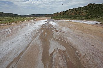
Salty bed and red bluffs, Little Red River, Hall County, Texas
|
|
 |
|
| Physical characteristics | |
| Main source | Briscoe County, Texas 2,282 ft (696 m) 34°27′01″N 101°03′05″W / 34.4503416°N 101.0512593°W |
| River mouth | Hall County, Texas 1,839 ft (561 m) 34°33′59″N 100°36′19″W / 34.5664465°N 100.6054053°W |
| Length | 30 mi (48 km) |
| Basin features | |
| River system | Red River of the South |
| Tributaries |
|
The Little Red River is a stream in Texas that is about 30 miles (48 km) long. It doesn't always have water flowing in it, which is why it's called an "intermittent stream." This river starts in Briscoe County, Texas. It flows generally east and northeast. Finally, it joins another river called the Prairie Dog Town Fork Red River in Hall County, Texas.
Contents
What is the Little Red River?
The Little Red River is a natural waterway in the Texas Panhandle. It's known for its unique landscape. The river plays a role in the local environment. It helps shape the land it flows through.
How Does the Little Red River Form?
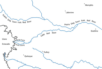
The Little Red River actually begins as two smaller streams. These are called the North Prong Little Red River and the South Prong Little Red River. They are like the river's "arms." Both of these smaller streams start in Briscoe County, Texas. They begin near the eastern edge of the Caprock Escarpment. This is a big cliff-like area of the Llano Estacado.
Where Do the Prongs Flow?
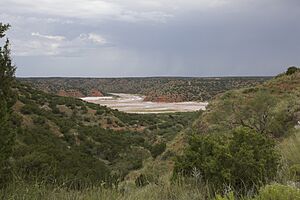
The North Prong and South Prong flow through a beautiful area. This area is known as Caprock Canyons State Park and Trailway. The North Prong flows to the north side of a place called Haynes Ridge. The South Prong flows to the south side of Haynes Ridge. Haynes Ridge is a well-known feature in Caprock Canyons.
Where Do the Prongs Meet?
The two prongs eventually come together. They merge about 6 miles (9.7 km) north of Quitaque, Texas. When they meet, they form the main Little Red River. From this point, the river truly begins its journey.
Where Does the Little Red River Flow?
After forming, the Little Red River first flows eastward. It crosses through Briscoe County. Then, as it gets closer to the Hall County border, it turns northeast. The river continues its path through Hall County. This area is mostly open ranch land. It doesn't have many people living there.
Where Does the River End?
The Little Red River keeps flowing east. It eventually meets the Prairie Dog Town Fork Red River. This is where its journey ends. From its starting point to where it joins the Prairie Dog Town Fork, the Little Red River and its smaller streams drop a lot in elevation. They descend about 1,322 feet (403 m). The land along its path changes from flat to quite steep.
 | Roy Wilkins |
 | John Lewis |
 | Linda Carol Brown |


