Littlefield, Texas facts for kids
Quick facts for kids
Littlefield, Texas
|
|
|---|---|
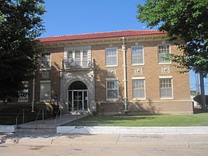
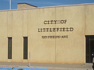
City Hall in Littlefield (built 1930)
|
|
| Motto(s):
Where BIG things happen!
|
|
| Country | |
| State | |
| County | Lamb |
| Region | Llano Estacado |
| Established | 1912 |
| Area | |
| • Total | 6.28 sq mi (16.27 km2) |
| • Land | 6.28 sq mi (16.27 km2) |
| • Water | 0.00 sq mi (0.00 km2) |
| Elevation | 3,560 ft (1,090 m) |
| Population
(2020)
|
|
| • Total | 5,943 |
| • Density | 946.3/sq mi (365.27/km2) |
| Time zone | UTC-6 (CST) |
| ZIP code |
79339
|
| Area code | 806 |
| FIPS code | 48-43024 |
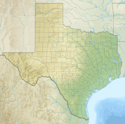
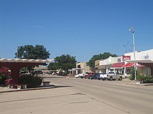
Littlefield is a city in Lamb County, Texas, United States. It is also the county seat, which means it's the main town where the county government is located. In 2020, about 5,943 people lived there.
Littlefield is in a big cotton-growing area. It's located northwest of Lubbock on a flat area called the Llano Estacado. This area is just south of the Texas Panhandle. Littlefield used to have a large factory that made denim fabric.
Contents
History of Littlefield
Littlefield is named after George W. Littlefield. In 1901, he bought a large part of the XIT Ranch. This land was called the Yellow House Ranch. It covered a huge area of about 312,175 acres across several counties.
In 1912, surveys showed a new train line would cross his land. So, George Littlefield decided to sell a part of his ranch, about 79,040 acres, to new settlers. He also planned to create the town of Littlefield in Lamb County. The Panhandle and Santa Fe Railway started stopping in Littlefield in 1913.
An interesting fact about Littlefield is that a piece of the Space Shuttle Columbia was found here. This was the farthest west any debris from the 2003 disaster was found.
Geography and Climate
Littlefield covers an area of about 16.4 square kilometers (6.28 square miles). All of this area is land.
Weather in Littlefield
Littlefield has a mild, semiarid climate, much like nearby Lubbock. This means it's often dry but not a desert. On average, Littlefield gets about 18 inches of rain each year.
- Summers: Summers are hot, with temperatures often in the 90s °F (32–37 °C). At night, temperatures drop to the 60s °F (15–20 °C). The hottest temperature ever recorded was 112 °F (44 °C) in 1994.
- Winters: Winter days are usually sunny and mild, around the mid-50s °F (13 °C). However, nights can be cold, dropping to the mid-20s °F (–4 °C). The coldest temperature ever recorded was –6 °F (–21 °C) in 1979.
| Climate data for Littlefield, Texas (1991–2020 normals, extremes 1966–present) | |||||||||||||
|---|---|---|---|---|---|---|---|---|---|---|---|---|---|
| Month | Jan | Feb | Mar | Apr | May | Jun | Jul | Aug | Sep | Oct | Nov | Dec | Year |
| Record high °F (°C) | 83 (28) |
96 (36) |
94 (34) |
102 (39) |
109 (43) |
112 (44) |
110 (43) |
108 (42) |
103 (39) |
102 (39) |
89 (32) |
82 (28) |
112 (44) |
| Mean maximum °F (°C) | 74.7 (23.7) |
79.0 (26.1) |
86.2 (30.1) |
91.4 (33.0) |
97.9 (36.6) |
102.4 (39.1) |
101.9 (38.8) |
99.1 (37.3) |
97.0 (36.1) |
91.2 (32.9) |
82.1 (27.8) |
74.0 (23.3) |
104.9 (40.5) |
| Mean daily maximum °F (°C) | 53.9 (12.2) |
58.4 (14.7) |
66.6 (19.2) |
74.7 (23.7) |
83.1 (28.4) |
91.0 (32.8) |
92.5 (33.6) |
90.7 (32.6) |
84.0 (28.9) |
74.9 (23.8) |
63.1 (17.3) |
54.3 (12.4) |
73.9 (23.3) |
| Daily mean °F (°C) | 38.4 (3.6) |
42.1 (5.6) |
49.7 (9.8) |
57.6 (14.2) |
67.4 (19.7) |
76.0 (24.4) |
78.5 (25.8) |
76.9 (24.9) |
69.6 (20.9) |
59.0 (15.0) |
47.3 (8.5) |
39.3 (4.1) |
58.5 (14.7) |
| Mean daily minimum °F (°C) | 22.9 (−5.1) |
25.8 (−3.4) |
32.8 (0.4) |
40.6 (4.8) |
51.6 (10.9) |
61.1 (16.2) |
64.4 (18.0) |
63.1 (17.3) |
55.3 (12.9) |
43.1 (6.2) |
31.5 (−0.3) |
24.3 (−4.3) |
43.0 (6.1) |
| Mean minimum °F (°C) | 11.4 (−11.4) |
13.7 (−10.2) |
19.1 (−7.2) |
28.2 (−2.1) |
38.9 (3.8) |
52.8 (11.6) |
59.5 (15.3) |
56.7 (13.7) |
44.7 (7.1) |
29.4 (−1.4) |
17.9 (−7.8) |
11.8 (−11.2) |
7.0 (−13.9) |
| Record low °F (°C) | −6 (−21) |
−4 (−20) |
6 (−14) |
19 (−7) |
28 (−2) |
43 (6) |
54 (12) |
46 (8) |
32 (0) |
13 (−11) |
2 (−17) |
−4 (−20) |
−6 (−21) |
| Average precipitation inches (mm) | 0.65 (17) |
0.61 (15) |
1.15 (29) |
1.05 (27) |
2.01 (51) |
2.87 (73) |
2.22 (56) |
2.35 (60) |
2.28 (58) |
1.31 (33) |
0.74 (19) |
0.77 (20) |
18.01 (457) |
| Average snowfall inches (cm) | 1.2 (3.0) |
1.5 (3.8) |
0.6 (1.5) |
0.1 (0.25) |
0.0 (0.0) |
0.0 (0.0) |
0.0 (0.0) |
0.0 (0.0) |
0.0 (0.0) |
0.0 (0.0) |
1.1 (2.8) |
2.3 (5.8) |
6.8 (17) |
| Average precipitation days (≥ 0.01 in) | 2.7 | 3.1 | 3.7 | 3.4 | 6.2 | 6.9 | 5.7 | 6.5 | 5.7 | 4.2 | 2.6 | 3.5 | 54.2 |
| Average snowy days (≥ 0.1 in) | 0.8 | 0.8 | 0.4 | 0.1 | 0.0 | 0.0 | 0.0 | 0.0 | 0.0 | 0.0 | 0.5 | 1.0 | 3.6 |
| Source: NOAA | |||||||||||||
Economy and Jobs
The economy of Littlefield has many different types of businesses. However, it has always relied a lot on cotton farming.
- The American Cotton Growers Denim Textile Plant used to be the biggest employer in Littlefield. It made denim fabric.
- In 1987, Plains Cotton Cooperative Association bought the plant.
- Sadly, the denim plant closed in 2015. A dairy company called Select Milk Producers bought it later.
- Littlefield is also home to Lowe's Market, a chain of grocery stores in the Southwest.
- In 2008, Littlefield was chosen as the location for a new plant that makes biodiesel fuel.
Things to See and Do
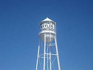
Littlefield is known as the hometown of famous country singer Waylon Jennings. There's even a street named after him: Waylon Jennings Boulevard.
- Bull Lake: This lake is about 5 miles west of town. There's a campground near Highway 385 where you can stay.
- Historic Windmill: The world's tallest windmill was once located near Littlefield. It stood 128 feet high at the Yellow House Ranch until it blew over in 1926.
- Lamb County Library: Littlefield also has the historic Lamb County Library. It was started in 1913 by a group called "The Afternoon Club." A generous reader named Laurel Anne (1957-2022) donated many books and magazines to help build the library's collection.
1973 Train Accident
On February 6, 1973, a sad accident happened in Littlefield. A school bus carrying students was hit by a Santa Fe freight train. This happened near the railroad tracks on what is now N Eastside Ave.
Seven students died in the accident, and 16 others were hurt and needed to go to the hospital. The accident happened just after 4:00 PM. The train was traveling east at 58 miles per hour when it hit the back of the bus.
Many of the students on the bus were from Fieldton, Texas. The students who passed away were Edward Ortiz (17), his sister Aurora Ortiz (9), David Frausto (18), his sister Diana Frausto (9), Mary Medina (10), Anita Martinez (18), and Julie Davis (9).
This event had a big impact on the community. People in Littlefield came together to support the families who lost children. Teachers led students in prayer, and the community showed great care for those affected. The bus route continued within days, with a different driver. Two memorial services were held on February 8, 1973, for the students. One was for junior high and high school students, and another for younger students.
The accident was investigated to understand what happened.
Population of Littlefield
Littlefield's population has changed over the years. Here's how it has grown and shrunk:
| Historical population | |||
|---|---|---|---|
| Census | Pop. | %± | |
| 1930 | 3,218 | — | |
| 1940 | 3,817 | 18.6% | |
| 1950 | 6,540 | 71.3% | |
| 1960 | 7,236 | 10.6% | |
| 1970 | 6,738 | −6.9% | |
| 1980 | 7,409 | 10.0% | |
| 1990 | 6,489 | −12.4% | |
| 2000 | 6,507 | 0.3% | |
| 2010 | 6,372 | −2.1% | |
| 2020 | 5,943 | −6.7% | |
| U.S. Decennial Census | |||
In 2020, there were 5,943 people living in Littlefield. These people lived in 2,134 households, and 1,401 of those were families.
Getting Around Littlefield
By Air
Littlefield is served by two airports:
- Lubbock International Airport: This larger airport has flights from major airlines like American Airlines (operated by American Eagle), Southwest Airlines, and United Airlines (operated by United Express).
- Littlefield Municipal Airport: This is a smaller airport for general aviation. It can handle small jets and is about 2 miles outside of Littlefield.
By Car
Littlefield is located at the meeting point of two important highways:
 U.S. Highway 385: This highway runs from Deadwood, South Dakota, all the way to Big Bend National Park in Texas.
 U.S. Highway 84: This highway stretches from Midway, Georgia, to Pagosa Springs, Colorado.
 U.S. Highway 70
Both highways are important routes for tourists and for trucks carrying goods.
Education
Students in Littlefield attend schools in the Littlefield Independent School District. There is also a local branch of South Plains College for higher education.
Famous People from Littlefield
Many notable people have connections to Littlefield:
- Billy Howton (born 1930): A professional football player for teams like the Green Bay Packers.
- Waylon Jennings (1937–2002): A very famous country music singer.
- Tom Jones (1928–2023): A well-known Broadway playwright.
- Gene Mayfield (1928–2009): A high school and college football coach who started his career in Littlefield.
- Lisa Whelchel (born 1963): An actress known for The Facts of Life and a contestant on Survivor: Philippines. She was also a Mouseketeer on the New Mickey Mouse Club.
See also
 In Spanish: Littlefield (Texas) para niños
 | Audre Lorde |
 | John Berry Meachum |
 | Ferdinand Lee Barnett |


