Lookout Point Lake facts for kids
Quick facts for kids Lookout Point Lake |
|
|---|---|

Lookout Point Reservoir
|
|
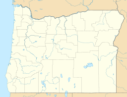
| Location | Lane County, Oregon |
| Coordinates | 43°53′48″N 122°43′34″W / 43.89667°N 122.72611°W |
| Type | Reservoir, mesotrophic |
| Primary inflows | Middle Fork Willamette River |
| Primary outflows | Middle Fork Willamette River |
| Catchment area | 991 square miles (2,570 km2) |
| Basin countries | United States |
| Surface area | 4,360 acres (17.6 km2) |
| Average depth | 104 feet (32 m) |
| Max. depth | 234 feet (71 m) |
| Water volume | 477,700 acre-feet (0.589 km3) |
| Residence time | 1.9 months |
| Shore length1 | 35 miles (56 km) |
| Surface elevation | 932 feet (284 m) |
| Settlements | Lowell, Oakridge |
| 1 Shore length is not a well-defined measure. | |
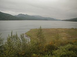
Lookout Point Lake, also known as Lookout Point Reservoir, is a big lake in Oregon, United States. It's located in Lane County and was made in 1953. This lake was formed when the Lookout Point Dam was built across the Middle Fork Willamette River.
The lake is about 20 miles (32 km) southeast of Eugene. It sits just upstream from Dexter Lake, which is another reservoir. The town of Lowell is close by, on the north side of Dexter Lake. A main road, Oregon Route 58, runs along the south side of Lookout Point Lake. The lake stretches for about 10 miles (16 km), reaching almost to the town of Oakridge.
The Lookout Point Dam is 276 feet (84 m) tall. It can hold a huge amount of water, about 477,700 acre-feet (589,200,000 m3). This dam is very important because it helps stop floods, creates electricity, and offers a fun place for boating and other outdoor activities.
Contents
Building Lookout Point Lake
How the Dams Were Built
Lookout Point Lake and Dexter Lake were created in the early 1950s. The United States Army Corps of Engineers built the dams that hold back the water for both lakes. Dexter Lake helps control the water that flows out of Lookout Point Lake. Together, these two dams work to prevent floods downstream in the river.
Generating Electricity
Both dams have special powerhouses that make electricity. Lookout Point Dam has three units that can produce a lot of power, up to 120,000 kilowatts. This is enough to power many homes!
Managing Water Levels
The water level in Lookout Point Lake is usually high from May to August. This is a good time for boating and other water sports. Starting in July, the lake's water is slowly released to meet the needs of people living downstream. After September, the lake is emptied faster. This makes space for the large amounts of river water that flow into the lake during the winter. The Lookout Point and Dexter projects are part of 13 similar projects built by the Army Corps of Engineers in the Willamette Valley.
Fun Activities at Lookout Point Lake
Boating and Fishing
Lookout Point Lake is a great spot for outdoor fun! You can go boating or fishing here. While there are many fish like northern pikeminnows and suckers, it can be a bit tricky to catch fish like rainbow trout that many people enjoy. Sometimes, strong winds and big waves can make fishing harder. Also, the lake's water level changes throughout the year, which can affect fishing.
Camping and Picnics
Around the lake, you'll find several places for picnicking and launching boats. These spots are managed by the county, the state, or the Willamette National Forest. Some boat ramps might not reach the water when the lake level is low. However, the ramps near Lowell and the main dam usually work all year. If you want to camp, Black Canyon Campground is available. It's managed by the United States Forest Service and is located near the southeast end of the lake.
 | Precious Adams |
 | Lauren Anderson |
 | Janet Collins |


